Download
1 / 29
290 likes | 463 Vues
What is an Earthquake and how does it occur?. A sudden motion or trembling of the earth caused by the abrupt release of energy that is stored in the rocks.

E N D
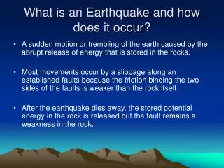
What is an Earthquake and how does it occur? • A sudden motion or trembling of the earth caused by the abrupt release of energy that is stored in the rocks. • Most movements occur by a slippage along an established faults because the friction binding the two sides of the faults is weaker than the rock itself. • After the earthquake dies away, the stored potential energy in the rock is released but the fault remains a weakness in the rock.
How Earthquakes are Measured • 1935 Charles Richter divised the richter scale to measure the amount of energy released during an earthquake. • Richter magnitude is calculated from the height of the largest earthquake body wave recorded on a specific type of seismograph.
What’s a Tsunami? • It’s a wave generated in a body of water by a physical disturbance. • Possibly produced by an earthquake or volcanic eruption. • Erroneously known as “tidal waves” • “First the waters withdraw from the shore, leaving a seabed exposed. Then the waters return as a breaker that may reach heights of 40 feet. The wave carries away virtually everything in its path and may travel a mile or more inland before returning to sea.”
How do EarthquakesOccur in San Francisco • Earthquakes occur along plate boundaries, like the one shown at right between the Pacific Plate (to the west) and the North American Plate (to the east). • The yellow dots represent earthquake epicenters, which are aligned along faults. As the plates move, stress builds up along faults. When this stress is released, the blocks or plates move and an earthquake occurs. The distribution of epicenters reveals that several fault zones -- on either side of San Francisco Bay and Santa Clara Valley -- take up portions of the movement between the Pacific and North American Plates. • One of these faults, the San Andreas, runs through San Juan Bautista, the Santa Cruz mountains, north through the San Francisco Peninsula, off shore from the Golden Gate, and then on-shore just east of the Pt. Reyes Peninsula. The San Andreas Fault is considered the main boundary between the Pacific and North American Plates. KH
Major Earthquakes seen in San Francisco: THE EARTHQUAKE OF 1906 • The San Francisco earthquake of 1906 is perhaps the most discussed earthquake in history • After this earthquake in San Francisco, subsequent fires destroyed almost the entire city. • Casualty count: as many as 3000 people might have died, 225,000 people were left homeless out of a population of 400,000. • First foreshock was registered at 5:12am on April 18, 1906. • The Earthquake itself occurred on the San Andreas Fault with an epicenter near San Francisco which lasted for approximately 47 seconds and was felt from Oregon to Los Angeles and inland as far as central Nevada. • The earthquake measured 7.9 on the magnitude scale and caused ruptures visible for 290 miles. • Fires burned out of control afterwards which destroyed a large amount of property • These fires were fueled by natural gas minds breaking; as water mains were also broken. During this time, the city fire department had much fewer resources to fight the fires with then they do today. • The fire ultimately destroyed over 500 city blocks of downtown core KH
San Francisco’s City Hall after 1906 Earthquake Sky view of San Francisco after the destruction DAMAGE WAS ESTIMATED AT $500 MILLION DOLLARS IN 1906 Downtown San Francisco on April 19, 1906 HG
Major Earthquakes seen in San Francisco: The Earthquake of March 22, 1957 • The worst Earthquake since 1906 struck at 11:45am and registered 5.3 on the Richter scale. • The quake started some fires, including a blaze caused by spill in the chemistry lab at old Lowell High School. • Many buildings suffered damage in the earthquake • The top floor at St. Anne’s School at 13th and Irving was badly damaged but children were safe. • The McCrery Branch public library was completely destroyed HG
Major Earthquakes seen in San Francisco: The Earthquake of October 17, 1989“Ioma Prieta” • A magnitude 7.1 Earthquake struck the Bay Area just before the third game of the World Series at Candlestick park; the worst Earthquake since 1906 • The tremor collapsed a section of the San Francisco-Oakland Bay Bridge. • Damage was estimated at almost 3 billion dollars in San Francisco • The earthquake knocked out power for 3 full days. • The quake killed 62 people through Central California, injured 3757 and left more than 12,000 people homeless. • The earthquake triggered a four foot tsunami wave in Monterey Bay as well as a huge undersea landslide. HG
Other Significant Earthquake Occurrences in the 1900’s • MARCH 10, 1933: Southern California struck by major 6.3 Earthquake. Massive damage in Long Beach. Many school buildings collapsed. Fires were started by the earthquake. 115 people were killed. • FEBRUARY 9, 1971: 6.4 Earthquake centered in Southern California and caused major damage and knocked down freeways. At least 65 people were killed. Damage exceeded $1 Billion dollars • APRIL 6, 1990: Exhibition game at Candlestick between the Giants and the A’s was interrupted at 7:39 by a 4.5 earthquake. Regardless, they resumed the game and the A’s later won 9-2. • APRIL 28, 1990: A swarm of earthquakes measuring 4.3 to 4.6 knocked out electricity in homes of the Walnut Creek area. • JANUARY 17, 1994: Los Angeles was struck by a 6.7 Earthquake, the worst tremor in that city’s recorded history. It was felt as a slight bump for the people in San Francisco. Damage to the electric system caused power failures in throughout California. 57 people died. HG
The History of Hawaii • Each Year there are thousands of earthquakes that occur in Hawaii • Many of them are small • Big island earthquakes have magnitude of six or higher. • Reoccur every ten to twelve years. HG
The History of Hawaii • Two major regions on the Big Island that get the most earthquakes is East Kona and South Kona • Largest earthquake was on Ka’u District HG
Ka’u District Earthquake • It was a major earthquake in 1868 on the Southeast flank of Mauna Lua. • It killed 77 people • 31 by landslide • 46 by tsunami • destroyed several villages by this 15 meter tsunami HG
General Facts • Earthquakes occur in Hawaii • Mass of the volcanic cone pushes down and out on the plane of the Pacific tectonic plate on which it sits. • Pacific Plate pushes in a northwest direction. • Pressure builds up and the outer edge of the earth crumbles and snaps as slippage occurs. HG
New Madrid, Missouri The Earthquake of 1811 HG
December 16, 1811 • Earthquake hits New Madrid Missouri. • 1st in a series of four. January 23, February 7 • Trees toppled, Old river channels slammed shut and new ones opened. • One large lake had its water suddenly replaced by sand. Another lake, Reelfoot, was created in a matter of moments. • Over 150,000 acres destroyed/altered. • Thousands of after shocks followed in-between the first and fourth quake. HG
Effects • Wide Spread. • Damage was reported as far east as Charleston, South Carolina and Washington, DC. In Boston, Massachusetts, 1,000 miles away, church bells were made to ring. The effects of the quake were felt as far south as New Orleans and as far north as Canada. HG
Facts • Because of this sort of plate interaction it was recorded as the largest earthquake the U.S had ever seen. (1811) • No Richter Scale = estimated 8.0 • Still thought of as one of the largest earthquakes ever to occur In the U.S HG
New Madrid Fault • The New Madrid Fault extends from eastern Arkansas to about the junction of the Mississippi and Ohio Rivers. • Failed Rift: It is not located near one of the seven large tectonic plates. • Result: Ground is cold and brittle instead of hot and elastic thus when friction occurs it is much more abrupt and has the potential to escalate the magnitude of the earthquake. HG
Future for Missouri / Mid West • 1811-1812 Marked the beginning of large amounts of earthquake activity in Missouri. • Although there has been relatively little earthquake activity in Missouri since then scientists are predicting heavy quakes in the coming years. 6.0 or higher • Predicting earthquakes in the Mid-West rather then West Coast. • New Madrid Fault- 2010, next 50 years, predictions vary. • Disaster will hit the mid west again. HG
Effects • Wide Spread. • Damage was reported as far east as Charleston, South Carolina and Washington, DC. In Boston, Massachusetts, 1,000 miles away, church bells were made to ring. The effects of the quake were felt as far south as New Orleans and as far north as Canada. HG
The Good Friday Earthquake Alaska~ Friday March 27, 1964 5:36 PM LP
One of the most damaging earthquakes in the 20th century • Lasted between 3-5 minutes • Displacements up to 50 ft along various faults • Notable for the tsunami that accompanied it. LP
DAMAGES • The earthquake, local tsunamis due to landslides, and the regional tsunami were: • Responsible for taking lives of more than 122 people • Caused $106 million in damage • Destroyed such things as : 2 saw mills Union Oil Co. tank farm Wharf and buildings Alaska Railroad Depot A boat harbor LP
Estimated that 200,000 square kilometers of crust were deformed. Greatest area of vertical displacement ever measured in earthquake history. More than 2,000 landslides and avalanches were attributed to this earthquake. Earthquake had dramatic affects on lakes in Alaska. Movements of lakes cast chunks of ice onto shore and caused damage as high as 30 ft to trees. Another result of serious shaking was the temporary change of soil from the solid to liquid state (liquefaction). Affects in Alaska LP
Traveled as far south as Crescent City, California. Coincided with unusual observations in other portions of the US. For example, water level in one well in Dakota fluctuated more than 20 feet. Similar fluctuations were reported from Puerto Rico and Australia. Affects outside Alaska LP
Conclusion • If you have any further questions about earthquakes either refer to chapter 7 in the text or the second exam or feel free to contact the one and only brilliant Professor Sandy. LP