Understanding Tornado Formation: Key Ingredients and Processes
This lesson explores the dynamics of tornado formation, detailing what a tornado is—a violently rotating column of air in contact with the ground. We discuss the necessary conditions for supercell thunderstorms, including unstable air, wind shear, and lifting mechanisms. Key processes such as tilting and stretching of horizontal rolls that produce mesocyclones leading to tornadoes are examined. The lesson also highlights tornado characteristics worldwide and provides case studies to illustrate these phenomena.

Understanding Tornado Formation: Key Ingredients and Processes
E N D
Presentation Transcript
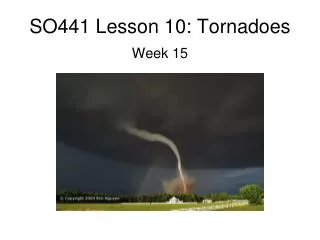
SO441 Lesson 10: Tornadoes Week 15
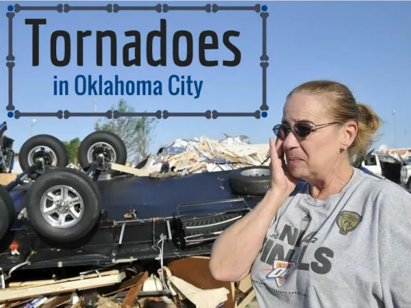
What is a tornado? • A violently rotating column of air • in contact with the ground • pendant from a cumuliform • Often (but not always) visible as a funnel cloud 21 May 2011, near Emporia, KS 22 May 2011, near Bernice, OK 25 May 2012, near Russell, KS
What exactly causes tornadoes to form? • We know the ingredients that cause supercell thunderstorms to form: • Conditionally unstable air • Strong vertical wind shear (both speed & directional shear) • Lifting mechanism: a dryline or warm front • And this “trigger mechanism” must be enough to overcome the “capping inversion” (region where temperature increases w/height) that exists ~5000 feet above ground • What seems to be missing in the ~90% of supercells that do not produce tornadoes? • Low-level (the near-surface) wind shear seems to hold the key! • Let’s examine how tilting leads to the formation of the rotating mesocyclone and possible tornado
What is the process of tornado formation? TILTING & STRETCHING “Horizontal roll” Image from Meteorology Today Low-level wind shear causes large areas of air to slowly turn. The thunderstorm updraft “tilts” this area of rotation, and it becomes the mesocyclone (rotating updraft in a supercell thunderstorm).
Tornadoes around the world From: Forbes, G. S., and Bluestein, H. B., 2001: Tornadoes, TornadicThunderstorms, and Photogrammetry: A Review of the Contributions by T. T. Fujita. Bull. Amer. Meteor. Soc., 82, 73-96.
A model of tornado complexity From: Forbes, G. S., and Bluestein, H. B., 2001: Tornadoes, TornadicThunderstorms, and Photogrammetry: A Review of the Contributions by T. T. Fujita. Bull. Amer. Meteor. Soc., 82, 73-96.
A top-down view of a tornado From: Forbes, G. S., and Bluestein, H. B., 2001: Tornadoes, TornadicThunderstorms, and Photogrammetry: A Review of the Contributions by T. T. Fujita. Bull. Amer. Meteor. Soc., 82, 73-96.
Side view of a supercell thunderstorm From: Forbes, G. S., and Bluestein, H. B., 2001: Tornadoes, TornadicThunderstorms, and Photogrammetry: A Review of the Contributions by T. T. Fujita. Bull. Amer. Meteor. Soc., 82, 73-96.
View into the tornadic part of the supercell FIG. 9. Fujita’s revised conceptual model of left-turn and right-turn tornadoes and their relation to the mesocyclone [(a)–(c): reprinted from Weatherwisewith permission of the Helen Dwight Reid Educational Foundation (see acknowledgments)] (a) formation of leftand right-turn tornadoes relative to the mesocyclone (Fujita 1974) From: Forbes, G. S., and Bluestein, H. B., 2001: Tornadoes, TornadicThunderstorms, and Photogrammetry: A Review of the Contributions by T. T. Fujita. Bull. Amer. Meteor. Soc., 82, 73-96.
Case study: Goshen, WY tornado 5 June 2009 Image source: Accuweather.com http://www.youtube.com/watch?v=3Aud6cBPYN4 Fig. 1. Tracks of the mesocyclone at 1.5 km AGL (blue) and tornado locations (green) as measured by the DOW radars. The DOW6–DOW7 30° dual-Doppler lobe is indicated in purple and the 2152 DOW7 30-dBZ radar reflectivity isopleth in the hook-echo region is indicated in black. The location of the radars used in this study and selected reference times along the tornado/mesocyclone track are indicated. This, and the following 4 slides, taken from Kosiba et al. 2013, their peer-reviewed publication in Monthly Weather Review. Kosiba, Karen, Joshua Wurman, Yvette Richardson, Paul Markowski, Paul Robinson, James Marquis, 2013: Genesis of the Goshen County, Wyoming, Tornado on 5 June 2009 during VORTEX2. Mon. Wea. Rev., 141, 1157–1181.
Radar views of the tornado: from above and from the side Fig. 2. (top) Expanded view of the LRR as viewed by DOW7 at 2152 and (bottom) a cross section through the LRR at the location of the black line. The LRR extended through the depth of the radar volume to at least 6 km.
Evolution of the tornadic circulation (14 min) as seen by Mobile Doppler Radar (left) and visually (right) Fig. 3. (a)–(h) Evolution of the 1° elevation reflectivity field (shown every other sweep, every 2 min), as measured by DOW7, from 2148 to 2202. An LRR (white ellipse) reappeared near the time of tornadogenesis. A low-reflectivity eye was barely discernible at 2154, but became prominent at 2200 onward. Reflectivity in the knob of the hook increased, and the tip of the hook coiled into a classically tornadic appearance. Fig. 4. (a)–(f) Visual evolution of the storm structure during the tornadogenesis period. Cloud-base lowerings associated with cyclonic and anticyclonic circulations that were evident in the radar wind fields are annotated. Photographs were taken from the DOW7 location looking east-southeast [courtesy of N. Atkins and R. Wakimoto (Lyndon State University/National Center for Atmospheric Research photogrammetry team)].
Evolution of the tornadic circulation (14 min) as seen by Mobile Doppler Radar Fig. 5. (a)–(h) Evolution of the Doppler velocity field at 1° elevation as measured by DOW7 (shown every 2 min). By 2152:50 (not shown), the velocity difference across the couplet exceeds 40 m s−1, the tornadic threshold established by Alexander and Wurman (2008). Between 2152 and 2202, the RFD wraps east of the tornadic circulation. Red arrows indicate anticyclonic regions, red curves delineate the SRFD and SRFGF region, red circles indicate a secondary cyclonic region, and blue curves denote a region of increasing divergence extending north of the displayed panels.
New thoughts on tornado genesis Fig. 17. (a)–(d) Schematic of the tornadogenesis process from 2148 to 2202. Blue lines indicate the strength and orientation of the SRFD, olive lines indicate the location and strength of the PRFGF and the SRFGF, and red lines indicate the FFGF. Enhanced convergence, associated with increased tilting (dashed black lines) and stretching (pink shading) occurs in (b) and (d). Changes in the SRFD were linked to enhanced production of ζ, tornadogenesis, brief weakening, and resumed intensification of the tornado. Intensity of the developing tornado is indicated schematically with the number of black arrows.
Where do U.S. tornado fatalities occur? (Ashley, WAF, 2007)
US tornado statistics Note: gradual decline in number of very strong (F3 or greater) tornadoes. Large increase in total tornadoes.
More U.S. tornado statistics Note: while the number of days with at least one tornado has increased in the last 80 years (to where a tornado occurs on ~ 200 days, or ~ 55%, of the year), the annual number of people killed by tornadoes has declined, especially since 1940.
Features of interest: Center of surface mid-latitude cyclone (area of low pressure): L Warm front boundary: red line Dryline boundary: brown line Area for thunderstorm initiation: region of maximum surface air convergence. Where does that occur? Along the boundaries! Region of maximum convergence: just east of the surface low L
L L

