APRS
APRS. The Automated Packet Reporting System by: Andy Zwirko - K1RA k1ra@k1ra.us http://www.k1ra.us/. Presentation Overview. Definition, purpose and scope of APRS APRS Pitfalls & Misconceptions History of APRS and its inventor Station Hardware Network and data flow

APRS
E N D
Presentation Transcript
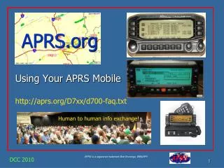
APRS The Automated Packet Reporting System by: Andy Zwirko - K1RA k1ra@k1ra.us http://www.k1ra.us/
Presentation Overview • Definition, purpose and scope of APRS • APRS Pitfalls & Misconceptions • History of APRS and its inventor • Station Hardware • Network and data flow • APRS protocol and raw packet decodes • Software • FARA members on APRS • The future of APRS and opportunities • Links
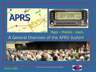
What is APRS? APRS = Automatic Packet Reporting System APRS is an open system that uses unconnected AX.25 radio packets to transmit and collect data. APRS data is usually overlaid on a map
APRS is: • A two-way information exchange using radio • A one-to-many, unconnected packet protocol. • A tactical protocol designed for local RF use. • A protocol with many reporting capabilities. • A protocol with SMS capabilities. • A protocol also adapted to the Internet. • A protocol with extensive flexibility built-in. • A protocol still under development.
Purposes of APRS Immediate digital information exchange between all participants in a local area or event. This includes: Positions and status of all stations and objects (GPS) Messages, Bulletins and Announcements Assist in Search and Rescue operations Gather and track weather data and telemetry (satellite, remote) DF bearings and signal strengths for quick transmitter hunting RF Connectivity plots of all stations Local OBJECTS on a common map display for all users Local Freqs, Nets, Meetings, Marathons, Races, Events Signal Finding Nets & Meetings Voice Alert Wx Info Field Data RF Ranging Frequency Traffic
APRS Network Nodes • Home stations • Mobile and Portable GPS tracker stations • Automatic Weather Stations • Digipeaters • Internet I-Gates
APRS Pitfalls & Misconceptions That APRS is just Vehicle Tracking vs. a Real-Time Information Distribution System. That APRS is dependent on GPS for its value (GPS is not needed. See Objects). Failure to use the APRS built-in Mile-Marks for tracking all other non-APRS mobiles. Using APRS clients that only do maps and ignore many of the APRS fundamentals. Failure to understand the importance of Objects Not understanding the APRS operator’s role as a Data Input (Objects, Messages, etc) Failure to use real-time messaging: Not using the D7 and D700 as data entry and clipboard display units at field events. Too much focus on Large Screen Displays vs. Individual Operator displays for events. Failure to display APRS symbols with all their attributes and colors Failure to manage the network by adjusting a local digipeater for the situation at hand. Not realizing the importance of Voice Operating frequencies in APRS. Failure to implement the original APRS Centralized Common Bulletin Board concept. Ignore the fundamental Decay Algorithm to accelerate new data, and decay old data!
Founder & History • Bob Bruninga, WB4APR is considered the “Father of APRS” and is still active on a daily basis. • Bob is a member of the United States Naval Academy Aerospace Engineering Dept. • APRS was developed in the early 1990's for local tactical digital communications, situational awareness and TWO-WAY information exchange using Amateur radio. • Bob Bruninga first used to track horses in 1994 • Designed to “be a cost effective mapping program that would allow positioning of mobile stations using GPS receivers.”
What is needed to participate? • Operating via RF • Radio - VHF transceiver and antenna • TNC - Terminal Node Controller • Computer with APRS software installed • GPS (optional) for mobile stations • Operating via the Internet • Computer with browser or APRS software • Mobile phone with browser or APRS software
VHF Transceiver • Any 2 meter radio will work as long as it will work on 144.390 carrier squelch • You will need to make a cable to connect mic audio, RX audio, and PTT to the TNC
TNC Encode/Decode • Known as a radio modem, converts the digital information from the computer and/or GPS into audio tones and AX.25 • The APRS network runs at 1200 baud
TNC Encode (only) • Cheaper than a regular TNC ($30-45) but it only transmits data • Has a single port that only allows connection to a GPS Open Tracker 1+ Tiny Trak 3
APRS Enabled Radios • Some radios have built in TNCs for direct connection to a computer or APRS interaction right on the display. Alinco DR-135 Kenwood TH-D7A Kenwood D-700A
GPS Receivers • Uses military controlled GPS satellites available to general public • Typical positions accuracy ranges from 1-5 feet • GPS must output NMEA to work with APRS • Many models available for under $100 • Serial, USB, Bluetooth interfaces available to PC
Station Configurations • Dedicated APRS system • GPS • Computer • Radio (separate) • TNC (encode/decode) • Mic-E APRS system • Radio (shared) • TNC (encode only) • GPS
Dedicated Equipment Pros / Cons • Pros • Can watch other units on map and send messages • Position is sent out at predetermined intervals • Separate radio system in car in case your 2M voice radio dies • Separate radio infrastructure in case your repeater goes down • Could also be used as Winlink or Packet station • Cons • Another radio in the car • More 2M RF to interfere with your local repeater traffic • Higher cost because of more equipment
Mic-E Pros and Cons • Pros • Don’t have to install another radio in the car • Cheaper than the dedicated equipment way • Can use the cheaper encode only TNC • Cons • Can not track other units on a map • Can not send messages to other units • Position only goes out when you talk on the radio • Position on map could be very old since you didn’t talk on radio • More expensive for the repeater owners • Won’t work on all repeater systems • No back-up radio if your voice radio fails • If the repeater fails, no one sees your position
Home / Fixed System • APRS Home Station without a GPS TNC Computer Radio
Trackers (one-way) One-way APRS is not normally recommended. APRS is a Network. We want good communications among all participants for maximum utility. Trackers have no APRS data display. So the receiver should be tuned to a beaconed Voice frequency so the operator can be involved in the Net! One-way trackers are good for non-manned assets at large movement events.. Not as the only APRS asset for a ham.
Tracker System • Portable tracker box, with no compute or display Tracker Radio GPS 2m Antenna
APRS Network Nodes • Stations • Home • Mobile • Digipeaters • Satellites • I-Gates APRS is a Network intended for real-time, two-way tactical information exchange.
SSID Suggestions Special Station Identifier (SSID) allows multiple stations with the same callsign to coexist on the network No SSID - Home Station, Home Station running I-Gate -1 Digipeater, Home Station running a Wide1-1 Digi, WX Digipeater -2 Digipeater [#2 or] on 70CM -3 Digipeater [#3] -4 HF to VHF Gateway -5 I-Gate (Not home station) -6 is for Operations via Satellite -7 Kenwood D7 HH -8 is for boats, sailboats and ships (maybe 802.11 in the future) -9 is for Mobiles -10 is for operation via the internet only -11 is for APRS touch-tone users (and the occasional Balloons) -12 Portable Units such as Laptops, Camp Sites etc. -14 is for Truckers -15 is for HF
Digipeaters • Extend the coverage of the portable and mobile units • Much like a repeater but operating on a simplex frequency. • Usually located at a high location on a tower • Can also be located at someone’s home to help fill in a certain area.
Paths WIDEn-N vs. Named • Digipeaters acknowledge WIDEn-N paths • WIDEn-N paths are decremented for each hop • Never need more than WIDE2-2 • Named path most efficient form of message propagation • Only the station with the matching Alias will digipeat the message • WD4HDL-1, N3HF-1
I-Gates – Tier2 Global Net I-Gates are internet gateways that expand the reach of APRS worldwide – www.aprs2.net An I-Gate listens to the local RF channel and relays the information into an APRS Internet data stream. I-Gates also relay information from the Internet data stream to a local RF station
Benefits of I-Gates • Reduces RF network congestion • Increases the trackability of mobile stations • Allows RF access of weather service bulletins and alerts • Can set up an APRS station without a radio and TNC • Any APRS station can be queried at www.findu.com or www.aprs.fi
Typical Local APRS Network Internet Gateway Digipeater Home Fixed Mobiles Digipeater Portables
Decoded APRS Packets • Location and Status
Decoded APRS Packets • Location and weather report
APRS Software • PDA Clients • AprsCE • APRS-Go • APRS-Palm • I-Gate • JavAPRS • AHub • aprsD • NOSaprs • PC Clients • APRSDos • WinAPRS/MacAPRS • UI-View • APRSpoint • APRS+SA • Xastir (Linux / Unix) • Internet Browser
APRSDos • The original APRS application. Development going back to 1992 • Very rudimentary maps • Has satellite tracking features, network utilization analysis, and direction finding support • Price – free • http://www.usna.edu/Users/aero/bruninga/aprs.html
WinAPRS • Uses USGS Tiger maps and integrates with Precision Maps from Undertow Software • Also uses old style APRSDOS vector maps. • NWS weather data overlay capability • Price – free • http://www.winaprs.com • Also hosts X-APRS, MacAPRS, dosAPRS
UI-View • Lots of features, more complex interface • Handles plug-ins (ex: NWS radar, Sat. telemetry) • Vibrant developer network • Uses user generated, or raster maps. • Integrates with Precision maps. Plug-ins for Street Atlas, Mapblast and Tiger Maps • Price – free • http://www.uiview.org
APRSpoint • Easy to use, familiar Microsoft style interface • Requires MapPoint 2004, 2006, 2009 or 2010 • Provides for routing • Price – $77 with maps, $47 without maps • http://www.aprspoint.com
APRS+SA • Interfaces with Delorme Street Atlas USA • Offers text-to-speech capabilities • Price - free
APRS-Go • Windows Mobile / PDA • Uses OSM public map set • Works with many TNCs • Price – free • PC version too http://www.aprsgo.com/