Download
1 / 47
480 likes | 617 Vues
Unit 3 – North America 6 th Grade Social Studies Todd Phillips Boyd Elementary. Sovereign: Queen Elizabeth II (1952) Governor-General: Sir Colville Young (1993) Government: Parliamentary democracy within the British Commonwealth. Population (2010 est.): 314,522

E N D
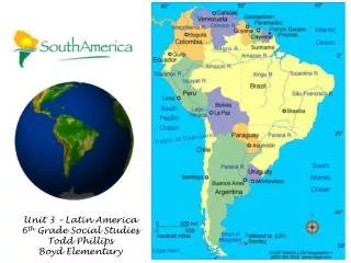
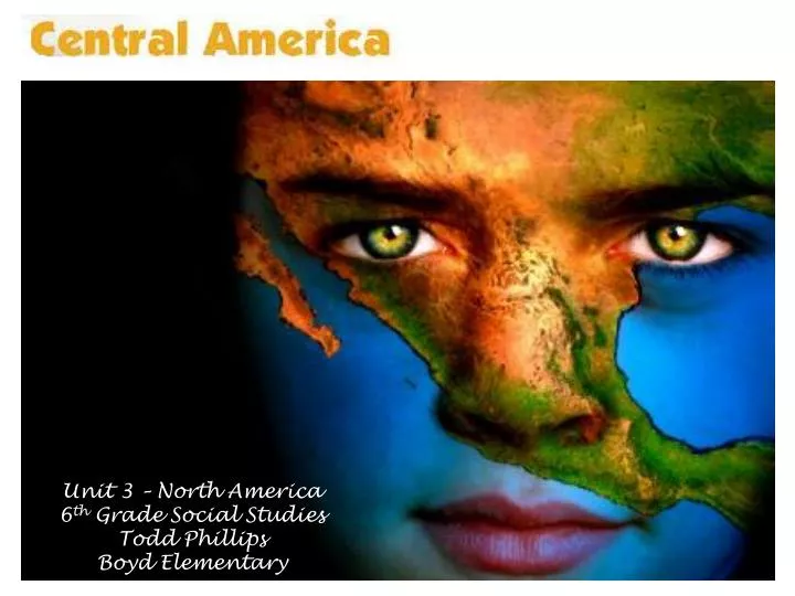
Unit 3 – North America 6th Grade Social Studies Todd Phillips Boyd Elementary
Sovereign: Queen Elizabeth II (1952) • Governor-General: Sir Colville Young (1993) • Government: Parliamentary democracy within the British Commonwealth. • Population (2010 est.): 314,522 • Capital (2003 est.): Belmopan, 8,700 • Largest city: Belize City, 52,600
Languages: English (official), Spanish, Mayan, Garifuna (Carib), Creole • Ethnicity/race: mestizo 48.7%, Creole 24.9%, Maya 10.6%, Garifuna 6.1%, other 9.7% • Religions: Roman Catholic 50%, Protestant 27% (Pentecostal 7%, Anglican 5%, Seventh-Day Adventist 5%, Mennonite 4%, Methodist 4%, Jehovah's Witnesses 2%), none 9%, other 14% (2000)
National Holiday: Independence Day, September 21 • Monetary unit: Belize dollar
GEOGRAPHY: • Belize is situated on the Caribbean Sea, south of Mexico and east and north of Guatemala in Central America. In area, it is about the size of New Hampshire. Most of the country is heavily forested with various hardwoods. Mangrove swamps and cays along the coast give way to hills and mountains in the interior. The highest point is Victoria Peak, 3,681 ft (1,122 m).
Industries: garment production, food processing, tourism, construction. • Natural resources: arable land potential, timber, fish, hydropower. • Major trading partners: U.S., UK, Jamaica , Mexico, Guatemala, Cuba, China, Japan (2004).
National name: Republic of Costa Rica • President: Laura Chinchilla (2010) • Government: Democratic republic. • Population (2010 est.): 4,516,220 • Capital and largest city (2003 est.):San José, 1,527,300 • Languages:Spanish (official), English
Ethnicity/race:white (including mestizo) 94%, black 3%, Amerindian 1%, Chinese 1%, other 1% • National Holiday:Independence Day, September 15 • Religion:Roman Catholic 76%, Evangelical 14%, Jehovah's Witnesses 1%, other Protestant 1%, other 5%, none 3% • Monetary unit: Colón
GEOGRAPHY: • This Central American country lies between Nicaragua to the north and Panama to the south. Its area slightly exceeds that of Vermont and New Hampshire combined. It has a narrow Pacific coastal region. Cocos Island (10 sq mi; 26 sq km), about 300 mi (483 km) off the Pacific Coast, is under Costa Rican sovereignty.
Industries: microprocessors, food processing, textiles and clothing, construction materials, fertilizer, plastic products. • Natural resource: hydropower. • Major trading partners: U.S., Netherlands, Guatemala, Japan, Mexico, Brazil (2004).
National name:República de El Salvador • President-elect: Mauricio Funes (2009) • Government: Republic. • Population (2010 est.): 6,052,064 • Capital and largest city (2003 est.):San Salvador, 1,791,700 • Languages:Spanish, Nahua (among some Amerindians)
Ethnicity/race:mestizo 90%, white 9%, Amerindian 1% • National Holiday:Independence Day, September 15 • Religions:Catholics 83%; growing population of evangelical Protestants (1992) • Monetary units: Colón; U.S. dollar
GEOGRAPHY: • Situated on the Pacific coast of Central America, El Salvador has Guatemala to the west and Honduras to the north and east. It is the smallest of the Central American countries, with an area equal to that of Massachusetts, and it is the only one without an Atlantic coastline. Most of the country is on a fertile volcanic plateau about 2,000 ft (607 m) high.
Industries: food processing, beverages, petroleum, chemicals, fertilizer, textiles, furniture, light metals. • Natural resources: hydropower, geothermal power, petroleum, arable land. • Major trading partners: U.S., Guatemala, Honduras, Nicaragua, Mexico, Germany, China (2006).
National name:República de Guatemala • President: Álvaro Colom Caballeros (2008) • Government: Constitutional democratic republic. • Population (2010 est.): 13,550,440 • Capital and largest city (2003 est.):Guatemala City, 2,655,900
Languages:Spanish 60%, Amerindian languages 40% (23 officially recognized Amerindian languages, including Quiche, Cakchiquel, Kekchi, Mam, Garifuna, and Xinca) • Ethnicity/race:Mestizo (Ladino)—mixed Amerindian-Spanish ancestry—and European 59.4%, K'iche 9.1%, Kaqchikel 8.4%, Mam 7.9%, Q'eqchi 6.3%, other Mayan 8.6%, indigenous non-Mayan 0.2%, other 0.1% (2001)
Religions:Roman Catholic, Protestant, indigenous Mayan beliefs • National Holiday:Independence Day, September 15 • Monetary unit:Quetzal
GEOGRAPHY: • The northernmost of the Central American nations, Guatemala is the size of Tennessee. Its neighbors are Mexico on the north and west, and Belize, Honduras, and El Salvador on the east. The country consists of three main regions—the cool highlands with the heaviest population, the tropical area along the Pacific and Caribbean coasts, and the tropical jungle in the northern lowlands (known as the Petén).
Industries: sugar, textiles and clothing, furniture, chemicals, petroleum, metals, rubber, tourism. • Natural resources: petroleum, nickel, rare woods, fish, chicle, hydropower. • Major trading partners: U.S., El Salvador, Honduras, Mexico, South Korea, China (2006).
National name:República de Honduras • President:Porfirio Lobo (2010) • Government: Democratic constitutional republic. • Population (2010 est.): 7,989,415 • Capital and largest city (2003 est.):Tegucigalpa, 1,436,000
Languages:Spanish (official), Amerindian dialects; English widely spoken in business • Ethnicity/race:mestizo 90%, Amerindian 7%, black 2%, white 1% • Religions:Roman Catholic 97%, Protestant 3% • National Holiday:Independence Day, September 15 • Monetary unit:Lempira
GEOGRAPHY: • Honduras, in the north-central part of Central America, has a Caribbean as well as a Pacific coastline. Guatemala is to the west, El Salvador to the south, and Nicaragua to the east. The second-largest country in Central America, Honduras is slightly larger than Tennessee. Generally mountainous, the country is marked by fertile plateaus, river valleys, and narrow coastal plains.
Industries: sugar, coffee, textiles, clothing, wood products. • Natural resources: timber, gold, silver, copper, lead, zinc, iron ore, antimony, coal, fish, hydropower.Major trading partners: U.S., Costa Rico, Mexico, El Salvador, Guatemala (2006).
National name: Republic of Nicaragua • President: Daniel Ortega (2007) • Government: Republic. • Population (2010 est.): 5,995,928 • Capital and largest city (2003 est.):Managua, 1,390,500 • Languages:Spanish 98% (official); English and indigenous languages on Atlantic coast (1995)
Ethnicity/race:mestizo 69%, white 17%, black 9%, Amerindian 5% • Religions:Roman Catholic 73%, Evangelical 15%, Moravian 2%, none 9% (1995) • National Holiday:Independence Day, September 15 • Monetary unit: Gold Cordoba
GEOGRAPHY: • Largest but most sparsely populated of the Central American nations, Nicaragua borders Honduras to the north and Costa Rica to the south. It is slightly larger than New York State. Nicaragua is mountainous in the west, with fertile valleys. Two big lakes, Nicaragua and Managua, are connected by the Tipitapa River. The Pacific coast is volcanic and very fertile. The swampy Caribbean coast is aptly called the “Mosquito Coast.”
Industries: food processing, chemicals, machinery and metal products, textiles, clothing, petroleum refining and distribution, beverages, footwear, wood. • Natural resources: gold, silver, copper, tungsten, lead, zinc, timber, fish. • Major trading partners: U.S., El Salvador, Mexico, Honduras, Costa Rica, Venezuela, China, Guatemala (2006).
National name: Republic of Panama • President: Ricardo Martinelli (2009) • Government: Constitutional democracy. • Population (2010 est.): 3,410,676 • Capital and largest city (2003 est.):Panama City, 1,053,500 • Languages:Spanish (official), English 14%, many bilingual
Ethnicity/race:mestizo 70%, Amerindian and mixed (West Indian) 14%, white 10%, Indian 6% • Religions:Roman Catholic 85%, Protestant 15% • Monetary units: balboa; U.S. dollar
GEOGRAPHY: • The southernmost of the Central American nations, Panama is south of Costa Rica and north of Colombia. The Panama Canal bisects the isthmus at its narrowest and lowest point, allowing passage from the Caribbean Sea to the Pacific Ocean. Panama is slightly smaller than South Carolina. It is marked by a chain of mountains in the west, moderate hills in the interior, and a low range on the east coast. There are extensive forests in the fertile Caribbean area.
Industries: construction, brewing, cement and other construction materials, sugar milling. • Natural resources: copper, mahogany forests, shrimp, hydropower. Major trading partners: U.S., Sweden, Spain, Netherlands, Costa Rica, Netherlands Antilles, Japan, Mexico, Colombia (2004).
The 48 mile-long (77 km) international waterway known as the Panama Canal allows ships to pass between the Atlantic Ocean and Pacific Ocean, saving about 8000 miles (12,875 km) from a journey around the southern tip of South America, Cape Horn.
History of the Panama Canal • By August 15, 1914 the Panama Canal was officially opened by the passing of the SS Ancon. At the time, no single effort in American history had exacted such a price in dollars or in human life. The American expenditures from 1904 to 1914 totaled $352,000,000, far more than the cost of anything built by the United States Government up to that time. Together the French and American expenditures totaled $639,000,000. It took 34 years from the initial effort in 1880 to actually open the Canal in 1914. It is estimated that over 80,000 persons took part in the construction and that over 30,000 lives were lost in both French and American efforts.
History of the Panama Canal cont. • From 1819, Panama was part of the federation and country of Colombia but when Colombia rejected United States plans to build a canal across the Isthmus of Panama, the U.S. supported a revolution that led to the independence of Panama in 1903. • The new Panamanian government authorized French businessman Philippe Bunau-Varilla, to negotiate a treaty with the United States. The Hay-Bunau-Varilla Treaty allowed the U.S. to build the Panama Canal and provided for perpetual control of a zone five-miles wide on either side of the canal. • Although the French had attempted construction of a canal in the 1880s, the Panama Canal was successfully built from 1904 to 1914. Once the canal was complete the U.S. held a swath of land running the approximately 50 miles across the isthmus of Panama.
History of the Panama Canal cont. • The division of the country of Panama into two parts by the U.S. territory of the Canal Zone caused tension throughout the twentieth century. Additionally, the self-contained Canal Zone (the official name for the U.S. territory in Panama) contributed little to the Panamanian economy. The residents of the Canal Zone were primarily U.S. citizens and West Indians who worked in the Zone and on the canal. • Anger flared in the 1960s and led to anti-American riots. The U.S. and Panamanian governments began to work together to solve the territorial issue. In 1977, U.S. President Jimmy Carter signed a treaty which agreed to return 60% of the Canal Zone to Panama in 1979. The canal and remaining territory, known as the Canal Area, was returned to Panama at noon (local Panama time) on December 31, 1999.
History of the Panama Canal cont. • Additionally, from 1979 to 1999, a bi-national transitional Panama Canal Commission ran the canal, with an American leader for the first decade and a Panamanian administrator for the second. The transition at the end of 1999 was very smooth, for over 90% of the canal employees were Panamanian by 1996. • The 1977 treaty established the canal as a neutral international waterway and even in times of war any vessel is guaranteed safe passage. After the 1999 hand-over, the U.S. and Panama jointly shared duties in defending the canal. • The Panama Canal opened officially on August 15, 1914. The world scarcely noticed. German troops were driving across Belgium toward Paris; the newspapers relegated Panama to their back pages. The greatest engineering project in the history of the world had been dwarfed by the totality of World War I.
How the Panama Canal Works • http://www.pancanal.com/eng/general/howitworks/index.html • How the Panama Canal Works • A Trip through the Panama Canal