AOML/HRD Activities - Improved Decision Support
140 likes | 168 Vues
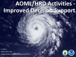
AOML/HRD Activities - Improved Decision Support. F. Marks NOAA HFIP Lead NOAA/AOML Hurricane Research Division. How do we get there…. Science Higher resolution coupled models – critical to storm evolution forecasts – especially intensity changes

AOML/HRD Activities - Improved Decision Support
E N D
Presentation Transcript
AOML/HRD Activities - Improved Decision Support F. Marks NOAA HFIP Lead NOAA/AOML Hurricane Research Division
How do we get there… • Science • Higher resolution coupled models – critical to storm evolution forecasts – especially intensity changes • Forecast techniques to understand, reduce and communicate forecast uncertainty • Information Technology • Increased computing power - to run advanced hurricane/global models and reduce uncertainty • Services oriented IT architecture for inter-agency data exchange (Open Standards) • Observations • Improved use of existing and planned systems • New observations
Airborne Observations • In-situ • Wind, press., temp. • Expendables • Dropsondes • AXBT, AXCP, buoys/floats • Remote Sensors • Doppler Radar • SFMR • Scatterometer/ profiler • Doppler Wind Lidar • UAS P-3 Flight Tracks Hurricane Bill (2009) New G-IV TA Doppler Radar NASA/NOAA Global Hawk
Airborne Observations 20090818I1 2126-0229 UTC SFMR (red), flight-level winds (black), & rain (blue) Hurricane Katrina, 28 Aug. 2005. Visible Satellite and TA Doppler from NOAA WP-3D in Hurricane Bill: 5 missions at 12-h intervals 00Z 19–21 August collecting Doppler SO
Satellite Observations • GOES IR & Visible Rapid Scan Imagery • convective evolution • eye structure • SSM/I and TRMM • Rainfall • wind speed • TPW & SAL • Scatterometry (QuikSCAT) • wind fields • Altimetry • OHC
Landbased Observations Hurricane Ike 13 September 2008 • Digital Hurricane Consortium • Towers & Sticknets • Mesonets & Doppler on Wheels • Profiler
Improved Observation Data Built upon HWind relational database
Improved Model Data • Global: • FIM global model developed at ESRL with help from NCEP run on TACC • Uses unique global grid (soccer-ball-like horizontal, adaptive vertical coordinate) • Regional: • Experimental HWRF developed at AOML & ESRL based on NCEP HWRF • Triply-nested regional model down to 1-km horizontal resolution National Hurricane Forecast System D1 D2 D3
Model Data: Global Model tracks – init 00Z 19 August FIM Courtesy of Stan Benjamin
Model Data: Regional HWRFx real-time demo simulations (https://storm.aoml.noaa.gov/hwrfx/) • 2009 hurricane season: • Ran HWRFx at resolution (9/3km), no ocean, no vortex initialization (HWRF IC/BC) • HWRFx run real-time twice a day (00Z, 12Z) for >90 cases 126 h forecasts • Provided in ATCF format to DTC & multi-model regional ensemble • NJET statistics (average): • Simulation time: 2.5 h • Post-processing: 50 min Thiago Quirino, Gopal, AOML/HRD
Visualization of Model and Observations • Integration of HWind database & Model • Integration of HWind database & NRL satellite imagery Hurricane Ike (2008) TS Fay (2008) • Exploring AWIPS-II integration through use of common standards • Integration of HWind database & YouTube Hurricane Danny (2009) Thiago Quirino, Guy Ravitz, AOML/HRD
Visualization of Model and Observations Observed 00Z 20 August 20090819I2 2137-0224 UTC HWRFx 24 h forecast initialized at 00Z 19 August
NHC Requirements • On-screen controls to accommodate TPC application (one hand) • Capability to annotate text labels and conventional symbols. • Display basic satellite and radar images in GIS mode • Animation in GIS mode • Display basic GIS parameters (e.g., county/parishes, cities, rivers, lakes, roads, elevation, population, bathymetry, etc.) on animating imagery (e.g., satellite & radar) • Add dynamic data...watch/warnings (breakpoints), model output, evacuation zones, storm surge. • Potential 3-D applications
Summary • Keys to success: • Partnership: Research (AOML/HRD, StormCenter, NASA) working closely with Operations (NWS/SRH, NHC) and Decision Makers (FEMA) • Blend traditional and HFIP hurricane research activities to support operations and decision support • Integrated use and support of operational and research data sets (NWS, HFIP, NASA) for decision support through new applications and common (open) standards (AWIPS-II)