Download
1 / 19
230 likes | 532 Vues
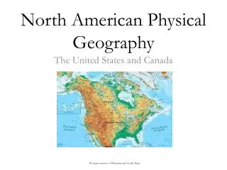
North American Physical Geography. The United States and Canada. All images courtesy of Wikimedia and Google Maps. Important Physical Features. Mountain Ranges Rocky Mountains Appalachian Mountains Sierra Nevada Mountains Alaska Range Bodies of Water

E N D
North American Physical Geography The United States and Canada All images courtesy of Wikimedia and Google Maps
Important Physical Features Mountain Ranges • Rocky Mountains • Appalachian Mountains • Sierra Nevada Mountains • Alaska Range Bodies of Water • Mississippi-Missouri-Ohio River system • Great Lakes • Columbia River • St. Lawrence
Rocky Mountains • Largest mountain range in North America and youngest • Peaks make up the Great Continental Divide • Stretches from Alaska to Mexico
Appalachian Mountains • Second largest North American range • Oldest range in North America • Low altitude peaks due to weathering and erosion • Stretches from Alabama to Nova Scotia
Mississippi-Missouri-Ohio Rivers • River system composed of three of the largest rivers in North America • System drains 31 states and 2 Canadian provinces • All flows to the Gulf of Mexico near New Orleans
Columbia and St. Lawrence Rivers • C- 4th largest in US; starts in Rocky Mnts of British Columbia and ends empties into the Pacific • St. L- Connects the Great Lakes to the Atlantic Ocean
Great Lakes • Consists of Lakes Superior, Michigan, Huron, Erie, and Ontario • Largest repository of fresh water in the world • Contains 21% of the world’s surface fresh water • Volume of 5,400 cubic miles, and a surface area of 94,000 square miles
Great Salt Lake • 2000 square mile lake • Six times saltier than the oceans due to the fact that it has no outlet
Grand Canyon • Carved out by the Colorado River over a 5 million year time period • Over a mile deep in some places • The canyon itself has been dated at an estimated 17 million years old
Canadian Shield • A very thin layer of soil on top of bedrock • Many bare outcroppings of the bedrock as a result of glaciation • Canadian Shield is immensely rich in raw minerals • Not many people live here; why?
Death Valley • 3,000 square miles of desert located in the Mojave Desert • Hottest place in North America • Driest place in North America • Badwater Basin is the lowest place in North America
Resources • Mineral • Both the US and Canada have immense mineral wealth, stretching from oil to precious metals • Vegetation • US has healthy lumber industry, as well as a plethora of agricultural ventures • Canada utilizes their lumber more than the US does as they have a larger supply
LEMPOSA of North America • Latitude • Elevation (both positive and negative) • Mountain Barriers/Orographic Effect • Proximity to water/Continentality • Ocean Currents • Storms and Atmospheric Pressure? • These are less predictable, but what types of storms are abundant in North America? What about in the locations we are looking at?
What kinds of climates do the following locations have? And why?