Physical Geography
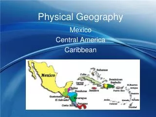
Physical Geography. Mexico Central America Caribbean. Political Features. Mexico. Political Map Mexico consists of 31 states “United Mexican States” Physical Map. Central America consists of which countries?. Made up of 7 countries Belize Guatemala El Salvador Honduras Nicaragua

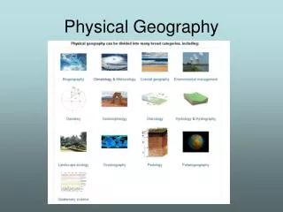
Physical Geography
E N D
Presentation Transcript
Physical Geography Mexico Central America Caribbean
Mexico • Political Map • Mexico consists of 31 states • “United Mexican States” • Physical Map
Central America consists of which countries? • Made up of 7 countries • Belize • Guatemala • El Salvador • Honduras • Nicaragua • Costa Rica • Panama • “Big Guys Eat Ham and Not Canned Peaches.”
Caribbean Islands • Over 7,000 islands • Divided into three island groups • Greater Antilles • Includes islands such as Cuba, Jamaica, Hispaniola (Haiti and Dominican Republic), and Puerto Rico. • Lesser Antilles • Includes smaller eastern islands such as Montserrat. • Bahamas • Includes 700 islands east of Florida and north of the Caribbean Sea.
Summarizing Activity • What are 3 countries within Central America? • What islands are considered the Greater Antilles? • Where are the Lesser Antilles located?
Mexico & Central America - Land • Both are an isthmus • A narrow strip of land with water on 2 sides and joins 2 larger bodies of land • 2 major peninsulas in Mexico • Baja California • Yucatan Peninsula • Central America has narrow plains are along both coastlines
Mexico’s Land • Mountains: • Sierra Madre Occidental (west) • Sierra Madre Oriental (east) • Very rugged, some active volcanoes • Sierra Madre Mountains are the primary mountain range in Mexico
Plateau of Mexico • Large raised area of land • Located between the mountain ranges • Covers half the country • Most of Mexico’s population lives there • (Mexico City – one of the largest cities in the world) • WHY? • Flat, fertile soil • Plains • Narrow coastal plains are located on each coast
Mountains are in the central region – covers 80% Rugged landscape with over a dozen active volcanoes – the most active in the Americas Land is extremely fertile because of volcanic ash Central America’s Land
Panama Canal • Built through the Isthmus of Panama to allow ships to travel between the Atlantic and Pacific Oceans.
Time Elapse • Animaniacs
Caribbean Land • Archipelago - chain of islands • Bahamas and Lesser Antilles • Caribbean Islands stretch over 2,000 miles from Florida to the Northeast coast of South America. • Islands have rugged coastlines with either white or dark sands.
Some of the Lesser Antilles (Aruba, Barbados) Coral, Sand and Sediment Coral = the remains of tiny sea animals that form together over a long period of time. Sand and sediment begin to pile up on top, soil eventually forms, plants take root, and an island is born. Greater Antilles Tops of volcanic mountains that have pushed up from the ocean floor. Cuba – ¼ mountains Jamaica, Hispaniola, and Puerto Rico How were the islands formed?
Summarizing Activity • What is an isthmus? • What are two key physical features of Mexico? • What type of physical feature covers 80% of Central America? • What is the Panama Canal? • What is an archipelago? • Explain the differences in how the Greater and some of Lesser Antilles were formed.
Major Bodies of Water • Oceans/Seas: • Pacific Ocean = West • Gulf of Mexico • Mexico = East • Central America = North • Caribbean Sea = East
Other Major Bodies of Water • Mexico • Most rivers form in the mountains • Flow to the East - Gulf of Mexico • Flow to the West - Pacific Ocean • Longest is the Rio Bravo (Rio Grande) • Forms part of the border with the U.S. • Central America • Lake Nicaragua • Located in Nicaragua • Panama Canal • Located in Panama
Summarizing Activity • Explain the importance of the Rio Grande and the Panama Canal.
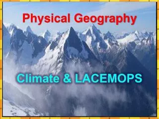
Mexico’s Climate • Arid & semiarid (desert) • hot all year • Highlands (mountains) • cold most of the year • Tropical wet & dry (rainy & dry season) • warm all year • Tropical wet • warm & wet all year
Tropical wet east coast hot, humid, and rainy Tropical wet and dry west coast hot, wet, and dry seasons Highlands central region cold mountains Central America’s Climate
Caribbean’s Climate • Two main zones • Tropical wet • Tropical wet and dry • Climate is affected more by sea and wind than by elevation or latitude. • Most important factor – is a location’s nearness to water. • The sea breezes blowing toward shore keep temperatures mild. • Average shore temperature is 80º • Also more rain falls on sides of islands facing the winds (windward) than on the side away from the wind (leeward). • Islands with mountains receive more rain than the flat islands. • Average rainfall is 200+ inches per year.
VegetationMexico, Central America & Caribbean • Desert scrub • Mexico - Low-growing grasses • Mountains • Mexico – mixed forest • C. A. – short grasses, shrubs • Temperate grassland • Mexico - Plateaus = long grasses • C.A. – West coast • Caribbean – Cuba – west coast • Tropical rainforests • Mexico - Coastal plains of south • C.A. – Central regions, east coast • Caribbean – majority of islands
Summarizing Activity • Describe the general climate of Central America and the Caribbean. • Explain why climate is affected more by sea and wind than by elevation or latitude in the Caribbean. • What is the difference between a windward and leeward side of an island? • What type of vegetation is found in Mexico, Central America and the Caribbean?
I Think I’ll Live . . . There! - Mexico • Location, climate and natural resources affect where people live and work. • Very little farmland – 12% • Lack of rainfall makes farming difficult • People have settled in cities to find jobs in factories. • 75% live in urban areas - 19 million people live in Mexico City • Other Mexicans have settled in areas rich in natural resources in order to make a living. • Northern Mexico – Minerals – silver, copper, lead, iron, oil • Oil is Mexico’s most valuable resource – found along the Gulf of Mexico
Settled in areas close to the USA border to work in factories owned by foreign companies. • Factories are called maquiladoras • Tourism is also extremely important – Cancun, Acapulco
Life is Different in Cuba! • Natural Resources • Some of the best soil in the West Indies (Caribbean) • Grow sugarcane, tobacco, coffee beans • Sugarcane is Cuba’s most important product • 75% of Cubans live in cities and towns • Similar to Havana (capital) • Work in factories that make clothing, process sugar cane or make cigars • Rural areas • Work on farms • Communist government controls the country’s farms and businesses
I’ll Trade with You! • Mexico has a great location for trading . . . Right next to the USA. • Sends about 80% of exports to the USA • Fruits and vegetables are a chief export • Oil is another major export • Cuba doesn’t trade with the USA . . . Even though it’s only 90 miles away from Florida. • USA has an embargo against Cuba • USSR used to be a major trading partner until it dissolved in the early 90’s. • Major trading partners today are China and Venezuela. • Major exports are sugar, nickel, tobacco and fish.
Summarizing Activity • Where do most people choose to live in Mexico? Why? • What is the most valuable resource in Mexico? • What is a maquiladora? • What are 2 major resources of Cuba? • Who is the chief exporting partner for Mexico and Cuba?
Plateau of Mexico • Mexico City is located at the southern-end of the plateau • 2nd largest city in the world with over 19 million people • City is built on a dry lakebed with soft, loose soil • Greatly affected by air pollution and natural disasters • Why???
Oil is Mexico’s most important resource Also the source of terrible air pollution in and around Mexico City Mountains surrounding the city trap exhaust from cars and factories Enable the smog (brown haze) to lay over the city. Wind currents are not strong enough to blow the pollutants over the mountains. Overpopulation and industrialization also impacts air pollution. The government monitors pollution levels in the air Will close factories and change school hours if the levels get too high Strict rules on when you can drive your car . . . Factory emissions . . . Inspections of cars. WHY THESE RESTRICTIONS??? Air Pollution in Mexico
Major Concerns about air pollution . . . • Damage to vegetation • Harm to the atmosphere . . . Air • Harm to human beings • Damage caused by acid rain • Buildings and ancient monuments/ruins in Mexico
Summarizing Activity • What type of pollution does Mexico City face? • Emissions in Mexico City come from what? • What traps pollutants above Mexico City? • In Mexico City, you might not be allowed to drive your car everyday. . . True or False.
Why is the Plateau of Mexico & Mexico City in danger of natural disasters? • Underneath Mexico City tectonic plates are colliding together • Western edge of North American tectonic plate • Near the Pacific, Cocos and Caribbean plates • Causes earthquakes and volcanoes on a regular basis • Many volcanoes surround the city, including Popocatepetl, the 2nd highest peak in Mexico, located about 50 miles away. • Popo is still active with last activity occurring in 1994.
Natural Disasters • Hurricanes • Form over warm water (80 degrees or warmer) • Winds from 75 mph to 200 mph • Usually lasts a week or more, moving 10-20 mph over the ocean • Heavy rain • Can cause flooding and mudslides • Flooding & Mudslides • Caused from excessive amounts of rain • Happens in deforested areas