Download
1 / 21
210 likes | 239 Vues
This article discusses the goals, current status, and accomplishments of transitioning MODIS wind products from CIMSS to the NESDIS operational environment.

E N D
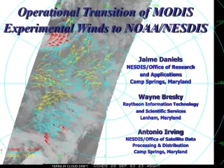
Operational Transition of MODIS Experimental Winds to NOAA/NESDIS Jaime Daniels NESDIS/Office of Research and Applications Camp Springs, Maryland Wayne Bresky Raytheon Information Technology and Scientific Services Lanham, Maryland Antonio Irving NESDIS/Office of Satellite Data Processing & Distribution Camp Springs, Maryland TERRA IR CLOUD DRIFT
Topics • Goals of the transition process • Current status & accomplishments to date • Plans for the transitioning MODIS wind capability into NESDIS operations
Goals of the Transition Process • Move the responsibility for production and distribution of the MODIS wind products from CIMSS to the NESDIS operational environment • Actively engage and coordinate with the user community with respect to their use of the MODIS wind products • Get the MODIS wind products into the hands of the users • In as timely a manner as possible • In the format needed • Via newly established distribution pathways Take advantage of this workshop to: i) Highlight MODIS wind products; ii) Interact with current and potential new users of these; and iii) Walk away with new/additional requirements for these products which will help me move transition along….
Current Status & Accomplishments to Date • MODIS winds capability has been successfully transferred from CIMSS to NESDIS/ORA • After some effort, both groups produce the same product when using same inputs • CIMSS (C-version) • NESDIS/ORA (Fortran-version) • With software baseline established, we can move forward
Current Status & Accomplishments to Date • NESDIS/ORA initiates routine experimental production of MODIS wind products at the NOAA Science Center • Terra IR CD & WV winds over the Arctic (July 2003) • Just recently (~ 9/15) we began routine production of Terra IR CD & WV winds over the Antarctic & Aqua IR CD & WV winds over the Arctic & Antarctic • MODIS imagery made available on CIMSS server* • Forecasts from NCEP’s Global Forecast System (GFS) NWP model used in the processing** • CIMSS is using forecasts from US Navy’s NOGAPS NWP model • During CIMSS & ORA testing we found some rather significant differences between the two model wind fields, which in turn, resulted in differences in our respective MODIS wind fields.
(NOGAPS) (GFS)
Considerationsin the Tracer Tracking Step… Model wind forecast defines this vector which determines where to position the “search scene” Match Target scene Search Scene Time t0 Time t0 + t • Model wind field is used to help guide where we locate the search box • The range of possible displacements is the difference in size between • the tracking area & the search area (ie., lag size). This displacement is • also f(image pixel resolution & time interval between images). The ratio • on the right indicates the degree of model dependency • (u-uguess) & (v-vguess) < (L-2) X / 2T(X=pixel res; T=image time interval) • X T L RATIO • GOES 4km 30min 21 21 m/s; (u & v must be within 21m/s of guess) • MODIS 2km 90min 35 6 m/s; (u & v must be within 6 m/s of guess)
MODIS wind examples • Time series of difference stats • Terra IR CD vs. raob; vs.GFS analysis • Terra WV vs. raob; vs. GFS analysis
One Day of Arctic Orbits MODIS band 27 (6.7 mm)
Terra IR Cloud-Drift vs. Radiosonde 8/19/2003 – 10/2/2003
Terra Water Vapor Motion Winds vs. Radiosonde 8/19/2003 – 10/2/2003
Terra IR Cloud-Drift vs. GFS Analysis 8/19/2003 – 10/2/2003
Terra Water Vapor Motion Winds vs. GFS Analysis 8/19/2003 – 10/2/2003
Plan for Transitioning MODIS Wind Product Application to Operations • Operational readiness is dependent on: • Completion of dedicated communications infrastructure between NASA Goddard and the NOAA Science Center (Nov. 2003) • Will allow the timely transfer of near real-time MODIS data • Operational H/W procurement to store and serve up MODIS imagery & front-end ingest software to prepare MODIS imagery for input to MODIS wind application (~ June 2004)
“Near Real Time” MODIS Data Flow Diagram (23 July 2002) -- NOAA GB NGI (DEC ‘02) Building 32 – GSFC Gene Legg NOAA/OSDPD NOAA Science Center FB4 (NOAA) Ocean Fire Snow & Ice Land Winds 100 Mbs (FDDI) 10Mbs (FNS NOV ‘01) NOAA Facility L1B L2 MOD03 Processors SGI 100Mbs (FDDI) Satellite Active Archive Alex Kidd NOAA/NESDIS OSDPD NOAA Ocean Products Servers Shared Processing DoD • Building 32 – GSFC • NRT Processing of MODIS 5’ Granules • Level 1B and L2 product generation • MOD03 Geo location file generation • Capacity to process global Aqua & • Terra MODIS data Product Generation & Distribution • NOAA Science Center • Level 3 product generation • At present, limited to N. America coverage • Ocean Color OCL2A/B, and MOD28 currently available • Requests for level 1B and expanded coverage are being evaluated Stennis S C NRL, NAVO
In the Interim… • MODIS wind application software is in the process of being transferred from NESDIS/ORA to NESDIS/OSDPD (operations) • Terra and Aqua IR CD & WV winds over Arctic & Antarctic will be produced in a routine, experimental mode using MODIS imagery from the CIMSS server • NCEP GFS model forecasts will be used • Product will be placed into BUFR (same template as used for GOES winds) and made available on a anonymous ftp server
In the Interim… (cont’d) • NESDIS ORA & OSDPD will work with all potential users to get them access to the MODIS wind datasets (BUFR, etc) • Internal to NOAA we will • Work with NOAA/NCEP to get these BUFR products into the NCEP database which will facilitate impact tests by the Joint Center for Satellite Data Assimilation (JCSDA) • Work with NOAA/NWS to get the MODIS wind products into selected NWS WFOs who request them (in digital form) • NESDIS ORA will continue to work closely with CIMSS to incorporate updated science algorithm and/or processing methodologies