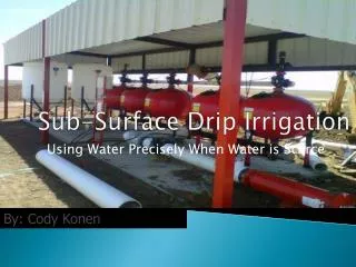
Surface Water Movement: Stream Systems and Floods
Explore the dynamics of surface water movement, stream systems, and floods. Learn about runoff, watersheds, stream carrying capacity, and flood monitoring systems. Understand how water shapes the Earth's surface through erosion and deposition.

Surface Water Movement: Stream Systems and Floods
E N D
Presentation Transcript
EARTH SCIENCEGeology, the Environment and the Universe Chapter 9: Surface Water
Surface Water Movement SECTION9.1 • Running water is an agent of erosion, carrying sediments in streams and rivers and depositing them downstream.
Surface Water Movement SECTION9.1 New Vocabulary runoff watershed divide suspension bed load discharge flood floodplain
Surface Water Movement SECTION9.1 The Water Cycle • The water cycle, also referred to as the hydrologic cycle, is a never-ending, natural circulation of water through Earth’s systems.
Surface Water Movement SECTION9.1 • The Water Cycle
Surface Water Movement SECTION9.1 Runoff • Water flowing downslope along Earth’s surface is called runoff.
Surface Water Movement SECTION9.1 Runoff Soil composition • Soil that has open surface pores allows water to infiltrate. The particle size that makes up a soil helps determine the pore space of the soil. Large grain size Fine grain size Mixed grain size
Surface Water Movement SECTION9.1 Runoff Rate of precipitation • If the rate of precipitation (e.g. rainfall) exceeds the rate of infiltration, the water will become runoff.
Surface Water Movement SECTION9.1 Runoff Vegetation • Vegetation can slow the rate of runoff of surface water. Raindrops are slowed when they strike the leaves of trees or blades of grass, and they trickle down slowly.
Surface Water Movement SECTION9.1 Runoff Slope • Water from precipitation falling on slopes flows to areas of lower elevation. The steeper the slope, the faster the water flows.
Surface Water Movement SECTION9.1 Stream Systems Tributaries • Rivers that flow into other streams are called tributaries.
Surface Water Movement SECTION9.1 Stream Systems Watersheds and divides • All of the land area whose water drains into a stream system is called the system’s watershed. • A divide is an elevated land area that separates one watershed from another.
Surface Water Movement SECTION9.1 Stream Systems Watersheds and divides • The watershed of the Mississippi River includes many stream systems, including the Mississippi, Missouri, and Ohio Rivers. The Continental Divide marks the western boundary of the watershed.
Surface Water Movement SECTION9.1 Stream Carrying Capacity • The ability of a stream to transport material, referred to as its carrying capacity, depends on both the velocity and the amount of water moving in the stream.
Surface Water Movement SECTION9.1 Stream Carrying Capacity • Discharge is the measure of the volume of stream water that flows past a particular location within a given period of time (measured in cu.ft./s or m3/s).
Surface Water Movement SECTION9.1 Stream Carrying Capacity • Stream discharge is the product of a stream’s average width, average depth, and the velocity of the water.
Surface Water Movement SECTION9.1 Floods • A flood occurs when water spills over the sides of a stream’s banks onto the adjacent land.
Surface Water Movement SECTION9.1 Floods • The broad, flat area that extends out from a stream’s bank and is covered by excess water during times of flooding is known as the stream’s floodplain.
Surface Water Movement SECTION9.1 Floods • When rivers overflow their banks, the floodwater deposits sediment. Over time, sediment accumulates along the edges of a river, resulting in natural levees.
Surface Water Movement SECTION9.1 Flood Monitoring and Warning Systems • In areas that are prone to severe flooding, warning systems, such as those established by the National Weather Service and the U.S. Geological Survey, are the first step in implementing emergency management plans.
Stream Development SECTION9.2 • Streams erode paths through sediment and rock, forming V-shaped stream valleys.
Stream Development SECTION9.2 New Vocabulary stream channel stream bank base level meander delta rejuvenation
Stream Development SECTION9.2 Supply of Water • The region where water first accumulates to supply a stream is called the headwaters. Stream channels
Stream Development SECTION9.2 Supply of Water • The headward erosion of Stream A cuts into Stream B and draws away from its water into one stream, in a process called stream capture. Stream channels
Stream Development SECTION9.2 Formation of Stream Valleys • The height of a stream above its base level determines how much downcutting energy the stream will have.
Stream Development SECTION9.2 Formation of Stream Valleys Meanders • A bend or curve in a stream channel caused by moving water is called a meander.
Stream Development SECTION9.2 Formation of Stream Valleys Meanders • Water moving along the outside of a meander curve has the greatest velocity erodes the side of the streambed. • Along the inside of a meander, the water moves more slowly and deposition is dominant.
Stream Development SECTION9.2 Formation of Stream Valleys Meanders
Stream Development SECTION9.2 Formation of Stream Valleys Meanders • A winding stream may cut off a meander and once again flow along a straighter path. The blocked-off meander becomes an oxbow lake, which eventually dries up.
Stream Development SECTION9.2 Deposition of Sediment • When streams lose velocity, they lose some of the energy needed to transport sediment, and deposition of sediment occurs.
Stream Development SECTION9.2 Deposition of Sediment Alluvial fans • Alluvial fans are fan-shaped, sloping depositional features that form when water flows down steep slopes onto flat plains.
Stream Development SECTION9.2 Deposition of Sediment Deltas • The triangular deposit that forms where a stream enters a large body of water is called a delta.
Stream Development SECTION9.2 Rejuvenation • During rejuvenation, a stream resumes the process of downcutting toward its base level. • This causes an increase in the stream’s velocity, and the stream’s channel once again cuts downward into the existing meanders.
Section Check SECTION9.2 How could a mature river near its base level be rejuvenated and start eroding downward again? Answer: A river can be rejuvenated when the land the river flows over is uplifted. A drop in sea level can also increase the vertical distance between the river channel and base level and cause the river to erode downward.
Lakes and Freshwater Wetlands SECTION9.3 • As the amount of water changes and the amount of sediments increases, lakes can be transformed into wetlands and eventually into dry land.
Lakes and Freshwater Wetlands SECTION9.3 New Vocabulary lake eutrophication wetland
Lakes and Freshwater Wetlands SECTION9.3 Origins of Lakes • Natural lakes, bodies of water surrounded by land, form in different ways in surface depressions and in low areas.
Lakes and Freshwater Wetlands SECTION9.3 Origins of Lakes • Some lakes form when stream flow becomes blocked by sediment from landslides or other sources. • Other lakes, such as moraine-dammed lakes, cirque lakes, and kettle lakes, have glacial origins.
Lakes and Freshwater Wetlands SECTION9.3 Lakes Undergo Change • A depression that receives more water than it loses to evaporation or use by humans will exist as a lake for a long period of time. • However, over geologic time, most lakes are temporary features.
Lakes and Freshwater Wetlands SECTION9.3 Lakes Undergo Change • The process by which bodies of water become rich in nutrients that stimulate excessive plant growth is called eutrophication. Eutrophication
Lakes and Freshwater Wetlands SECTION9.3 Lakes Undergo Change Eutrophication • Although eutrophication is a natural process, it can be sped up with the addition of nutrients, such as fertilizers, that contain nitrogen and phosphorus.
Lakes and Freshwater Wetlands SECTION9.3 Lakes Undergo Change • A wetland is any land area that is covered with water for a part of the year.
Lakes and Freshwater Wetlands SECTION9.3 Lakes Undergo Change Freshwater wetlands • Wetlands play a valuable role in improving water quality.
Lakes and Freshwater Wetlands SECTION9.3 • The area of wetlands in the United States was drastically reduced until the 1980s. Since then, efforts have been made to preserve wetlands.
Surface Water CHAPTER9 Chapter Assessment How do wetlands improve water quality? Answer: Wetlands trap sediment that might otherwise enter a stream or lake. Wetland plants reduce the concentration of nutrients in runoff. Some pollutants are trapped in wetland vegetation or by wetland sediment.