Download
1 / 39
390 likes | 516 Vues
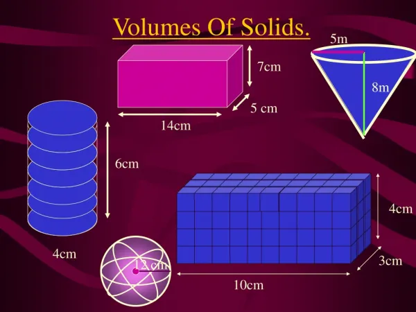
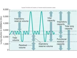
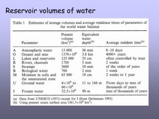
Reservoir volumes of water. Ice volume & equivalent water depth. The geoid – mean “sea level”. Map prior to satellite records. Modern geoid (SL) – areas of high variability. SL variability greatest near major currents. Gulf Stream and Loop Current. Oceanographic Satellites.

E N D
The geoid – mean “sea level” Map prior to satellite records
SL variability greatest near major currents Gulf Stream and Loop Current
Oceanographic Satellites 1978 SEASAT sea-surface temperature and chlorophyll (productivity) 1992 TOPEX & JASON
Geometry of satellite altimetry Defining the geoid
Dynamic topography Satellite tracks across the Gulf Stream
Ice and isostasy The basic idea has been around for a while
RSL over last 5 ka variable response globally
Submerging coasts > 2 mm / yr
Local effectsshoreline configuration Greater hydro-isostatic depression for promontory
Local effects on apparent sea level Increased tidal range within an embayment
Choose your RSL curve North America Away from the big ice
North America northern areas
Modeling the forebulge Local to regional effect
Global pattern of RSL >50 yrs Tide-gauge records
Global tectonic effects on RSL 1 Ma to 100 Ma
Timing of late Quaternary highstands • Chappell & Shackleton 1986 B. Shackleton 1987 • C. Bloom & Yonekura 1990
Huon Peninsula, Papua New Guinea Shoreline terraces preserved by uplift
Huon Peninsula text
Cutting coastal terraces Several options for the same terrace setting
Stage 5e on the Huon Peninsula The “prominent terrace”
Late Quaternary highstand reference points Barbados Huon Peninsula
Huon Peninsula record compared with the marine isotope record Chronology – close enough?
The Fairbanks curve U-series on corals from Barbados