Download
1 / 12
120 likes | 305 Vues
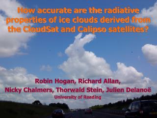
Robin Hogan, Richard Allan, Nicky Chalmers, Thorwald Stein, Julien Delanoë University of Reading. How accurate are the radiative properties of ice clouds derived from the CloudSat and Calipso satellites?. Overview.

E N D
Robin Hogan, Richard Allan, Nicky Chalmers, Thorwald Stein, JulienDelanoë University of Reading How accurate are the radiative properties of ice clouds derived from the CloudSat and Calipso satellites?
Overview • To understand the role of clouds in climate we need global measurements of their vertically resolved properties • We have developed an ice-cloud retrieval algorithm combining the CloudSat radar and Calipso lidar • Previously we have used these to evaluate the ice water content distributions in the Met Office and ECMWF forecast models • For climate, need to be confident in the retrieved radiative properties • In this talk this is assessed in two ways using instruments in the same “A-train” of satellites as CloudSat and Calipso: • Comparison with simultaneous MODIS retrievals of ice clouds; MODIS uses two solar radiances to estimate optical depth and effective radius, from which ice water path is estimated • Use the radar and lidar retrievals in a radiative transfer model to predict the top-of-atmosphere fluxes; compare with fluxes simultaneous estimated from the broadband CERES radiometer
What do CloudSat and Calipso see? • Radar: ~D6, detects whole profile, surface echo provides integral constraint • Lidar: ~D2, more sensitive to thin cirrus and liquid clouds but attenuated Cloudsat radar CALIPSO lidar Insects Aerosol Rain Supercooled liquid cloud Warm liquid cloud Ice and supercooled liquid Ice Clear No ice/rain but possibly liquid Ground Target classification Delanoe and Hogan (JGR 2010)
In July 2006, cloud occurrence in subzero troposphere was 13.3% The fraction observed by radar was 65.9% Some thin cirrus not detected The fraction observed by lidar was 65.0% Optically thick clouds not fully penetrated The fraction observed by both was 31.0% CloudSat and Calipso sensitivity
Standard variational approach Sophisticated forward models used for both single scattering properties of ice particles and lidar multiple scattering 1. New ray of data: define state vector First guess of ice extinction coefficient,a measure of ice particle number concentration and thelidar extinction-to-backscatter ratio Retrieval framework 2. Forward model 2a. Radar model 2b. Lidar model Including multiple scattering 2c. IR radiance model Optional use of MODIS Not converged 4. Gauss-Newton iteration Derive a new state vector 3. Compare to observations Check for convergence Converged Proceed to next ray of data 5. Calculate retrieval error Details in Delanoe and Hogan (JGR 2010)
Example ice cloud retrievals Lidar observations Retrieved visible extinction Lidar forward model Retrieved ice water content Radar observations Retrieved effective radius Radar forward model Delanoe and Hogan (2010)
Comparison with MODIS • All ice retrieval algorithms, no matter what instruments they use, are sensitive to assumed ice particle shape • In the “VarCloud-BR” version, we try to replicate the MODIS assumption that particles are largely bullet rosettes • Leads to reasonable agreement in mean optical depth, t • Significant scatter is likely due to 3D radiative transfer effects in the MODIS retrievals • Our favoured assumption, oblate aggregates (“VarCloud-OA”) leads to poorer agreement due to the inconsistency with the MODIS assumptions Stein et al. (2010)
Effective radius, re, also shows a better agreement when we use the same assumption as MODIS Surprisingly, ice water path, IWP, shows much better agreement with oblate aggregate assumption! Reason seems to be that MODIS estimates re from radiances that are dominated by the first few optical depths of the cloud where the particles are smaller It then (wrongly) assumes re is constant with height, leading to an overestimate in IWP: Comparison with MODIS Effective radius, re Ice water path, IWP • Still not clear which microphysical assumptions are best • An alternative approach is to consider broad-band fluxes…
Evaluation using CERES TOA fluxes • Radar-lidar retrieved profiles containing only ice used with Edwards-Slingo radiation code to predict CERES fluxes • Small biases but large random shortwave error: 3D effects? Longwave Bias 0.3 W m-2, RMSE 14 W m-2 Shortwave Bias 4 W m-2, RMSE 71 W m-2 Nicky Chalmers
CERES versus a radar-only retrieval • How does this compare with radar-only empirical IWC(Z, T) retrieval of Hogan et al. (2006) using effective radius parameterization from Kristjansson et al. (1999)? Longwave Bias –10 W m-2, RMSE 47 W m-2 Shortwave Bias 48 W m-2, RMSE 110 W m-2 Bias 10 W m-2 RMS 47 W m-2 Nicky Chalmers
Remove lidar-only pixels from radar-lidar retrieval Change to fluxes is only ~5 W m-2 but lidar still acts to improve retrieval in radar-lidar region of the cloud How important are cirrus only seen by lidar? Longwave Bias 4 W m-2, RMSE 9 W m-2 Shortwave Bias –5 W m-2, RMSE 17 W m-2 Nicky Chalmers
Conclusions • Ice cloud properties can be retrieved from CloudSat and Calipso with an accuracy that enables them to be used to predict shortwave and longwave top-of-atmosphere fluxes within the likely error of CERES • This gives us more confidence in our ongoing work to use of these retrievals to evaluate models • Differences in microphysical assumptions can explain differences with other retrievals (e.g. MODIS); work still required to determine the most appropriate assumptions • Currently we are working on simultaneous retrievals of ice, liquid, rain and aerosol, to be applied both to the A-Train of satellites and to the new EarthCARE satellite EarthCARE