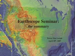
Earthscope Seminar: the summary
130 likes | 249 Vues
The EarthScope Seminar, held on April 30, 2007, led by Teresa Mae Lassak, delved into the structural, evolutionary, and dynamic aspects of North America's geology. The seminar emphasized utilizing arrays of data—including seismic and geological— to enhance our understanding of the San Andreas Fault System and regional seismic hazards. Key topics included the relationship between mantle structure and crustal tectonics, exploration methodologies like InSAR and gravity measurements, and the ongoing inquiries regarding the Colorado Plateau and other geological features.

Earthscope Seminar: the summary
E N D
Presentation Transcript
Earthscope Seminar: the summary Teresa Mae Lassak April 30th, 2007
Earthscope • Use arrays of data (geologic, seismic, exploration) to: • Understand the structure, evolution and dynamics of North America. • Enhance understanding of SAF. • Better understand seismic and natural hazards. • “Investigate the relationship between mantle structure and dynamics, and crustal tectonics, and between tectonics and fluids in the crust.”
Focus regions • Cascadia • San Andreas Fault System • Colorado Plateau
Data/Techniques Used • Broadband seismic stations (Ambient noise) • Surface deformation data • Receiver functions • S-Wave triplications • Interferometric synthetic aperature radar (InSAR) • Magnetotelluric electrical resistivity data (MT) • Seismic reflection • Drilling • Gravity measurements
Cascadia • Geometry of subducted plate? • Earthquake prediction? • Papers: • Episodic Tremor and slip on the Cascadia subduction zone: The chatter of silent slip • G. Rogers and H. Dragert • High-Resolution Surface-Wave Tomography from Ambient Seismic Noise • N.M. Shapiro,M. Campillo, L. Stehly, and M.H. Ritzwoller • Low-Velocity Zone Atop the 410-km Seismic Discontinuity in the Northwestern United States • T.-R.A. Song, D.V. Helmberger, and S.P. Grand
Cascadia: Lingering Questions • Yellowstone: what is it? • plume? • or some thing else? • What is a mechanism for the flattening of a slab, and subsequent detachment? • How does a dehydrated slab detach and sink, and how does it affect the flow field in the mantle? • How could a plume could break through a slab?
San Andreas Fault System • Geology of SAF • Use both geology and seismology • SAFOD • Fluids? • Papers: • Fine-scale structure of the San Andreas fault zone and location of the SAFOD target earthquakes • Thurber, C., S. Roecker, H. Zhang, S. Baher, and W. Ellsworth • Internal structure of the San Andreas fault at Parkfield, California • Unsworth, M.J., P.E. Malin, G.D. Egbert, and J.R. Booker
SAF: Lingering Questions • Has SAFOD looked at fluids present in the rocks at depth. • Have there been porosity/permeability studies in the borehole? • Fluids… • Data shows a greater apparent resistivity measured parallel to SAF • Interpreted as a high porosity region with saline fluids in fault zone • Does that make sense? • How important is the source of fluids potentially present in SAF? • Fluids may be crustal, mantle, or meteoric. • Would fluid from different sources be more or less likely to assist in rupture?
Colorado Plateau • Origin of Colorado plateau thickening? • Injection of new material? • Other causes? • Farallon slab affect the uplift? • Papers: • Upper mantle structure beneath the eastern Colorado Plateau and Rio Grande rift revealed by Bouguer gravity, seismic velocities, and xenolith data • Roy, M., J.K. MacCarthy, and J. Selverstone • Raising the Colorado Plateau • McQuarrie, N., and C.G. Chase
CP: Lingering Questions • What is our best guess as to what caused the thickening of the Colorado Plateau? • How would basalt extraction from peridotite (which may leave a lower-density residuum) affect uplift?
Remaining questions… • Are surface deformations a manifestation of mantle influence on the lithosphere? If so where and how? • What types of integrated studies would help begin addressing problems related to our understanding of the crust and mantle within a system? • Detailed structure of the Moho, 410-, and 660-km discontinuities beneath the western US ? • What implications/relationship does boundary layer structure have for the surface tectonics of North America? • Are joint inversions utilizing the vast array of EarthScope data planned/in progress?
Remaining questions… • Does the group think that other nationwide geophysical exploration projects used in conjunction with Earthscope data would be beneficial to studying the NA continent? • a nation-wide gravity survey, • nation-wide EM survey, • etc… • How far will Earthscope go?