MSc Remote Sensing at London’s Global University
50 likes | 171 Vues
Explore cutting-edge remote sensing technology & environmental data collection at UCL. Interdisciplinary program with renowned teaching faculty.

MSc Remote Sensing at London’s Global University
E N D
Presentation Transcript
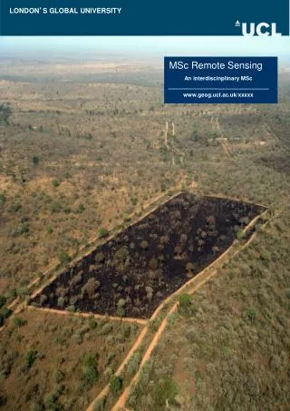
LONDON’S GLOBAL UNIVERSITY MSc Remote Sensing An interdiscinplinary MSc www.geog.ucl.ac.uk/xxxxx
LONDON’S GLOBAL UNIVERSITY MSc Remote Sensing An interdiscinplinary MSc www.geog.ucl.ac.uk/xxxxx
Remote Sensing at UCL/UoL The MSc in Remote Sensing is the leading Master's level programme in remote sensing in the UK. The programme, although based at UCL, draws expertise and teaching from across many parts of the University of London. It provides students with the opportunity to study at an advanced level the ways in which remote sensing instruments in space and on aircraft may be used to collect environmental information about the Earth. The MSc in Remote Sensing is integrated with the UCL Geography MSc programmes, providing flexibility in the course options. Distinctive features of the programme include the intercollegiate nature of the programme, which exposes students to a range of departments and expertise across fields from monitoring and modelling vegetation and carbon stocks, sea ice, climate and the cryosphere, solid earth and geology, fire impacts, photogrammetry and metrology, new sensor technology, ocean processes. The course provides an ideal foundation for PhD research, or for employment in spatial analysis, environmental consultancies, XXXX. As one of the world’s top universities, UCL excels across the physical and natural sciences, social sciences and humanities. The MSc is run by UCL Geography, which enjoys an outstanding international reputation for its research and teaching. The MSc in Remote Sensing is designed to appeal to students from a range of disciplines looking to understand the role that remote sensing can play in understanding the environment. It will appeal not only to those with backgrounds in environmental sciences, but to those from physics, engineering etc. who wish to exploit their skills in an environmental science context. The programme also caters for those who have been in employment and wish to change career.
Programme structure All students take four core remote sensing modules in the first term and choose a further four modules from a range of options in the second term. Additionally, students undertake a piece of original research leading to a dissertation of up to 15,000 words with the support of an academic supervisor. 1st term (60 credits) Core module 1: XXXX An introduction to the structure and functioning of aquatic systems along a continuum from the mountain zone to the coastal shelf. Hydrological, geomorphological, physico-chemical and biological processes and system linkages are examined in the context of current legislative frameworks. Core module 2: XXXX Covers the design and implementation of chemical, biological and physical monitoring systems, and the techniques necessary for intelligent acquisition of aquatic system data. Case-studies cover a wide range of environments, including lakes, rivers, estuaries and coastal waters in the light of recent changes in environmental legislation and advances in instrument technology. Core module 3: XXXX An introduction to sediment core analysis and its application to issues of recent aquatic environmental change, such as lake acidification, eutrophication and climate change. Practical classes provide taxonomic expertise for a range of fossil groups. Core module 4: XXXX A residential fieldclass provides practical experience of quantitative field sampling across different aquatic environments and in the context of key management and conservation issues. This module also covers laboratory procedures and numerical analysis of environmental data-sets. 2nd term (60 credits) Options may include: Aquatic Macrophytes, Coastal Change, Environmental GIS, Lakes, Marine Conservation, Science and Politics of Climate Change, Surface Water Modelling, and Wetlands. 3rd term (60 credits) Dissertation (XXXX)
Programme information The programme can be taken full-time over one year or part-time. Entry requirements Potential applicants are expected to have a minimum good second-class Honours degree in a relevant discipline (e.g. oceanography, marine studies, geography, civil engineering, geology, geography, forestry, mathematics, physics) from a UK university or equivalent from an overseas institution. Extensive work experience covering related areas will be also be considered. Funding For funding details please visit www.ucl.ac.uk/scholarships How to apply Contact the Graduate Admissions Assistant (masters@geog.ucl.ac.uk) to request a Graduate Application Pack. Application materials may also be downloaded at www.ucl.ac.uk/admission/graduate-study/application-admission/ Further information Academic enquiries may be addressed to XXXX@geog.ucl.ac.uk Further information is available at: www.geog.ucl.ac.uk/XXXX Lecturing staff include Tao Cheng Mathias Disney Jon Iliffe Seymour Laxon Philip Lewis JianGuo Liu Phillipa Mason Jan-Peter Muller Stuart Robson XXXX XXXX XXXX XXXX