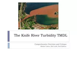
The Knife River Turbidity TMDL
300 likes | 523 Vues
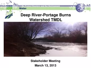
The Knife River Turbidity TMDL. Comprehensive Overview and Critique - Matias Valero, Rob Little, Rod Sykora -. The setting. SW Great Lakes Basin 15 miles NE of Duluth. Two Harbors. Duluth. Knife River. Knife River. 83.6 sq . mile watershed area. Superior National Forest.

The Knife River Turbidity TMDL
E N D
Presentation Transcript
The Knife River Turbidity TMDL Comprehensive Overview and Critique -Matias Valero, Rob Little, Rod Sykora-
The setting • SW Great Lakes Basin • 15 miles NE of Duluth. Two Harbors Duluth Knife River
Knife River 83.6 sq. mile watershed area. Superior National Forest Two Harbors Duluth! Outlet, Knife River Township
Overview of the TMDL Reach • Knife River: Class 2A Cold Water Fishery. • Only tributary on the North Shore with no natural barriers preventing fish migration. Also the only naturalized steelhead trout population in MN. • “Shall permit the propagation and maintenance of a healthy community of cold water sport or commercial fish and associated aquatic life, and their habitats. These waters shall be suitable for aquatic recreation of all kinds, including bathing, for which the waters may be usable.” –MN Rules • Water Quality Standard: 10 NTU’s (Nephalometric Turbidity Units). • Listed impairments: Turbidity (1998), pH (2002), Dissolved Oxygen (Little East branch, 2008)
Who? • Many groups involved in data gathering, TMDL preparation and implementation, including: • MPCA, DNR Fisheries, NRCS, MN-BWSR, EPA, Izaak Walton League, Knife River and Duluth Townships, St Louis and Lake County SWCD’s, Lake Superior Steelhead Assoc, Knife River Stewardship Committee, St. Louis County Forestry, UMD, UMN BBE!
Objective of TMDL Study • Clean Water Act Section 303 (d) says that TMDL’s must be written for all waters on the impaired waters list. Ultimate goal of the TMDL is to return the water quality of the stream to the MN WQ standards. • The Knife River is a popular trout fishing stream, of high value to residents across the North Shore and beyond. • Applied goal was to identify the amount of turbidity-causing pollutants that can be in the water and still meet WQ standards for turbidity. -In addition, the TMDL was also intended to identify sediment sources in the river, along with appropriate sediment reduction strategies.
Turbidity and TSS • TMDL reports must be submitted as an analysis of concentration. So, since turbidity is not a direct measure of concentration a surrogate parameter of Total Suspended Solids (TSS/day) was used. -TSS, VSS, and turbidity data gathered from 2004-2006, Macroinvertebrate and sediment survey performed in 2007, and Streambank and Bluff Erosion study completed in 2008, all identifying and quantifying sources of pollution and magnitude of sediment transported by the river.
TMDL Equation • TMDL = LC = ∑WLA + ∑LA + MOS • The only point-sources of pollution in the Knife River watershed are construction sites large enough to require an MPCA stormwater permit—Very little point source sediment contribution. • Bank erosion, bluff erosion, and overland runoff much greater factors in TSS and Turbidity analysis.
Land use details • Heavily forested. (70%) Few cattle pastures. 80 miles of road. • One little township at mouth of river (>1,000 people).
Setting details • Tributaries begin on fairly mild slopes, but slope quickly increases towards the main stem of the Knife. Average 6-8% slope. • North Shore geology (thin, clay soil, bedrock) leads to extreme flashiness. High turbidity levels are associated with these flashy high flows, particularly after spring snowmelt and rain events.
Variety of Monitoring • Automatic sampling of turbidity, TSS, VSS, precipitation and flow rate over a three year period (2004-2006) • Field measurements for temperature, pH, DO, turbidity, and conductivity. • Flow data taken from the USGS National Water Information System. Eventually, UMD and UMN were contracted to do additional near-bank geomorphic surveys and macroinvertebrate studies. • Fish were not reviewed in TMDL, because MN DNR already gathers trout population data at various sites along the Knife annually.
Four gage stations 3 stations representative of main subwatersheds, and one at river mouth.
Data Parameters Gathered • Rosgen Level 2 geomorphic survey performed at 3 severe erosion sites, which lead to further geomorphic studies through U of M contract.
Prior turbidity impairment data • Prior to TMDL study, 2 stations (MPCA), lead to impaired classification.
Grab sample turbidity data • Collected over three years, both in situ and through lab analysis. Example (mouth of river): • Shows clear need for assessment, diagnosis, and remediation.
Importance of TSS vs. VSS • Low volatile suspended solids (VSS) concentrations indicated very little organic matter present in the Knife watershed. The predominance of inorganic solids (TSS) indicated that the turbidity impairment is mainly due to inorganic sediment.
Field data vs. Lab data • Gathered field data during peak flow events, as well as constant in situ data. Field data captured using a sonde had a higher variability compared to data analyzed in lab (Hach turbidimeter), so lab data was used for TSS and turbidity evaluation in the TMDL.
FLUX Analysis of TSS Load Data • Note-high variance for 2006 load data. Differing FLUX methods between years.
Flow Duration Curve Nice.
Load Duration Curve • Excedances during moist conditions, not low flows—typical of zero-point-source waters.
TMDL • LA was found by U of M geomorphic study to consist mainly of bank erosion (59%), bluff degradation (29%), and overland/tributary flow(12%). • MOS calculated as median TSS value – minimum TSS value. • 70-90% load reduction needed in high-moist flows.
Implementation plan -Remediation already under way-1,700+ trees planted, water quality newsletter being shared with hundreds of residents, almost 10,000 acres of private land already under forest stewardship plan. -Continued bankside tree planting (MCC) focus on relieving suspended sediment, erosion, as well as combatting low flows (log jams/pools) and extreme temperatures (shade), all of which are problems for coldwater fisheries. -Ditch maintenance, gully and bluff stabilization, channel restoration, rain gardens, etc. Needs final TSS reduction of 90% at high flows and 65% at low flows.
Implementation cont’d. -Continued monitoring of Knife River watershed by St. Louis SWCD, USGS. -Tracking local, state, federal implementation strategies through BWSR E-link online database. -Coordination with U of M and MPCA on soil erosion research and modeling along North Shore. -Only 5 permitted construction projects in the watershed in 2008, expected to continue and slightly increase, especially near Lake Superior. (0.25% of watershed) -Knife River township expected to increase 18% by 2035—unlikely that any point sources will be implemented. Hence, no reserve capacity included in TMDL.
Critique of the study • Lab and Field data gathered has a large variance—they decided to go with the lab data for final TMDL estimates, but still used field data to justify assumptions, like TSS/turbidity relationships. • A variety of different possible relationships between TSS and turbidity, dependent on local site parameters like sediment type (clay downstream vs. larger till upstream)—assuming a single constant relationship for each monitoring site fails to address conditions at individual bluffs and eroding banks along the course of the river.
Good things • Wide variety of sources for sample data—field, lab, in situ, USGS, U of M, etc—enough to toss out high variance data and produce a more precise load estimate. • Huge focus on community activism and support, getting every resident in the Knife River area involved in the quality and protection of their waters and soils. • Ongoing monitoring plan, didn’t end when TMDL was completed. • Expansive variety of in-progress and planned remediation projects along banks, bluffs, gullies, ditches, and so on. • Great consistency between sample data and historical data.
Historical Consistency of Data • Sampling Period (2004-2006) vs. Historical Data (30+ years of USGS data)
Critique • Fulfills all 10 required elements of a submitted TMDL (EPA) • -pH and DO were not addressed in this TMDL, though data was gathered. Implementation strategies also do not discuss effects on DO and pH levels. • Conservative margin of safety. • Repeatedly references ‘pursuing funding’ for implementation projects, but does not give actual sources of funding for implementation projects-assumed Clean Water Legacy Act, BWSR, local support. • Requires widespread landowner cooperation—St. Louis and Lake SWCD’s are actively pursuing more continued cooperation.
Questionable assumptions, unclear methods. • FLUX Data-lists methods used, stratification involved, and load estimates, but doesn’t explain rationale behind different methods. • pH and DO—importance of remediating these impairment parameters? Hardly mentioned in TMDL. Presumably will be addressed in future, separate TMDLs. • Unclear when 90% high flows and 65% moist conditions decreases in load will be achieved, or how quickly and effectively implementation strategies will decrease turbidity.
Summary and Conclusions • The Knife River TMDL was another step in a long series of data collection methods, implementation projects, and remediation goals enacted on both a local, county, state, and federal level. Lots of enthusiasm in the area. • TMDL was comprehensive and well-written, with few gray areas. • Causes of turbidity were well researched, empirically and mathematically, through various studies across several years. Key sources during high flow events are stream bank erosion and overland precipitated flow erosion. • Draft of full-spectrum implementation plan has been released, is in the process of finalization (7/2011).