Download
1 / 22
220 likes | 299 Vues
Reconstructing Saharan palaeohydrology for modern water resources impact, mineral aerosol export, and human migration history. Remote sensing and DEM analyses reveal highstands and cycles of Lake MegaFazzan.

E N D
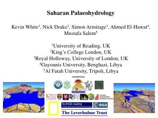
Saharan Palaeohydrology Kevin White1, Nick Drake2, Simon Armitage3, Ahmed El-Hawat4, Mustafa Salem5 1University of Reading, UK 2King’s College London, UK 3Royal Holloway, University of London, UK 4Gayounis University, Benghazi, Libya 5Al Fatah University, Tripoli, Libya
Introduction Reconstructing Saharan palaeohydrology is of importance because 1. Impact on modern water resources
Introduction Reconstructing Saharan palaeohydrology is of importance because 1. Impact on modern water resources 2. Export of mineral aerosol
Introduction Reconstructing Saharan palaeohydrology is of importance because 1. Impact on modern water resources 2. Export of mineral aerosol 3. Impact on human migration out of Africa
Lacustrine sediments widespread throughout the region, but when were the highstands and how large was the area inundated?
Remote sensing enables fieldwork to be targeted to important palaeoenvironmental sites
3 km Multispectral optical remote sensing enables identification of outcrops of lacustrine sediments rich in sulphates and carbonates
5 km But heavily silicified limestones can only be identified by radar Landsat ETM+ Radarsat
Well developed cyclical sedimentation around the margins of the basin (over 500m a.s.l.)
Five limestone/sand cycles are found throughout the Fazzan basin, but only the top cycle is young enough to fall within the range of OSL dating (420 +/- 34 ka)
Coquinas (340m a.s.l), death assemblages representing nearshore beach ridges (113 ±10, 107 ±6, 97.7 ±5.1)
Interdunes in the Ubari sand sea (ca.500m a.s.l.), higher mesas 118 +27–20, 47 +17–13 and 14.3 +1.7–1.7 ka. Dark humic palaeolake sediments in the base of interdunes 9.12 +0.09-0.14, 8.31 +/- 0.5 BP 8.42 +0.04-0.12, 6.69 +0.03-0.05, 5.94 +/- 0.4, 3.36 +/- 0.45 ka
Shorelines preserved adjacent to escarpment Shorelines dated and their heights determined using DGPS
200 km Maximum lake area (from SRTM3 DEM) is 134,617 km2, drainage basin area is 450,000km2 (ca. 1/3rd catchment)
500m 527m Though not as big as Lake MegaChad (344,320 km2), Lake MegaFazzan is second largest Palaeolake in the Sahara 340m
Modelling studies show that, in the vicinity of large water bodies, 6% lake cover affects the climate as much as orbital forcing (Coe and Foley 2003)
Conclusions • Remote sensing and DEM analyses enable palaeohydrological reconstruction of Lake MegaFazzan • Its maximum size was about 134,617 km2 • Evidence of highstands at 420, 120, 74, 47, 30, 14 and 10 ka • 4 as yet undated lacustrine cycles that are older than 420 ka • Wet during much of the Early Holocene; however, evidence of abrupt shifts to arid conditions at 9.8, 7.4 and 6.0 ka • Further study of relationship with highstands in surrounding basins is critical to understanding Saharan palaeoenvironments