EU INCO-DEV STRAPEAT PROJECT
290 likes | 473 Vues
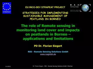
EU INCO-DEV STRAPEAT PROJECT STRATEGIES FOR IMPLEMENTING SUSTAINABLE MANAGEMENT OF PEATLAND IN BORNEO. The role of Remote sensing in monitoring land cover and impacts on peatlands in Borneo – applications and limitations PD Dr. Florian Siegert RSS - Remote Sensing Solutions GmbH

EU INCO-DEV STRAPEAT PROJECT
E N D
Presentation Transcript
EU INCO-DEV STRAPEAT PROJECT STRATEGIES FOR IMPLEMENTING SUSTAINABLE MANAGEMENT OF PEATLAND IN BORNEO The role of Remote sensing in monitoring land cover and impacts on peatlands in Borneo – applications and limitations PD Dr. Florian Siegert RSS - Remote Sensing Solutions GmbH www.rssgmbh.de Dr. Florian Siegert, RSS - Remote Sensing Solutions GmbH, München
STRAPEAT – the role of RSS • The task of RSS within the team • investigate the extent and quality of the peatlands in Borneo using remote sensing techniques • establish an integrated GIS database which includes remote sensing derived information, ground data and current land use • establish a GIS based planning tool to support sustainable use of peat lands Dr. Florian Siegert, RSS - Remote Sensing Solutions GmbH, München
STRAPEAT – Achievements • selection of study sites across Borneo • Survey on available Landsat ETM 7 scenes and procurement • Processing of Landsat TM 7 images • GeoreferencingSpectral enhancement, radiometric correctionMosaiking Dr. Florian Siegert, RSS - Remote Sensing Solutions GmbH, München
STRAPEAT – Achievements • Image classification and interpretation (mapping scale 1:100.000) • Delineation of infrastructure in PAN images (15m ground resolution • Verification in selected test sites using GPS Techniques (in cooperation with UNPAR, UGM, UNIMAS) Dr. Florian Siegert, RSS - Remote Sensing Solutions GmbH, München
STRAPEAT study sites 300 km courtesy JRC Dr. Florian Siegert, RSS - Remote Sensing Solutions GmbH, München
STRAPEAT study site: Kuching-Sarawak Dr. Florian Siegert, RSS - Remote Sensing Solutions GmbH, München
STRAPEAT study site: Kuching-Sarawak Dr. Florian Siegert, RSS - Remote Sensing Solutions GmbH, München
STRAPEAT study site: Kuching-Sarawak Dr. Florian Siegert, RSS - Remote Sensing Solutions GmbH, München
STRAPEAT study site: Kuching-Sarawak 25 km Dr. Florian Siegert, RSS - Remote Sensing Solutions GmbH, München
STRAPEAT study site: Kuching-Sarawak Logging in 1998/99 50 km Dr. Florian Siegert, RSS - Remote Sensing Solutions GmbH, München
STRAPEAT study site: Kuching-Sarawak Logging 50 km Dr. Florian Siegert, RSS - Remote Sensing Solutions GmbH, München
STRAPEAT study site: Kuching-Sarawak Peat swamp forest 50 km Dr. Florian Siegert, RSS - Remote Sensing Solutions GmbH, München
STRAPEAT study site: Sampit-Kalimantan 50 km 350 km Dr. Florian Siegert, RSS - Remote Sensing Solutions GmbH, München
STRAPEAT study site: Sampit-Kalimantan 50 km 350 km Dr. Florian Siegert, RSS - Remote Sensing Solutions GmbH, München
STRAPEAT study site: Sampit-Kalimantan 50 km 350 km 50 km Dr. Florian Siegert, RSS - Remote Sensing Solutions GmbH, München
STRAPEAT – future work • Change detection analysis in two study sites • Area of two Landsat ETM 7 scenes • Change in land and forest cover between 1999 – 2002 Dr. Florian Siegert, RSS - Remote Sensing Solutions GmbH, München
STRAPEAT – future work • Establishment of a GIS project, integration of • Satellite imagery • Classification results • Change detection results • available GIS data (district boundarys, villages etc) • Ground observations on biodiversity and land use • Biophysical data (hydrology, climate) • Peat depth measurements • 3 D models of peat volume • GPS measurements • Map production: scale 1:100.000 Dr. Florian Siegert, RSS - Remote Sensing Solutions GmbH, München
STRAPEAT – future work • Specific tasks • Calculations (area of peat land area, change, carbon storage, carbon emission) (in cooperation with UNIHEL, UNINOT, ALTERRA) • Analyse impacts on peat catchments (in cooperation with UNINOT, ALTERRA) • Contribute to the establishment of an interactive GIS (in cooperation with ALTERRA, UNINOT, BPPT • Training in RS, GPS and GIS Dr. Florian Siegert, RSS - Remote Sensing Solutions GmbH, München
STRAPEAT – future work Dr. Florian Siegert, RSS - Remote Sensing Solutions GmbH, München
STRAPEAT – future work Dr. Florian Siegert, RSS - Remote Sensing Solutions GmbH, München
Peat fires, Kalimantan, BIRD, 24 August 2002 NIR MIR TIR Radiative energy release Dr. Florian Siegert, RSS - Remote Sensing Solutions GmbH, München
STRAPEAT – future work Dr. Florian Siegert, RSS - Remote Sensing Solutions GmbH, München
STRAPEAT – future work Dr. Florian Siegert, RSS - Remote Sensing Solutions GmbH, München
STRAPEAT – future work Dr. Florian Siegert, RSS - Remote Sensing Solutions GmbH, München
STRAPEAT – future work Dr. Florian Siegert, RSS - Remote Sensing Solutions GmbH, München
STRAPEAT – future work Dr. Florian Siegert, RSS - Remote Sensing Solutions GmbH, München
Thank you for your attention ! Dr. Florian Siegert, RSS - Remote Sensing Solutions GmbH, München
STRAPEAT – Achievements • Image classification and interpretation (mapping scale 1:100.000) of the following classes: • Peat landDifferent types of peat swamp forest • tall peat swamp forest • medium peat swamp forest • low pole peat swamp forest • Mangrove forest • Riverine and freshwater swamp forests • Dry Grasslands • WetlandsDegraded peat swamp forests • by logging operation <2 years • by logging operation >2 years • Other • Fire scars (old and recent) Dr. Florian Siegert, RSS - Remote Sensing Solutions GmbH, München
STRAPEAT – Achievements • Land use • Agriculture • Land clearance • Plantations (Oli palm, pulp wood) • Aquaculture (e.g. crab ponds) • Delineation of infrastructure in PAN images (15m ground resolution: • Rivers, lakes • Infrastructure • roads, logging roads, logging railways • irrigation canals • villages Dr. Florian Siegert, RSS - Remote Sensing Solutions GmbH, München