Download
1 / 18
180 likes | 356 Vues
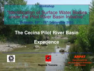
Workshop “Identification of Surface Water Bodies under the Pilot River Basin Initiative” Brussels, 25 th - 26 th September 2003. The Cecina Pilot River Basin Experience. ARPAT Agenzia regionale per la protezione ambientale della Toscana. Ministero dell’Ambiente APAT. Regione Toscana.

E N D
Workshop “Identification of Surface Water Bodies under the Pilot River Basin Initiative” Brussels, 25th - 26th September 2003 The Cecina Pilot River Basin Experience ARPAT Agenzia regionale per la protezione ambientale della Toscana Ministero dell’Ambiente APAT Regione Toscana
The Cecina River Basin Surface Area: 900 km2 Length of River: 80 km Flow regime (Q = 1030 : 0,01 mc/s) Regional River Basin 4 Provinces (Livorno, Pisa, Siena, Grosseto) 19 Municipalities 2 “ATO” (Territory with unified water management)
River Basin Characteristics: “La Puretta” where the river is used for the production of drinking water
River Basin Characteristics: The upper and central part of the basin is under high industrial pressures
Main Environmental Problems: Water Scarcity Point source pollution from urban and industrial sources Diffuse pollution (agriculture) Soil contamination (industry) Degradation of riparian zone by human activities
Guidance documents to be tested • water bodies • pressure and impact • designation of heavily modified bodiesof water • classification of inland surface water status and identification of reference conditions • monitoring • best practices in river basin planning • tools on assessment and classification of groundwater
Testing the Horizontal Guidance on the “Identification of Water Bodies” 1st step: Identify the boundaries of the surface water categories In the Cecina PRB there are only rivers and the estuarine part of the coast 2nd step: Identify the boundaries of surface water types Using system “A” every river is in the same Ecoregion (3) and present the same typology for size (small) and geology (siliceous/calcareous); different typologies were identified for the altitude. The coastal water body is in the Ecoregion 6, euhaline and shallow. 3rd step: Identify the boundaries using physical characteristic delineating discrete and significant elements geographical (surface of the catchment and river length), geological and geomorphological characteristics, climatic, hydric,hydrological and hydro geological features. The Regional Legal criteria identify significant elements: size, flow, environmental and social values, water uses, water quality. 4th step: Identify the boundaries on the basis of other relevant criteria (Status, Pressures and Impacts, Uses, Protected Areas) Status and Pressures and Impacts criteria have been considered.
QUALITY STATUS CRITERIA Water quality indices LIM chemical and biochemical index: DO, BOD5, COD, NH4, NO3, Ptot, E. coli IBE (EBI) Biological index based on Macro - invertebrates SECA Synthetic Index for the assessment of the Ecological Status (combination of LIM and IBE) SACA SyntheticIndex for the assessment of “Environmental Status” (combination of SECA and some Hazardous substances parameters)
SURFACE WATER BODIES IDENTIFICATION 8 7 3 2 9 5 1 6 4
SUMMARY OF THE SURFACE WATER BODIES FIRST IDENTIFICATION 9 Water Bodies (no lakes): • 3 sections of the main channel of the Cecina river; • 5 tributaries (Pavone, Possera, Botro S. Marta, Botro Grande di Montecatini V. di C., Sterza); • 1 coastal water body • Minimum Size • Length: 2,15 km (Botro S.Marta) Catchment area: to be computed • Maximum Size • Length: 34,1 km (Cecina, headwater section); Catchment area: 368,3 km2 (Cecina, mid section)
Other specific key issues Very small water bodies At this stage very small surface water bodies have been considered not significant, according to the national and regional legal framework. The framework defines the term significant using the following criteria: • dimension and flow (> 120 days/year); • environmental and social values and their relevance for water uses; • influence on water quality. According to this approach some small streams (Botro S. Marta and Botro Grande) have been identified as water body for their impact on the quality of the main river.
Other specific key issues Aggregation At this stage aggregation was thought not to be useful for the WFD purposes in this basin. Sub - division No sub-division was thought to be required due to the small size of the basin. Protected areas The Region is still defining protected areas (such as vulnerable zones and Natura sites); at this stage, these have not been considered for the identification exercise. Wetlands - none
Specific problems • Biological elements not sufficient (EBI not enough!); The current identification has been carried out using biological indicators which refer only to macro – invertebrates (EBI). Information on the classification of surface water for fish and shellfish life has been also used (National Law). We intend to consider the inclusion of I.F.F. (River Functionality Index) for the review of WB identification. Extension of the monitoring network (including small and very small waters); Number of monitoring stations affects the identification process. Reference condition; Not yet.
Recommendation and Suggestions • Divide water but stay on the ground ! Avoid the risk of loosing contact with the essential characteristics of the aquatic ecosystems within your basin (bureaucracy confuses, Art. 1 “Protect All Waters”) . Use the WFD glossary and help to make it richer; Test the Wetlands Guidance.