Download
1 / 16
160 likes | 260 Vues
Join us at Lawrence, KS on Jan. 10-11, 2013, to explore the history and evolution of FishNet 2, a network for sharing fish collection data. Learn about the Biological Object Search Service (BOSS) and engage in spatial queries, data downloading, and more. Collaborate with experts to expand and enhance the global network of fish collections.

E N D
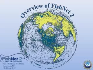
FishNet 2 Collaborative Georeferencing WorkshopLawrence, KS 10-11, Jan 2013
History 1999: Creation of original FishNet Network Z39.50 protocol for sharing data Search via Species Analyst (distributed query model) 2005: FishNet 2 created Transition to DiGIR Protocol Search via DiGIR Portal (distributed query model) 2010: FishNet 2 (centralized query model) Harvesting of DiGIR, DwCA, IPT, Static Spreadsheets Search via FishNet 2 Portal (centralized query model) 2012-2016:Portal &data expansion and enhancement
Global network of fish collections 48 data providers 3.2 million lots 30+ million specimens 57% georeferenced
Generalizing FishNet 2: The Biological Object Search Service (BOSS)
Full Text Searches Common NamesSynonyms Institutional Temporal Geographic
Search Results ProviderSummary Occurrence Records GeographicSummary TaxonSummary
Search API • Characteristics • “REST” like style • Output in CSV or Tab • API Key to track usage • Services • Taxon • Provider • Occurrence • Occurrence Counts • Allows integration with research workflows Percina aurora www.fishnet2.net/api/v1/occurrence/?api=myapikey&t=percina aurora
Interoperability: RVertNet > library(rvertnet) > f1=vertoccurrence(t="Hypophthalmichthys molitrix",grp="fish") > f2=subset(f1,Latitude !=0 & Longitude != 0) > world = map_data("world") > ggplot(world, aes(long, lat)) + geom_polygon(aes(group = group), fill = "white",color = "gray40", size = .2) + geom_jitter(data = f2, aes(Longitude, Latitude), alpha=0.6, size = 2.5, color = "red") +opts(title = "Hypophthalmichthys molitrix (Silver Carp)") • http://github.com/vijaybarve/rvertnet
by the Numbers Number of Records Number of Queries or Visitors
Current Project Goals: To expand the number of records within FishNet to approximately 4 million lots representing over 30 million specimens To georeference all "georeferencable" records lacking geographic coordinates To repatriate results to source data providers
“Preliminary” Assignments 2 out of 4 million records in need of georeferencing~290,000 locality records