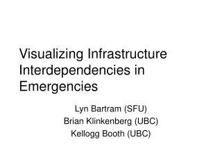
Visualizing Infrastructure Interdependencies in Emergencies
240 likes | 265 Vues
Explore GIS applications in managing emergencies, visualizing interdependencies, challenges, and the need for real-time data in disaster planning. Learn about infrastructure dependency types and conditions affecting coordination in emergencies. Overcome political and technical challenges for effective GIS integration.

Visualizing Infrastructure Interdependencies in Emergencies
E N D
Presentation Transcript
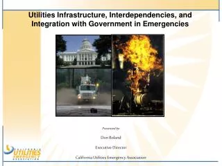
Visualizing Infrastructure Interdependencies in Emergencies Lyn Bartram (SFU) Brian Klinkenberg (UBC) Kellogg Booth (UBC)
Overview • Motivation and approach • GIS in Emergency Mgmt: (Brian) • Approaches and issues • Visualising interdependencies (lyn, Kelly) • Current approaches • Issues and challenges • Where we need to go from here • (hint) this involves you
Motivation • In disaster planning, response and recovery, we need to monitor and visualize the various activities underway, including coordinated efforts where we may have partial information, uncertain data or external constraints that are changing in real-time as the various interdependent infrastructures coordinate their efforts.
Motivation • ~20% of 9/11 infrastructure disruptions involved infrastructure interdependencies • Telecom, power, oil and gas, water substantially more • Emergency management at ~50% • These were both built (physical) and human • Deep “silos” of expert infrastructure knowledge and operations • Communication and coordination across infrastructures is problematic and untracked
Objectives for I2V • Support emergent conditions • Training works well for predicted but falls short in emergent events • Common visual language • Establish coordinating frame of reference • GIS (but it’s not enough) • “what if” capabilities • Spatio-temporal representation • Track, record and capture • Augment information (annotation and plans) • Collaborative environment • Multiple decision makers need to negotiate and remain aware of activity
GIS, EM and CIP • Disaster • Vulnerability analysis • Damage assessment • Hazardous materials • Resource inventory • Personnel resources • Infrastructure • Mass care/shelter status
GIS, EM and CIP • Risk assessment and risk modelling applications are not present in most municipalities. • These applications should be implemented, ensuring integration with other organizations dealing with surveillance, detection, planning security programs, mitigation of hazards, preparedness for actual emergencies, response, and short and long-term recovery. • There remains a perception that a GIS provides cartographic capability rather than a spatial modelling and analysis capability.
GIS, EM and CIP • Data accessibility is one of the major issues when dealing with emergency management. • “There is a critical need for real-time data and information, a temporal requirement that often cannot be met in the field” (Cutter 2003, 443) • In real situations, there is often greater need for high temporal resolution data than for high spatial resolution data. • Real-time personnel / vehicle tracking is critical. • Accessible, interpreted remotely sensed imagery showing the impacts (area extent, significance of damage) is vital, but difficult to provide (wrt technical skills) and often not familiar to first-responders.
GIS, EM and CIP • The main issues related to the information flows in a GIS for EM can be summarized in two categories: • Political issues: Information sharing policies among private corporations and different levels of government, information property issues, sensitivity of information. • Technical Issues: Metadata standards, Information and system compatibility. • Both sets of constraints need to be overcome before GIS could be integrated into practical decision-making
GIS, EM and CIP • The inexperience of emergency managers with GIS precludes them from using it to aid decision-making to its full potential. • The size of computer screens does not provide necessary detail for regional scale emergency management decision making. This makes it difficult to relate computer-based output to broad scale decision-making.
Visualizing “interdependence” • Four conditions for infrastructure interdependency [Mendonça 2007] • Input: the infrastructure requires input from another to provide a service (power) • Shared: physical components and activities in providing the service are shared (roads) • Exclusive-or: either one or another infrastructure can be in use for a service (generation, water) but not both • Co-location
Interdependency types • Physical: elements of the physical environment that depend on other elements. Examples include power lines, water mains, buildings housing infrastructure (substation, communication tower) • Resource: goods/services that are needed. Emergency beds depend on staff. Hospital capacity (beds) depend on medicine. Workers depend on transportation. • Role/person: coordination of decisions will depend on the right people being in the right place. Mike from the power managers needs to talk to Jill from the hospital about backup generation capacity before taking a line out. • Information. Decisions depend often on having the right information from other sources.. • activity/event. This describes the situation where actions or events cannot take place without another action/event occurring.
Visualizing Interdependencies • Hard to show in GIS • Need to show different types • Time/state • (un)certainty of data • Novel display environments
Table displays • Large shared wall screens • “Private” + “public”
A Prototype for GAANT Chart SchedulingVisualization and Interaction Dependency Rationales “Slack” in start/stop date/times Screen layout for large charts Visual comparison of multiple charts
Dependency Rationales • Identify types of dependencies • Color code to support decision making • “scroll over” identifies type with icon
“Slack” in start/stop date/times • Microsoft Project assumes earliest start • Display slack times • Allow manipulation to utilize slack time
Screen layout for large charts • Radial display mode • Organize based on critical path • “minimize” crossings and “long” arcs
Visual comparison of multiple charts • Ability to display multiple charts • “Linking” to identify common elements • Visual highlighting of “differences”
Understanding interdependency: we need your input • Physical: elements of the physical environment that depend on other elements. • SIMULATOR and SCHEMATICS from existing infrastructure data. • Resource: goods/services that are needed. • SIMULATOR ? . • Role/person: the right people being in the right place. • PROCEDURES (incomplete), EXPERT KNOWLEDGE • Elicit and capture • Information. • PROCEDURES, DOCUMENTATION (incomplete), EXPERT KNOWLEDGE • Elicit and capture • Activity/event. • PROCEDURES (incomplete) and EXPERT KNOWLEDGE • Elicit and capture