Download
1 / 76
760 likes | 934 Vues
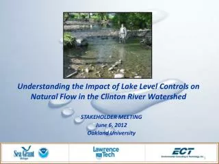
Understanding the Impact of Lake Level Controls on Natural Flow in the Clinton River Watershed. STAKEHOLDER MEETING June 6, 2012 Oakland University. Agenda. Investigation Clinton River Watershed Current conditions and flow management Stakeholder engagement and survey results

E N D
Understanding the Impact of Lake Level Controls on Natural Flow in the Clinton River Watershed STAKEHOLDER MEETING June 6, 2012 Oakland University
Agenda • Investigation • Clinton River Watershed • Current conditions and flow management • Stakeholder engagement and survey results • Environmental Impacts • Recreational Impacts • Hydrologic Modeling • Socio-economic Modeling • Summary
Purpose of this Meeting • Provide you, the stakeholders, with background information on watershed issues and this study • Brief you on project findings as a follow up from 2010 public forums • Assure you that no actions or decisions have been made
Study Goals • Document environmental, social, and economic trends related to current conditions • Forecast river/lake conditions under alternative flow management scenarios • Solicit public comment (stakeholder engagement) • Provide technical guidance on possible means of implementing the various management alternatives
Key Project Participants • NOAA – Michigan Sea Grant • Integrated Assessment Program
Key Project Participants • NOAA – Michigan Sea Grant • Integrated Assessment Program • Lawrence Technological University • Environmental Consulting & Technology, Inc • VeritasEconomic Consulting, LLC • Oakland University • City of Auburn Hills
Technical Advisory Board • Oakland County WRC • Oakland County PEDS • Michigan DNR • Michigan DEQ • Sylvan Lake Association • Oakland Lake Association • Clinton River Watershed • Council • Trout Unlimited • City of Auburn Hills • City of Rochester Hills • City of Rochester • Waterford Township • Outdoor Escorts LLC • Spalding DeDecker • Local Business Owners & • Citizens
A watershed is a region draining into a river, river system, or other body of water.
Precipitation Direct runoff vs. infiltration Drought or excessive dry weather (climate change) Human Impacts Runoff from increased urbanization Wetland/floodplain alterations Alteration of groundwater flows Regulating impoundment discharges Factors Impacting Flow
760 square miles • 80 miles from headwaters to the outlet at Lake St. Clair • Includes portions of Wayne, Lapeer, Macomb, Oakland & St. Clair counties • Includes 63 communities • 1.5 million people live within the watershed • Most populated watershed in Michigan
Process for Establishing Lake Level Controls • Part 307 of the Michigan Natural Resources and Environmental Protection Act establishes “normal levels” • Initiated by a riparian owners petition or a county board • Requires an impact study • Set by the court
Factors Considered when Establishing a Lake Level • Protection of public health, safety and welfare • Preservation of natural resources of the state • Lake and stream habitat • Wetlands • Preservation and protection of property values around the lake • Interaction with surrounding lakes or watershed were not considered in 50s/60s
Factors Considered when Establishing a Lake Level • 50 lakes/impoundments in the study area • 21 with court ordered lake levels • 1960’s • 8 structures actively managed by OCWRC office: • Cemetery-Dollar, Van Norman, Look, Watkins, Orchard, Cass, Dawson Mill, Crystal
Interactive Map – Low Flow Pictures Channel at Paddock and Huron 5 4 Exit of Underground Channel 6 7 Opdyke and Auburn 3 Riverside Park Entrance to Underground Channel 2 1 Walter Moore Dam Price Dam 24
August 12, 2010 Price Dam 1 September 1, 2010
August 12, 2010 3 Entrance to Under Ground Channel September 1, 2010
4 Exit from Underground Channel Looking West September 1, 2010 August 12, 2010
4 Exit from Underground Channel Looking East August 12, 2010 September 1, 2010
6 Opdyke Rd and Auburn Rd September 1, 2010
7 Riverside Park – Auburn Hills September 1, 2010 Looking Upstream August 12, 2010 Looking Downstream
Median Flow - July 17, 2008 • No rainfall was recorded from July 15, 2008 to July 19, 2008 • The mean flow in the river over five days was 40 cfs (60 cfs in photo) • Most control structures were closed or minimally adjusted • Lake levels ranged from at court ordered level to 3 inches above Avon Rd Bridge in Rochester Hills - looking downstream (Moore 2008)
High Flow - May 23, 2004 • 20 year storm • 2.72 inches of rain fell over 24 hours • Mean flow in the river was 1000 cfs • Most control structures were opened to maximum • Before the storm lake levels started between 6” below and at court ordered level • After the storm lake levels rose to above the court ordered level (approximately 2 ft) Avon Rd Bridge in Rochester Hills – Upstream (Moore 2004)
Low Flow - July 6, 2010 • No Rainfall from July 4-8, 2010. • Mean flow in the river was 18 cfs. • All control structures were closed. • Lake levels ranged from 2 inches below to 2 inches above their court ordered levels. Avon Rd Bridge in Rochester Hills – looking downstream (Moore 2010)
Flow in Clinton River Closed to maintain lake levels Rainfall – remain closed
Frequency of Modification Every other year 30 days < 30 cfs and 14 days < 20 cfs
Stakeholder Engagement • Print Media (Fall of 2010) • Oakland Lakefront Magazine, Detroit Free Press, West Oakland Spinal Column, Press Release • Email List serves through Advisory Board contacts • Stakeholder Survey • 16 questions designed to help project team understand how the stakeholders interact, understand, and use the Clinton River and the connecting lakes (hard copy at forum and online version). • Fall 2010 Public Forums: • Waterford Township (Nov 3), Auburn Hills (Nov 4), and Oakland University (Nov 13) • Approximately 170 people attended three public meetings (89 surveys) • 59 surveys were completed online around the same time (138 total)
Stakeholder Engagement • OCWRC office correspondence: • sent mailers in 2010 to Lake Improvement Boards to encourage citizen and community leaders to attend public forums. • project information sheet with survey information was mailed to each lake improvement board member in spring 2011 (12 Boards and 93 members). • Summer 2011 Events (100s of flyers distributed): • Clinton River Water Festival, Oakland University, Auburn Hills. • Auburn Hills Fishing Derby, Riverside Park, Auburn Hills. • CRWC River Fest Rochester Municipal Park, Rochester. • Total of 10 online surveys were completed during 2011 Total of 148 Responses
Survey Results Lake and River Region
Survey Results Survey Responses from Each ZIP Code
Lake Level Fluctuation Please indicate your level of agreement with the following statement: "I would tolerate moderate fluctuation in lake levels if it meant an overall healthier watershed."
Lake Level Fluctuation How much fluctuation are you willing to tolerate on your lake for an overall healthier watershed: