Download
1 / 13
130 likes | 237 Vues
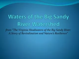
Explore the importance of wetlands in the Big Sandy River watershed, their role in nature's resilience, and the threats they face from impaired waters and toxic spills. Learn about the significance of wetlands, the impact of impaired waters, and strategies for conservation.

E N D
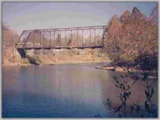
Waters of the Big Sandy River Watershed from “The Virginia Headwaters of the Big Sandy River: A Story of Revitalization and Nature’s Resilience”
Wetlands What is a wetland? An area that is either permanently flooded or where soils are partially saturated with water at all times Home to plants that love water and can survive in areas of low oxygen Naturally formed from seeps and springs or in depressed extensions of a floodplain
Wetlands Why should we care about them? The Headwaters contains ~ 167 acres of wetlands Act as filtration systems (Nature’s Kidneys) Reduces flooding Treats acid mine drainage Protected since many plants and animals are becoming endangered or threatened Home to hydrophilic animals and migratory birds
Impaired Waters What do impaired waters consist of? Any water body or segment of a water body that violates limits set for a water quality standard 32 segments of the Headwaters are recognized as impaired due to fecal coliform violations, low dissolved oxygen measurements, poor benthic populations, or PCB contaminations
Fecal Coliform Violations • Escherichia coli (E. Coli) a type of fecal coliform bacteria • lives in digestive system of warm-blooded organisms • presence in water indicates high loading of human or animal wastes Fate and Transport of Fecal Coliform Bacteria
Low Dissolved Oxygen • DO = amount of oxygen present in a water column • DO is critical for life in a body water • Running water, submerged aquatic vegetation DO • Increased temperatures, animal respiration DO
Benthic Macroinvertebrates • Poor benthic communities indicates poor water quality • Reside on the bottom of stream • Macro = large enough to see with the naked eye • Invertebrates = organisms w/o backbone Some Haysi High School students trying out the Virginia Save Our Streams method Online step-by-step identification key
PCBs or Polychlorinated Biphenyls • man-made compounds • used to make oil w/ low risk of flammability • spilled and dumped in many places before hazard was known
Toxic Spills in the Headwaters • Acid Mine Drainage • Impoundment Failure • Mine water release Iron hydroxide precipitate (orange) in a Missouri stream receiving acid drainage from surface coal mining.
Didymo Didymo video for Allegheny County, VA
Floodplain Management Normal for stream ecosystem… but worsened by human impacts such as deforestation John Flannagan Dam created for flood management and water supply Aerial view of flooding on the Levisa Fork River in Grundy, Virginia, USA, in 1984
Photo Credits • Wetlands photo – Florida Everglades courtesy of Nicole Tucker • Wetlands photos – UVA-Wise wetlands for AMD treatment courtesy of Audrey Mullins, Guest River Restoration Project • Cows in Stream – courtesy of Wisconsin Department of Natural Resources • Russell Fork photo – courtesy of Gene Counts • VA SOS photo – courtesy of Nicole Tucker • Acid Mine Drainage – courtesy of D. Hardesty, USGS Columbia Environmental Research Center. • Didymo photos – courtesy of Tim Daley, PA DEP • Grundy flood and John Flannagan Dam photos – courtesy of U.S. Army Corps of Engineers