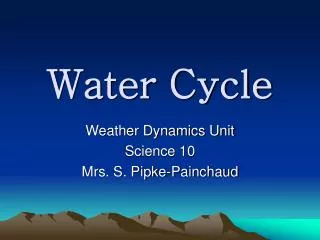
Understanding the Hydrological Cycle and River Systems: Processes and Features
220 likes | 333 Vues
The hydrological cycle, also known as the water cycle, is a closed system where water moves continuously from oceans to the atmosphere and back through precipitation and rivers. This cycle involves various processes such as erosion, transportation, and deposition, which shape the landscape. River systems operate within drainage basins, where the journey of a river from its source to its mouth can be divided into upper, middle, and lower courses. Each section features unique processes influencing both the river and the surrounding land, including the formation of valleys, floodplains, and meanders.

Understanding the Hydrological Cycle and River Systems: Processes and Features
E N D
Presentation Transcript
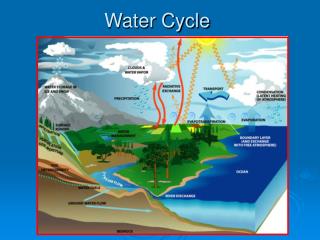
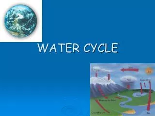
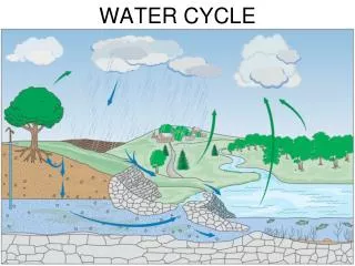
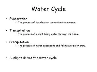
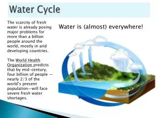
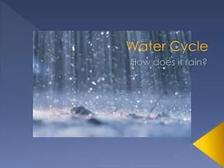
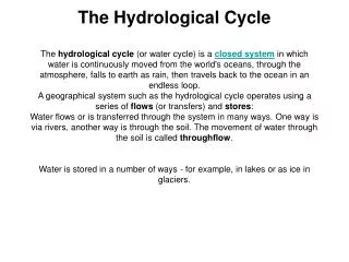
The Hydrological CycleThe hydrological cycle (or water cycle) is a closed system in which water is continuously moved from the world's oceans, through the atmosphere, falls to earth as rain, then travels back to the ocean in an endless loop.A geographical system such as the hydrological cycle operates using a series of flows (or transfers) and stores:Water flows or is transferred through the system in many ways. One way is via rivers, another way is through the soil. The movement of water through the soil is called throughflow.Water is stored in a number of ways - for example, in lakes or as ice in glaciers.
River processes are the means by which rivers change and shape the landscape around them. Erosion is the wearing away and breaking down of rock and soil. Transportation is the movement of river-borne material downstream. Deposition is the dropping or depositing of river-borne material. River processes shape the land in different ways as the river moves from its source to its mouth.
THE RIVER SYSTEM A river system is found inside a drainage basin (or river basin). A drainage basin is the area of land drained by a river and its tributaries. Any water falling inside the drainage basin will find its way into the main river channel (unless it is taken out of the system - for example by being piped to a factory). The boundary of a drainage basin is called the watershed. The next diagram shows a drainage basin. Make sure you know all the key terms used when talking about river systems.
The Course of a river • The journey of river from source to mouth is sometimes called the course of the river. The course of a river can be divided into three main sections: • The upper course • The middle course • The lower course • Rivers always flow downwards from highland areas to lowland areas, through the upper, middle, and finally the lower course. • As a river travels along its course, both the river and the landscape around it changes. On the one hand, the nature of landscape affects the river's course and flow - with hills, for example, making the river flow faster. On the other hand, the river will in its turn change the landscape - for example, carving out a deep valley or creating a flood plain.
EROSION • Erosion involves the wearing away of rock and soil found along the river bed and banks. Erosion also involves the breaking down of the rock particles being carried downstream by the river. • There are four main forms of river erosion: Attrition - rocks being carried by the river smash together and break into smaller particles Hydraulic action- river wears away the river bank from underneath Abrasion - rocks carried along by the river wear down the river bed and banks Solution - smaller particles are dissolved into the river
InterlockingSpurs As the river cuts its deep V-shaped valley in its upper course, it follows the path of the easiest rock to erode. Thus it tends to wind its way along, leaving the more resistant areas of rock as interlocking spurs.
V Shaped Valleys In the upper course of the river, it cuts rapidly downwards, as the river puts almost all of its energy towards cutting down to base level. This causes the most distinctive river feature, the V-shaped valley. Rocks and other material are washed into the river from the steep valley sides during times of heavy rainfall, adding to the material being carried by the river.
Levees Levees are naturally formed banks along the sides of a river channel in its lower course, as it flows through the flood plain. They are formed by the river depositing material when it floods. During a flood the river deposits its heaviest, coarsest material closest to its normal course. Over years this deposition has built up the natural embankments, built of coarse material. Beyond them the flood plain has been built up of the finer material that was deposited further away from the normal course of the river.
Waterfalls When a river runs over alternating layers of hard and soft rock, rapids and waterfalls may form. The graphic shows how waterfalls and rapids are formed.
Niagara Falls Victoria Falls The peninsular cliffs are in Zambia, the outer cliffs in Zimbabwe. Angel Falls • Location Auyantepui, Canaima National Park, Venezuela • TypePlunge • Total Height 979 m / 3,212ft • Height of Longest Drop 807 m / 2,648ft • Number of Drops2 • World Height Ranking 1
Meanders and Ox Bow Lakes As a mature river begins to curve, it cuts and erodes into the outside of the curve and deposits sediment on the inside of the cure. This is due to the fact that the stream moves more rapidly on the outside of the curve and more slowly on the inside of the curve. Thus, as the erosion and deposition continues, the curve becomes larger and more circular. Eventually, the loop of the curve reaches a diameter of approximately five times the width of the stream and the river begins to cut the loop off by eroding the neck of the loop. Eventually, the river breaks through at a cutoff and forms a new streambed. Sediment is then deposited on the loop side of the stream, cutting off the loop from the stream entirely. This results in a crescent-shaped lake that looks exactly like an abandoned river meander. Such lakes are called oxbow lakes because they look like the bow part of the yoke used with teams of oxen.
Flooding A flood occurs when a river bursts its banks and the water spills onto the flood plain. Flooding tends to be caused by heavy rain: the faster the rainwater reaches the river channel, the more likely it is to flood. The nature of the landscape around a river will influence how fast rainwater reaches the channel. Floods can bring both advantages and disadvantages to an area. Floods can deposit rich, fertile alluvium on agricultural areas. Also, flood water can replenish irrigation channels. On the other hand floods can destroy food supplies, homes and transport infrastructures. Causes of flooding Human causes:Deforestation- Cutting down trees causes increased run-off (water flowing over the surface of the earth). Rain water reaches rivers faster. Flooding becomes more likely. Urbanisation - Man-made surfaces such as concrete result in greater run-off. Rain water reaches rivers faster and can cause flooding. Natural causes:Heavy rainfallMelting snow
LEDCs tend to be hit more badly than MEDCs by the effects of flooding. This is partly because LEDCs have more agriculture, and farming communities are attracted to fertile floodplains. LEDCs often do not have the resources to prevent flooding or to deal with the aftermath of flooding. The Kariba dam on the Zambezi river. Part of its function is flood-control
Solutions to Flooding Afforestation- Planting more trees reduces run-off and increases interception.Canals – To straighten the river and increase flow. Dams- Although very expensive, dams can significantly reduce the risk of flooding downstream