Download

1 / 26
260 likes | 268 Vues
This website provides information on the current status of surface water and groundwater resources in Madhya Pradesh, as well as major irrigation projects and strategies for managing water resources. It also focuses on the evaluation and improvement of Haveli fields as a source of recharge.

E N D
Welcome to PMKSY works Water Resources Management by R.K.NEMA College of Agricultural Engineering Jawaharlal Nehru Krishi Vishva Vidyalaya Jabalpur M.P.
Present Status – Surface Water Rainfall (mm) 1200-1600 I , II 1000-1500 III,IV.V.VII,VIII 600-1000 IX,X 600-800 VI 600-800 600-1000 Surface Water Potential 2011-12 (lakh ha) Created 29.20 Utilized 16.72 Gap 12.96 1000-1500 1200-1600 Major Irrigation Projects : Bargi Jabalpur, Chambal Gwalior Bansagar Rewa, Tawa Hosangabad, Samrat Ashok Sagar Vidisha Area irrigated is 61.3 % (2013-14)
Ground Water Resources (2013-14) Availability 33.29 bcm Irrigation Draft 17.48 bcm Others 1.35 bcm Stage of dev. 57 % wells 16.23 lakh Tube wells 6.36 lakh Area irrig. 3226119 ha Water table in Canal Command +0.2 m/y Non command -0.7 to 2 m/y Percent Utilization >100 Over exploited 85-100 Critical 65-85 Semi critical <65 Safe Utilization level as percentage of Availability in blocks of MP (2011-12) >100 Over exploited 24 85-100 Critical 05 65-85 Semi critical 19 <65 Safe 266 Policy is required to use GW as an emergency reserve
u;s flapkbZ ifj;kstukvksa es fMªi vkSj fLiazdyj i)fr dks c<+kok • [ksr esa ty laxzg.k lajpuk ds lkFk lw{e flapkbZ dk mi;ksxA • NksVs fdlkuksa ds fy;s de ykxr dh Åaph Vadh ls pyus okyk lw{e flapkbZ ra=A • mn~ogu flapkbZ ifj;kstukvksa dks Hkh lw{e flapkbZ ls tksM+ukA • dLVe gk;fjax esa fLiazdyj] ,pMhihbZ ikbi] eksVj iai] fMªi QVhZxs’ku vkfn dks 'kkfey fd;k tk,A
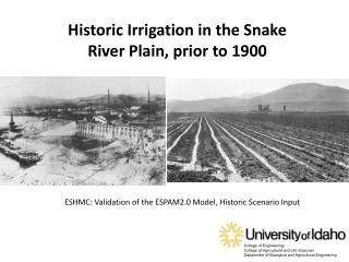
Havlei Fields : A Prominent Source of Recharge in Kymore Plateau and Satpura Hills
Evaluation of Recharge through Haveli fields Characterization Mapping Evaluation – Water Balancing Improvement Multiple uses for WP Singhara cultivation Water quality Additional recharge through recharge shaft Filter for direct recharge Status of Haveli fields and future prospects
Extent of Haveli Areas • Satellite data with IRS-ID PAN Sensor used to identity the Haveli areas in Patan block near Jabalpur. • 73,424 ha were under Haveli during year 2002-03 which is 11 percent of total area under the study. • An estimated spread of Haveli in Narsingpur district was 1,91,778 ha in the year 1986-87 and in Jabalpur district it was 2,78,624 ha . The total area of 4,70,402 ha was estimated to be reduced to 1,38,422 ha in the year 1999-2000.
Quantum of Haveli -Recharge • Study Period 3 years • Location 4 (3 Narsingpur + 1 Jabalpur) • Observations Gauging of Haveli field during kharif, measuring I, K, Rainfall, area extent through Satellite images • Approach Field water balance • Extent 11 percent of total area • Contribution 4 to 6 mm per day for 90-100 day 40 to 60 cm percolation • Inference Haveli recharge contribute to additional rise in water level by 4 to 6 m
Haveli Potential • Kympore plateau and Satpura hills can contribute 326994 ham, 239388 ham and 46384 ham recharge additionally through haveli fields. • Fallow land in all the state has also similar potential for recharge.
visf{kr dk;Z ;kstuk • ty lajpukvksa ds fuekZ.k o mi;ksx gsrq %& • mi;qDr LFkku dk p;uA • e/;izns'k dk ty lajpuk dk mi;qDr ekufp= rS;kj djuk &ftykokj@rglhy okj@fodkl[kaM ;k xzkeokj • lwnqj laosnu rduhd o HkkSxksfyd lwpukra= dk mi;ksx
ty lajpukvksa dks O;kid iSekus ij c<+kuk • ty lajpuk,a eq[;r% rhu mi;ksx esa vkrh gSaA • 1- fuLrkj rkykc 2- Hkwty lao/kZu ,oa 3- thounk;h flapkbZ • izLrkfor lajpuk,a ftudk mi;ksx mi;qZDr izdkj ls gks ldrk gSA • jiVk] ukyk ca/kku] rkykcksa dk fuekZ.kA • gosyh ca/kkuksa dh ejEer ,oa iquZfuekZ.k djukA • cyjke] rkykc tSlh ;kstukvksa dks lw{e flapkbZ ra= ls tksM+uk • [ksr ds dqy {ks=Qy dk 10 izfr’kr rkykc esa • ,d flapkbZ [kjhQ esa rFkk nks flapkbZ jch esa nsus gsrq i;kZIr ty miyC/k • mn~ogu flapkbZ ifj;sktukvksa dk fdz;kUo;u ,oa n{krkiw.kZ flapkbZ fof/k;ksa dk mi;ksxA
lajpukavksa ds fy, mi;qDr LFky dk pquko • dsUnzh; Hkwty eaMy }kjk izLrkfor LFky p;u i)fr ,oa • e/;izns’k ds fy,ekLVj Iyku ds vuqlkj • Ekkulwu ds iwoZ ,oa i'pkr~ lrg ls Hkwty Lrj dh xgjkbZ dks ysdj • lrg ls rhu ehVj uhsps rd dqy miyC/k Hkwty HkaMkj 16065 ,elh,e • Hkwty laHkj.k ds fy, fpfUgr fd;k gqvk {ks=Qy 119409 oxZ fd-eh- • miyC/k o"kkZ ty tks laHkj.k ds fy, miyC/k gS 99786 ,elh,e • miyC/krk ,oa laHkj.k dh laHkkoukvksa dks ns[krs gq, • vuqekfur laHkj.k ds fy, miyC/k ty 15280 ,elh,e • izLrkfor ty lajpukvksa ds }kjk vuqekfur Hkwty laHkj.k vuqekfur ykxr ,oa mudh la[;k • ijdksys’ku Vsad 0-2 ,elh,e 18-00 yk[k 15284 • pSd Mse 0-01 ,elh,e 4-00 yk[k 125019 • fjpktZ lkQV~ 0-01 ,elh,e 0-60 yk[k 125019 • ukyk ca/kku 0-005 ,elh,e 0-008 yk[k 229202 • lhesUV Iyx 0-01 38200 • o"kZ 2013 ds vuqlkj dqy vuqekfur ykxr 2153 djksM+
e/;izns’k esa mi;qDr ikbZ xbZ ty lajpuk,a • daVwj ca/kku • [ksr ca/kku • xyhIyx • cksjh ca/kku • ywtcksYMjMse • feV~Vh ca/kku • xsfo;ulajpuk • lhesaVokydslkFkywtcksYMjlajpuk • [ksrrkykc • MªkiLihyos • lwV Lihyos • pSdMse • ,uhdV • ijdksys'ku rkykc • LVkiMse • ukyk ca/kku • /kku dh caf/k;k • gosyh ca/kku • [ksresajiVk
Enhancing Ground Water Recharge using Kharif Fallow Percolation Pond - 50 m (L), 40 m (W), 3 m (D), 1:1 (S) 0.2 ha 2000 sq m storage 5244 cu m Recharge 50 % 2622 cu m 0.262 ha m Number of Ponds required for 1 ha m recharge 4 Recharge from 50 % of Fallow fields @ 10% of rainfall is 58000 ham Useful for in-situ Moisture conservation and recharge
Draught alleviation in rain-fed kharif • 10% of I ha 40 m (L), 25 m (W), 3 m (D), 1:1 (S) • Vol. of storage 2469 cu m Losses 493 cu m • Available water 1975 cu m = 19.75 cm
Some Suggessions • Appendix A-Two maps are to be generated • Surface and subsurface water • Irrigated areas through different sources Data format seems not sufficient • 1.4 For IR time domain has to be considered weekly/monthly • WR and IRR are to be updated • 1.6 Draught frequency source not mentioned
Sugessions • 2.2 Firs col has to be part of row A and B • 3.1 Spatial distribution of information is required for GW sources and Canal • 3.4 Quantification is required rather than numbers