Download
1 / 51
550 likes | 794 Vues
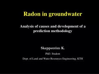
Radon in groundwater Analysis of causes and development of a prediction methodology. Skeppström K. PhD. Student Dept. of Land and Water Resources Engineering, KTH. Layout of presentation. Radon (focus of Rn in groundwater) Objective of project / Phases involved Methodology

E N D
Radon in groundwater Analysis of causes and development of a prediction methodology Skeppström K. PhD. Student Dept. of Land and Water Resources Engineering, KTH
Layout of presentation Radon (focus of Rn in groundwater) Objective of project / Phases involved Methodology Results & Discussions
Radon • Radioactive • Colourless, odourless, noble gas • Exists as 3 main isotopes: • 222Rn (uranium decay series, 238U),Half-life ( T1/2) = 3.8 days • 220Rn (Thorium decay series, 232Th), T1/2 = 56 seconds • 219Rn (Actinium decay series, 235U), T1/2 = 4 seconds • Cancer risk • 500 cases of lung cancer/year in Sweden; smokers have a higher risk. • Risk of developing of other cancers ?
226Ra 222Rn 218Po 214Pb 214Bi Uranium decay series 238U (parent) 214Po 234Th 210Pb 234Pa 210Bi 234U 210Po + 206Pb (stable) 230Th +
Principal cause of radon problem Geology
Genomsnittlig årlig stråldos i Sverige Source: Statens Strålskyddsinstitut
groundwater Construction material Soil gas / bedrock (Granite) Exposure routes
Radon problems in water Surface water Groundwater Dug wells (soil/sand aquifer) Drilled wells (Hard rocks)
How radon in water is a problem? 1000 Bq/l in water 100 Bq/m3 in air Dish washing 95 % Shower 60 – 70 % Bath 30 – 50 % Washing machine 90 – 95 % Tap water 10 – 45 % WC 30 %
- Radon in water Radon emanated in mineral grain escape in the pore space Recoil Theory Prerequisites Presence of parent elements, 238U or 226Ra • Transport mechanisms • Diffusion • Convection Pore space filled with water- Radon dissolves in the water • Dosimetry • 1000 Bq/l is dangerous Water extracted from drilled wells (fracture water) How is it a problem ?
Precipitation of 238U 234U, 230Th, 226Ra from water to surface of fracture Leaching of 238U and 234U Emanation of 222Rn Content of 238U in the rock: 10ppm 222 Rn Concentration of 222Rn in Bedrock: 0.33Bq/m3 rocks Concentration of 222Rn in groundwater: 5 milj Bq/m3
Radon Emanation Radium atom Radon atom Mineral grain Pore
Radon risk in Sweden Groundwater radon risk map of Sweden (after Åkerblom & Lindgren, 1997)
Any deduction? Granite types of rocks with high uranium concentration High radon concentration in water not always the case
Hypothesis of project • The hypothesis stipulates that the occurrence of radon from groundwater is governed by a number of well-defined factors ranging from: • Geological (bedrock, soil, tectonic structures, flow pattern and surrounding environment) • Chemical (oxidation reaction, other processes in water) • Topographical (difference in elevation and slope that determine flow pattern and renewal tendency and frequency) • Technical(withdrawal system & frequency which determine circulation as well as ventilation possibilities.
Purpose of research • Map processes and factors influencing radon content in groundwater • Develop a prediction model, based on statistics, that can be used to determine areas at risk.
Phases of the project Using GIS and multivariate analysis of data to assess factors affecting radon concentration – REGIONAL LEVEL Phase 1 Detailed study at Ljusterö to determine spatial & temporal variation of radon concentrations due to a range of factors. LOCAL SCALE Phase 2 Development of risk prediction model Phase 3
Phase 1 • Data collection from: • Swedish National Land Survey (elevation and landuse data) • Swedish Geological Survey, SGU (soil & bedrock geology, fractures, radiometric) • Municipalities (data about wells and radon content) • Data transformation and extraction using ArcGIS and its spatial analyst function • Statistical analyses including multivariate analysis of data.
Factors considered • Elevation • Soil geology • Bedrock • Fracture zone • Landuse • Uranium content Variables • Derived factors • Altitude difference • Predominant soil, bedrock, landuse within a certain vicinity e.g. 200 m • Slope of the terrain
Geographical Information System (GIS) • GIS is a computer system for managing spatial data. • Purpose of GIS • Organisation • Visualisation • Spatial Query • Combination • Analysis • Prediction
Visualisations with GIS Bedrocks Soil
What is my objective? For each well, relevant spatial patterns need to be extracted from the factor maps To generate continuous surfaces with a spatial resolution of 50 m + Derive factors Data obtained in different formats, e.g ASCII, point vector GIS Software: ArcMap Spatial analyst function Geostatistical software Ultra edit software
Statistical methods • Which method? • Relate radon concentration with a large number of variables • Variables are both qualitative and quantitative in nature • Non-normal distribution of many variables • Use of covariance and correlations ? Careful with the interpretations • Not much information about association between variables • Non-linear associations can exist • Very sensitive to ‘wild observations- outliers ’
Statistical Analyses • Use of multivariate analysis of data • Each observational unit is characterised by several variables. • It enables us to consider changes in several properties simultaneously • Non normality of data (non parametrical tests) • Statistical Methods • Analysis of variance • Principal Component Analysis (PCA)
PCA method • Eigenvectors of a variance-covariance matrix • Linear combinations of these variables • Its general objectives: • Data reduction (A small amount of k components account for much of the variability of the data) • Interpretation (may reveals relationships that were not previously suspected)
Boxplot Median 25%-75% Non-outlier range
Summary of results • High radon concentration in drilled wells is related to: • Low altitude • Granite rocks • Close distance to fracture • When overlying geology is lera/silt • Infrequent use of wells (summer houses) • An overview of the terrain in the surrounding of the wells (flat or hilly) is also of interest in connection to groundwater flow tendencies and speed of flow.
Data collection Preparation Phase (Expert system) Statistical analyses Expert assessment Selection of significant variables Operational phase (User Interface) Define study area Determination of risk values Determination of uncertainty values Suming up risk and uncertainty values Final Risk Evaluation Risk Variable Method
Risk Variable Modelling (RVM) V1 x R1 + V2 x R2 + V3 x R3 + ……….+ Vn x Rn = FRV FRV = Final risk value • Where Vi= a risk value for a specific variable (-2 to +2) Ri = the rating of the variable (1 to 3)
Field studies at Ljusterö • Why Ljusterö? • Number of wells = 198 • 141 wells exceeding 500 Bq/l (71%) • 96 wells exceeding 1000 Bq/l (48%) • Radon concentration • Mean = 1942 Bq/l • Minimum = 50 Bq/l • Maximum = 63560 Bq/l
What was done? To choose 3-4 study areas on Ljusterö, exhibiting drastic fluctuations in the radon concentration and to perfom detailed study at these locations