Download
1 / 52
520 likes | 741 Vues
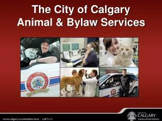
Integrated Base Mapping Management at the City of Calgary. Presented by : Leanne James ALS P.Eng. Supervisor of Cadastral Mapping, Land Information and Mapping. Geomatics Division Is Responsible for Base Mapping at the City of Calgary. How Does Geomatics Fit In?. Our Base Mapping Products.

E N D
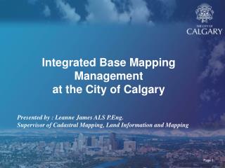
Integrated Base Mapping Managementat the City of Calgary Presented by : Leanne James ALS P.Eng. Supervisor of Cadastral Mapping, Land Information and Mapping
Geomatics Division Is Responsible for Base Mapping at the City of Calgary
Our Base Mapping Products • Legal Survey Fabric (LSF) • Ownership Parcel Fabric (OPF) • Single Line Road Network (Roadnet) • Digital Aerial Survey (DAS)
Legal Survey Fabric Block and Lot Lines Plan, Block and Lot Numbers
Ownership Parcel Fabric Ownership Polygons Addresses
Road Network Segments Junctions
Digital Aerial Survey Building Shapes Curb and Gutter Vegetation Contours
Base Mapping is used by the Entire Corporation as a foundation for other Mapping Products
Mapping Is Updated at Each Stage of the Land Development Cycle • Tentative plan • Approved tentative plan • Registered plan
Tentative Plan Circulation Process Approved Tentative Plan Conditions Satisfied and Final Approval Registered Plan
Associated Oracle Spatial Databases • GSDA - Geomatics Spatial Database Application • PUMA - Parcel Update Maintenance Application • RoadNet - Road Network Database
LSF OPF RoadNet LSF GSDA PUMA RoadNet
Plan received Translated Integrated Line work and Text Input LSF Mapping 3 Stages
Integration • Existing points are regenerated from the GSDA database • Common points are matched and a least squares adjustment is performed • Adjusted points are written to the database.
Plan Input • Geomatics cartographer checks out the affected section • Affected line work identified and updated • New line work is added
Legal Survey Fabric Registered Approved Tentative
Parcel Shapes created from LSF Addressing Received at ATP Stage Addressing Objects Created Line work and Text Input OPF Mapping
Ownership Parcel Fabric Approved Tentative Registered
RoadNet Tentative Stage • Place Junctions and Segments • Enter Built Status, Street names and Other Attribute Information
Roadnet Approved Tentative and Registered Stage • Update built status • Update barrier information • Add address range information
Digital Aerial Survey • Annual flight campaign covering 1/3 of the city and all new growth areas • Information is extracted from Aerial Photos
DAS • 90 different feature types • Most sections average 40,000 features • Accuracy 15cm • Scale 1:5000
Distribution of Mapping • Design Files are regenerated nightly from the GSDA • Converted to SDE layers • ESRI , Microstation and AutoCAD formats served up to corporation and external companies
Some Interesting Facts • 304,170 active parcels • 61,627 Ha or 293 sections. • 94,567 active roadnet segments • totaling 9,343 kms of road.
Tri-Services Mapping • Started the service in 1999 • Used for dispatch of EMS, Fire and Police inside Calgary and surrounding Municipalities. • 5 different mapping products. • 3 for dispatch • 2 for in-vehicle mapping
Tri-Services Mapping • Uses the Intergraph ICAD software • Automatically routes emergency vehicles
Constructed with • DAS • OPF • Roadnet
Tri-services Dispatch Mapping Accuracy Improvement Over Time
MD of ROCKYVIEW MD of FOOTHILLS MD of BIGHORN Rural Roadnet Mapping CALGARY Rural Roadnet
Rural Roadnet • 49,182 road segments • 12,422 Km of Roads • Distributed to the Calgary Regional Partners • Used for the Triservices Mapping at the City
Base Mapping and Projects Staff • 2 Integrators • 5 Cartographers • 4 Senior Cartographers • 2 Graph Systems Computer Analysts • 2 Coordinators • 1 Supervisor