Download
1 / 10
100 likes | 230 Vues
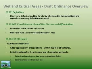
Wetland Critical Areas - Draft Ordinance Overview. 18.20: Definitions Many new definitions added for clarity when used in the regulations and several unnecessary definitions removed. 18.10.040: Establishment of Land Use Districts and Official Maps Correction to the title of soil survey

E N D
Wetland Critical Areas - Draft Ordinance Overview 18.20: Definitions Many new definitions added for clarity when used in the regulations and several unnecessary definitions removed. 18.10.040: Establishment of Land Use Districts and Official Maps Correction to the title of soil survey New “San Juan County Possible Wetlands” map 18.30.150: Wetlands The proposed ordinance: Adds ‘applicability’ of regulations – within 300 feet of wetlands. Includes options for the minimum size of regulated wetlands: Option 1: various minimum sizes, based on Importance Rating Option 2: one standard minimum size
Wetland Critical Areas Classifies wetlands based on their type and assigns Importance Ratings: Note: the majority of wetlands in SJC are likely “Low” Importance.
Wetland Critical Areas Clarifies the activities allowed within wetlands and their buffers (Removes the existing list of ‘regulated’ activities). These are two long lists; please refer to the draft ordinance for this text. Removes the standard buffer width protocol and establishes a site-specific buffer procedure (see Table 3.6 and the ordinance for detailed steps): Step 1: Determine the intensity of your proposed development. Step 2: Determine if there are any wetlands within a certain distance of your development (the distance is determined by the intensity of the development). If no possible wetlands are within this area, and you are not proposing any clearing, grading, vegetation removal, drainage modification, or other development within this area, no further action is needed. Step 3: Determine the sensitivity of the wetland & identify pollutant transport risk factors. Step 4: Determine the required buffer.
Table 3.3 Development Intensity Assign a rating of HIGH if implementation of the proposed development will result in any of the following: • The total Development Area (including any areas where vegetation will be cleared) exceeds the following percentages: or (b) Within the contributing area of the wetland, the development action changes the quantity or timing of surface or groundwater flow, resulting in either more or less water directed to the wetland, due to construction of cut-off trenches, curtain or foundation drains, ditches, berms, ponds, etc. Assign a rating of MEDIUM if implementation of the proposed development will result in conditions that do not meet the requirements of either the High or Low ratings. Assign a rating of LOW if implementation of the proposed development will meet all of the following: (a) The Development Area will not affect the breeding areas of animals listed by the State or Federal government as Endangered, Threatened, or Sensitive, or listed by San Juan County as a Species of Local Importance, or any plants with any of the aforementioned designations; and (b) Within the contributing area of the wetland, there are no changes in the quantity or timing of surface or groundwater flow, resulting in either more or less water directed to the wetland, due to the construction of cut-off trenches, curtain or foundation drains, ditches, berms, or ponds within the Development Parcel; and (c) Lights are directed away from wetlands and their buffers; and (d) The total Development Area comprises less than the following percentages: Staff note: The percentages shown above were derived from Semlitsch et al., 2009.
Wetland Critical Areas Buffers can be reduced in areas where the land slopes down away from the wetland: Down to 50 feet for Medium and High Importance wetlands & 15 feet for Low Importance wetlands. The site-specific buffer procedure takes the place of the existing provisions for buffer averaging, increases, and decreases. Consolidates and revises the process, requirements, and criteria for noncompensatory enhancement projects and clarifies the contents of critical area reports. Revises the regulation of ponds in wetlands (only allowed in low importance wetlands); Repeals Appendices A (San Juan County Wetlands Rating System), B (Mitigation / Enhancement Plan Contents), and C (Bonding).
660 ft. • EXAMPLE #1: Large parcel, low intensity • Check Development Intensity: • 10-acre flat parcel • 0.65-acre (67,015-sf) wetland • 1.4-acre Development Area includes: • 4,356-sf residence footprint • 3,600-sf paved driveway • 50,000-sf lawn • 2,300 sf garden & orchard • Total Development Area is less than 25% of the parcel • = LOW Development Intensity • Check distance to potential wetlands: 80 feet for Low Intensity Development • NO FURTHER ACTION NEEDED Garden & orchard Wetland 4,356-sf House footprint 130 feet Lawn
EXAMPLE #2: Small parcel, high intensity • Development Intensity: • 2.5-acre flat parcel • 6,500-sf wetland • 1.42-acre Development Area includes: • 3,300-sf residence footprint • 725-sf paved driveway • 56,600-sf lawn • 1,200-sf garden • Development Area is >50% of the parcel • = HIGH Intensity • Distance to potential wetlands: • 300 feet • Development Area extends into this area= DELINEATION REQUIRED • Delineation • Wet Prairie Wetland= a HIGH Importance Rating • Wetland Sensitivity Rating: HIGH • * 300-foot required buffer would nearly cover the parcel so development plans must be modified. Options include reducing the yard so development area is <50% (225 ft. buffer) or <35% (80 ft. buffer) or applying for a Reasonable Use Exception. Wetland 330 ft. 300 ft. 3,300-sf House footprint Garden Lawn
REASONABLE USE EXCEPTION FOR • EXAMPLE #2: • Development Intensity: • 2.5-acre flat parcel • 6,500-sf wetland • 0.52-acre Development Area includes: • 3,300-sf residence footprint • 725-sf paved driveway • 18,480-sf lawn Wetland 330 ft. Lawn 3,300-sf House footprint Garden