Download
1 / 19
190 likes | 329 Vues
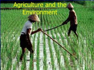
Innovative use of space technologies in the energy, environment and environmental monitoring, meteorology, agriculture and forestry sectors. Aire Olesk Estonian Trainee in ESA-ESRIN University of Tartu/Tartu Observatory Pärnu 26.08.2013.

E N D
Innovative use of space technologies in the energy, environment and environmental monitoring, meteorology, agriculture and forestry sectors Aire Olesk Estonian Trainee in ESA-ESRIN University of Tartu/Tartu Observatory Pärnu 26.08.2013
Space Technologies and Applications Integrated Applications
The benefits of space-based (EO)platforms • Global coverage • Frequent revisit and up-to-date information • Large range of swath size (e.g. coverage in a single acquisition) and resolution ranging from less thana metreto km-s • Ability to see through cloud and at night (e.g Synthetic Aperature Radar) • Rapid disaster management (prediction and monitoring, real-time decision-making) • Large store of archived data and continuity of missions allowing long term research into e.g. climate change, biomass etc. Sentinel-1
Innovative use of space technologies in the energy sector DInSAR • Measuring the subsidence at underground mining areas • Measuring the geological stability of oil and gas fields and pipe-lines, of large urban areasand single buildings • Subsidence information for power line poles and bridges Data: TerraSar-X, Tandem-X, Radarsat-2, Sentinel-1, Cosmo-Skymed, SMOS etc • EO satellites also produce 'sunshine maps' to help site solar power plants and bench-mark their operating efficiently' • Hydroenergy prediction (amount of precipitation, water capacity and speed of melting) • Wind speed and storm predictions (wind and solar farms) • Exploration and exploitation of oil and gas
Innovative use of space technologies in the energy sector Mean subsidence/riseof buildings in Tartu (mm per year) Period: 1993-2001 Source: ERS-1/-2
Innovative use of space technologies in the environment and environmental monitoring sector
Helping relief efforts in Japan - map of terrain displacement InSAR- synthetic aperture radar interferometry Possible to detect ground motion down to a few millimetres
Innovative use of space technologies in the environment and environmental monitoring sector Arctic sea-ice thickness based on two months' worth of data from the ESA’s ice mission, CryoSat-2. The first SMOS global map of soil moisture and ocean salinity
Innovative use of space technologies in meteorology sector • Accurate weather prediction and long term global climate change (EUMETSAT) • Short term and long term atmospheric changes on both, local and global scale • Weather warnings (monitor the volcanic eruptions and ash clouds, hurricanes, dust storms) • Satellites monitor the air we breath The mean density of nitrogen dioxide over Europe between January 2003 and June 2004, as measured by the SCIAMACHY instrument on ESA's Envisatsatellite. Source: ESA, University of Heidelberg Storm Ulli, EUMeTrain 2012
Innovative use of space technologies in forestry sector • Timber value estimation • Reforestation validation • Selective logging • Thinning and clearcut detection • Carbon stock for GHG inventories • Storm/fire damage estimation Country-wide forest biomass estimates from PALSAR L-band backscatter in 2010, Source: Regio Ltd, ESA Logging detection in Estonia in 2011-2012 Source: Regio Ltd, DMCii
Innovative use of space technologies in forestry sector Earth’s Northern Biomass mapped and measured • In higher resolution than ever before (pixel = 1 km on ground) • About 70 000 ENVISAT images from 2009-2011 combined to create the pan-boreal map for 2010 • Will be continued by the future Sentinel-1 mission • ESA’s seventh Earth Explorer is a Biomass mission (first P-band SAR mission, plus an experimental “tomographic” phase to provide 3D views of forests)
Copernicus – The European Earth Observation Programme • Copernicus - one of the two largest EU/ESA space programmes(in addition to Galileo) to stimulate innovation in European industry • Collects data from multiple sources: earth observation satellites and in situ sensors such as ground stations, airborne and sea-borne sensors • Copernicus (previously GMES) services address six main thematic areas: Land Monitoring, Marine Monitoring, Atmosphere Monitoring, Emergency Management, Security, Climate Change • Based on the Copernicus services, many other value-added services can be tailored to more specific public or commercial needs. • This will create new business opportunities and has a huge potential for job creation, innovation and growth. • A free and open data policy • Promotes growth and competitiveness in the EU
ESA’s Artes 20 programme Integrated Applications Promotion (IAP) - the development of operational services for a wide range of users through the combinationof different systems Cross-fertilisationacross disciplines (e.g. impact of Climate on Health, on Energy, on Transport, etc...) Example: Coastal flood warning system for the Baltic Sea (Pärnu City Government and Regio Ltd)
Integrated Applications • Severe floods in January 2005 in Pärnucaused by strong storms and heavy rain • 50 MEUR damage according to Estonian government estimations Proposed IAP Solution: • Web application presenting the flood forecast information http://space.regio.ee/iap/web/app.php/ • Cellular network text service disseminating the flood warning messages • Flood maps presenting the current situationand the evolution of the flooded area based on forecast
Educational and outreach projects • ESTCube-1 is the first Estonian satellite, launched in May 2013 • Built in Estonia by students from Tartu University, Estonian Aviation Academy, Tallinn University of Technology and University of Life Sciences • The main mission of the satellite is to test the electric solar wind sail • It also helps to build Estonianinfrastructure for future space projects and to educate space engineers • Image by ESTCube-1
Thank you for your attention! Studies are supported by European Social Fund’s Doctoral Studies and InternationalisationProgrammeDoRa, which is carried out by Foundation Archimedes.