January 29, 2007
January 29, 2007. The Next Edition of the Manual of Surveying Instructions and the Modern Cadastre. Presented by: Lance Bishop, BLM Chief Cadastral Surveyor California State Office, Sacramento, CA and Bob Dahl, BLM Cadastral Surveyor Lands, Realty & Cadastral Survey Division

January 29, 2007
E N D
Presentation Transcript
The Next Edition of theManual of Surveying Instructionsand the Modern Cadastre Presented by: Lance Bishop, BLM Chief Cadastral Surveyor California State Office, Sacramento, CA and Bob Dahl, BLM Cadastral Surveyor Lands, Realty & Cadastral Survey Division Washington, D.C. 46th Annual CSU Fresno Geomatics Engineering Conference Fresno, CA January 27, 2007
Agenda Cadastre – Cadastral – Cadastral Survey Little Fish in a Big Pond Case Study What is the Manual of Surveying Instructions? Why is the Manual relevant to the Private, County and State Surveyors in California?
Agenda Scope of the project - Technical project nested in a web of administration What is the process? How are we going about it? Where are we to date?
OHA → ↑ IBLA IBIA IBCA
Cadastral Presence • At the DOI level – BLM is 1 of 15 Bureaus and Offices • Within BLM – Cadastral is one of nearly 60 programs
What is the Manual of Instructions for the Survey of the Public Lands of the United States? (Manual) Whom/What is affected?
Why is the Manual Relevant to the Private, County and State Surveyor in California?
Case Study Group 1474, CA T. 14 N., R. 13 E., S.B.M. Section 23
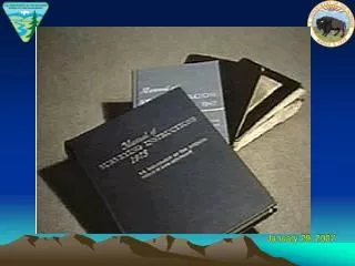
History of Surveys 1856-57 - A.H. Jones originally surveyed the township lines and subdivisional lines of the township 1916-17 - J.F. Duling, CE & PLS resurveyed multiple townships in the area for the Rock Springs Land and Cattle Co. 1919 San Bernardino County Surveyor’s office resurveyed portions of the township
Our First Plan for Survey Patents and subsequent sales were based on aliquot descriptions. Because of the elongation and the ¼ between 23/26 was not located only a standard breakdown of the section was authorized. Our survey put most of the structures in trespass with the NPS. Manual cite 6-15.
The Manual Section 5-2 “Where government lands are involved, the final authority …rests with the BLM” “If privately owned lands are involved, consideration is given to any protest made by an interested person concerning the work done by the BLM” The Landowner did protest!
Interior Board of Land Appeals Long established by the Department’s Interior Board of Land Appeals (IBLA) that a protestant who challenges a government resurvey will have the burden of demonstrating by a preponderance of the evidence that the disputed resurvey is not an accurate retracement of the survey which it purports to retrace. John W. and Ovada Yeargan, 126 IBLA 361, at 363 (1993) Our protestant did an outstanding job of proving his case.
The Manualcontinued: Section 5-21 The rules for the restoration of lost corners should not be applied until all original and collateral evidence has been developed…..
The Act ofMarch 3, 1909:Manual section 6-12 That no such resurvey or retracement shall be so executed as to impair the bona fide rights or claims of any claimant, entryman, or owner of lands affected by such resurvey or retracement
The Manualcontinued: Section 6-13 Bona fide rights are those acquired in good faith under the law.
The Manualcontinued: Section 6-15 continued The surveyor should neither rigidly apply the rules for restoration of lost corners without regard to effect on location of improvements…..
The Manualcontinued: Section 6-17 A claim cannot generally be regarded as having been located in good faith if no attempts have been made to relate it in some manner to the original survey.
Conclusions Our first direction, albeit in the end wrong, was well supported in Manual. The landowner may have won but still much of his later improvement are still in trespass. We do make mistakes, but our ultimate goal is to get it right.
CALIFORNIA CODES Business & Professions CodeDivision 3. Professions and Vocations GenerallyChapter 15. Land SurveyorsArticle 4. Issuance of License § 8741. Divisions of examination (b) Applicant shall be thoroughly familiar with Manual of Surveying Instructions procedures and rules
CALIFORNIA CODESBusiness & Professions CodeDivision 3. Professions and Vocations GenerallyChapter 15. Land SurveyorsArticle 5. Surveying Practice § 8773. Filing of written record of corner establishment or restoration required (a) & (b) “Lost corner” - defined by the Manual
CALIFORNIA CODE OF REGULATIONS Title 16. Professional and Vocational RegulationsDivision 5. Board for Professional Engineers and Land SurveyorsArticle 4. Miscellaneous § 464. Corner Record (f) BLM standard markings and abbreviations shall be used
Office of the Attorney General of the State of California 64 Opinions of the Attorney General 224 (1981) Manual of Surveying Instructions is “the authoritative reference book on the subject” of accessories to corner monuments
CALIFORNIA CODESEvidence CodeDivision 4. Judicial Notice§ 452. Matters which may be judicially noticed Regulations of the land office Actions of the BLM and of Departmental decisions
STATE COURTS OF CALIFORNIA Finley v. Yuba County Water District,99 Cal.App.3d 691 (1979); California v. Thompson, 22 Cal.App.3d 368 (1971), petitions for rehearing and hearing denied, by Supreme Court (1972) Rules for proportionate measurement is found in the Manual and Restoration pamphlet “Obliterated” corner and “lost” corner is defined by the Manual and the Restoration pamphlet.
STATE COURTS OF CALIFORNIAReid v. Dunn, 201 Cal.App.2d 612 (1962), cert. denied, by Supreme Court (1962) Record of Survey Map shows careful preparation and execution of the survey in compliance with the rules established by the Manual
STATE COURTS OF CALIFORNIAHanes v. Hollow Tree Lumber Company, 191 Cal.App.2d 658 (1961), cert. denied, by Supreme Court (1961) In unusual situations (up to one mile of distortion in original survey): unexplained or irreconcilable discrepancy, fictitious or grossly erroneous field notes – the Manual is quoted as the law in California
CALIFORNIA CASE LAW of NOTECounty of Yolo v. Nolan, 144 Cal. 445 (1904) Surveyor should endeavor to retrace the steps of the original surveyor
CALIFORNIA CASE LAW of NOTEWeaver v. Howatt, 161 Cal. 77 (1911); 171 Cal. 302 (1915) 1) Field notes and survey plat constitute parts of the descriptions in the original patents; 2) Monuments and objects prevail over courses and distances; 3) Lost corners will be restored by proportionate measurement; except
CALIFORNIA CASE LAW of NOTEWeaver v. Howatt, 161 Cal. 77 (1911); 171 Cal. 302 (1915) 4) Proportionate measurement is not used when it contradicts or conflicts with the official data that are not impeached and confine the actual position within certain limits; 5) In that case, the proportionate measurement position must be confined to the same limits.
UNITED STATES CODETitle 43 Public Lands § 2 The Secretary of the Interior or such officer as he may designate (BLM) shall perform all executive duties appertaining to the surveying and sale of the public lands of the United States
Other Federal Laws – Containing Survey Rules – The Federal Survey Rules Title 43 U.S.C. §§ 751-753, 772, 773
UNITED STATES CODETitle 25 Indians § 176 Whenever it becomes necessary to survey any Indian lands, the same shall be surveyed under the direction and control of the BLM And as nearly as may be in conformity to the rules and regulations under which other public lands are surveyed
1) BLM is authorized to resurvey the corners and lines of government surveys INTERIOR BOARD OF LAND APPEALSHoward Vagneur, 159 IBLA 272 (2003) 2) BLM Survey Manual defines a resurvey 3) Manual defines ‘existent’ ‘obliterated’ and ‘lost’ corners 4) Manual provides guidance to surveyors on how to base a resurvey on the ‘best available evidence’
INTERIOR BOARD OF LAND APPEALSHoward Vagneur, 159 IBLA 272 (2003) 5) BLM Official Surveys are presumed regular and 6) An accurate retracement and reestablishment of the lines of the original survey
United States Supreme Court It is settled law that the United States may survey what it owns and thereby establish and reestablish boundaries, but what the government does in this regard is for its own information and cannot affect the rights of owners on the other side of an existing boundary. United States v. State Investment Co., 264 U.S. 206, 212 (1924), citing Lane v. Darlington, 249 U.S. 331, 333 (1919).
MANUAL The Manual of Surveying Instructions describes how cadastral surveys of the public lands are made in conformance to statutory law and its judicial interpretation. (1973 Manual § 1-1.) It is within the province of the Director to determine what are public lands, what lands have been surveyed, what are to be surveyed, what have been disposed of, what remains to be disposed of, and what are reserved. (1973 Manual § 1-11.)
SUMMARY By fundamental law, upon the issuance of a patent for land by the Federal government; it is just as if the monuments, survey plat and field notes, and the laws, regulations and rules governing how to survey the land described in the patent, are stapled to the face of the patent. The survey rules are spelled out in the manuals, circulars, instructions and regulations issued by the GLO and later by the BLM.
Next Edition Website http://www.blm.gov/cadastral/Manual/nextedition.htm Contact Information Announcements: Upcoming Presentations General Information http://www.geocommunicator.gov/GeoComm/lsis_home/home/index.html http://www.glorecords.blm.gov