Download
1 / 15
150 likes | 329 Vues
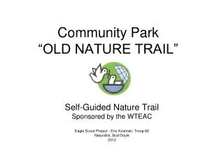
Community Park “OLD NATURE TRAIL”. Self-Guided Nature Trail Sponsored by the WTEAC Eagle Scout Project - Eric Kosinski. Troop 82 Naturalist, Bud Doyle 2012. Entrance.

E N D
Community Park “OLD NATURE TRAIL” Self-Guided Nature Trail Sponsored by the WTEAC Eagle Scout Project - Eric Kosinski. Troop 82 Naturalist, Bud Doyle 2012
Entrance • Walking this quarter mile long nature trail will give you a brief glimpse into Wall’s rich rural past. The entire sports complex, municipal buildings, and even the Intermediate School were all formerly farm fields. • The Eckman Farm upon which the sports complex was built actually used teams of horses rather than tractors to plow the fields and harvest the crops as recently as the early 1970’s. • Classes at the Intermediate School were regularly interrupted as the teams of horses passed along Allaire and Bailey’s Corner Roads to get to nearby fields.
Entrance • Farmers managed their lands wisely. They were the first conservationists as it was in their best interests to keep the fields fertile and productive. It was relatively easy to build the soccer and football fields as the land was already cleared, flat, and level. • Farmers were also aware of the need to protect wetlands as these water sources were used to irrigate their crops. • This nature trail wanders downhill from the former farm fields to a small stream. Along the way are periodic stops to learn about the unique relationship between human history and natural history.
Stop #1 • Entering this woodland, you are actually passing through former pasture land. • The types of trees growing here are red cedar, wild black cherry, and sassafras. The area was a former field. When a field is abandoned, weeds replace the crops. Soon shrubs and small trees replace the weeds, and eventually larger trees replace the shrubs and smaller tree species. This natural process is called secondary succession.
Stop #2 • We are rapidly proceeding downhill towards the stream. Looking back at the entrance, notice the abundance of plant life at the edge of the forest. Many varieties of trees, shrubs, and vines are competing for sunlight. That is quite a contrast to this part of the forest where the taller trees prevent sunlight from reaching the forest floor. • There are considerable changes from the edge of the forest to here. As the vegetation changes, so do the animals. Only rabbits and groundhogs were near the field. • In this part of the forest where there are numerous white and scarlet oak trees, look for squirrels and their nests high up in the trees. Also look on the ground for deer tracks. Acorns are the food of choice for both gray squirrels and deer. • Locate the large white oak tree to the right of the trail. This tree which has a split trunk is well over one hundred years old.
Stop #3 • We are now at the edge of the wetlands. Look for clumps of cinnamon fern and the large, bright green leaves of skunk cabbage during spring and summer. • The stream is a small tributary leading to Wreck Pond Brook, the primary drainage for most of central Wall. It sometimes dries up during periods of drought. Look for frogs along the stream.
Stop #4 • The trail now turns to the right and travels along the edge of the wetlands. Notice the differences between the drier oak forest and the wetter red maple forest that follows along the stream. Red maple trees are identified by their smooth gray bark. They are also called swamp maples as they can grow in wet soils by spreading their roots near the surface instead of growing down into the wet soil. • The valley of a stream is called the floodplain and the actual stream is referred to as the floodway. Look for high bush blueberries in the wet woods during August.
Stop #5 • Locate the mature holly tree. Try to estimate the diameter of the tree at your breast height (DBH, a forestry measurement). Each inch of diameter represents about ten years of growth. How old do you estimate the age of this tree? • Actually this tree is as old as most of the larger nearby oak trees. Holly can survive in a shady forest as it does not lose its leaves in autumn, which enables these trees to produce food (photosynthesize) year round.
Stop #6 • Look up towards the tree tops or forest canopy. • Looking downward, locate the under story of smaller trees. • Finally, look at the plants covering the ground. In addition to being horizontal, the forest is also vertical with different levels attracting different kinds of plants and animals.
Stop #7 Wetlands overlook: The trail now turns to the right, away from the stream and wetlands, up towards the fields.
Stop #8 • Take a moment to listen to the chatter of woodland birds such as catbirds, yellowthroats, wood peewees, and ovenbirds. • Maybe you can hear the drumming of a woodpecker or the caw of a crow or cry of a hawk flying overhead. You might also mistake the shrill call of a chipmunk as that of a bird.
Stop #9 In the forest you can find mammals such as the gray fox, raccoons, opossums, gray squirrels, chipmunks, deer, skunks, groundhogs, and rabbits. • Raccoons are usually found near the stream. • Squirrels and chipmunks live in the oak forest. • Groundhogs, rabbits, skunks, and opossums are usually found near the field edges. • Deer and gray fox travel throughout the area. • Box turtles, frogs, toads, and an occasional snake are observed in this woodland. While there are many animals in this forest, they are usually difficult to locate unless you are quiet and patient.
Stop #10 • Locate a few dead and dying trees that are still standing. These trees serve important jobs as homes and resting spots for a number of animals and birds. • The parts of the dead trees lying on the ground are now rotting away, returning the vitamins, minerals, and nutrients that they borrowed when they were alive back to the soil to be used by other plants. Algae, moss, fungi, bacteria, and insects helping the wood to rot away are referred to as decomposers.
Stop #11 • This is the final stop before you re-enter the fields. You can tell we are approaching the fields as the types of trees are changing with smaller species such as red cedar, cherry, sassafras, and locust replacing the larger oaks. • Along this trail you have seen many close interrelationships between human history and natural history. While many farms, forests, and open areas are rapidly becoming developed, we must not forget the importance of our natural environment and our heritage.
ExitVisithttp://www.wallnj.com/wteac.htmfor additional information The Wall Township Environmental Advisory Committee hopes that you have enjoyed walking through this natural area.