Comprehensive Online Resources for Georeferencing and Mapping Tools
Explore a variety of online resources for georeferencing and mapping that facilitate accurate location identification. This guide includes tools like Google Maps, Google Earth, and specialized services such as Canadensys and FuzzyG. Discover features such as satellite views, custom markers, distance measurement, and additional mapping layers. Useful for researchers and hobbyists alike, these platforms provide access to worldwide data, geographic features, and coordinates in various formats. Enhance your mapping experience with these essential tools.

Comprehensive Online Resources for Georeferencing and Mapping Tools
E N D
Presentation Transcript
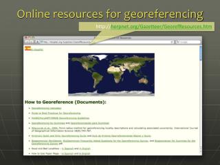
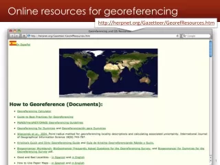
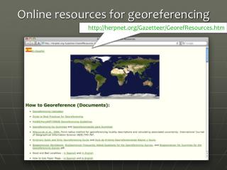
Online resources for georeferencing http://herpnet.org/Gazetteer/GeorefResources.htm
Online resources for georeferencing http://canadensys.net/digitization/georeferencing
Google Maps • http://maps.google.com • Search & directions • Free text search, zoom -dependent • Directions for travelling by car, bike, public transport and foot • Data compiled from different sources • Maps • Datum: WGS84 • Views: map, satellite (= aerial photography), terrain, Google Street View + various layers of information • Data compiled from different sources (indicated at the bottom of each map) • Third Party Plug-ins extend functionality
Google Maps - Searching You can search now with suggestions
Google Maps - Viewing Satellite Maps Terrain (under ‘More’) Earth (plug-in required)
Google Maps – Street View Street View
Google Maps – Street View I collected here
Google Maps – Getting coordinates • Requires additional widgets or plug-ins • Activate LatLng Marker in Google Maps Labs • Install a mapplet like GPS Location or Position Finder in ‘My Maps > Browse the directory’. Now deprecated! • Use Canadensys LatLong Crosshairs bookmarklet, this doesn’t work in Internet Explorer: http://www.canadensys.net/georeferencing • Use Distance Measurement Tool to measure extent • Use My Maps to save markers, create maps, share with others (including kml import)
Google Maps – Getting coordinates Google Maps Labs LatLng Marker Right-click and‘Drop LatLng Marker’ (activate in ‘Labs’ first)
Google Maps – Getting coordinates Canadensys bookmarklet Click to toggle Crosshairs Pan map to change position Click to get coordinates
Google Maps – Measuring extent Distance Measurement Tool (activate in ‘Labs’ first)
Google Earth • http://earth.google.com • 3D globe desktop application • Same data as Google Maps • Datum: WGS84 • No Map or Terrain view • Similar functionalities as Google Maps • Search is more limited than Google Maps (no suggestions) • Right-click and choose ‘Get Info’ for coordinates • Use ruler to measure extent • Several coordinate formats • Numerous information layers (format: kml)
AcmeMapper • http://mapper.acme.com/ • Google Maps interface • Datum: WGS84 (& NAD27) • Map, satellite, hybrid and terrain • Free text search not Zoom level-dependent • Markers cannot be moved, but new markers can be placed at crosshairs (click ‘Mark’) • Several coordinate formats for each marker + heading and distance from crosshairs • Saves all markers automatically
GEOnet Names Server (GNS) • http://earth-info.nga.mil/gns/html/ • Worldwide data from NGA andUS BGN • NIMA = National Imagery andMapping Agency • Datum: WGS84 • Degrees minutes seconds, • Precision is only to nearest minute • Feature type • Used as a source for many gazetteers • For US data, use Geographic Names Information System (GNIS): http://geonames.usgs.gov/pls/gnispublic/
Falling Rain • http://www.fallingrain.com • Worldwide gazetteer for citiesand towns • Great for hard-to-find localities, especially outside US • Datum: WGS84 • Degrees minutes (seconds), based on NIMA • Browse to find locality (no search) • Provides hierarchy, alternative names, topo maps, altitude, weather information and location of nearby towns in nautical miles (nm). Use Georef Calc to translate nm. • Example: Qaryeh-ye Gol`alam, Velayat-e Lowgar, AF
Getty Thesaurus of Geographic Names • http://www.getty.edu/research/conducting_research/vocabularies/tgn/ • Worldwide gazetteer byThe Getty • Useful for finding alternative and old names • Feature types • Geographical hierarchy • Coordinates only to minutes (or not at all)! • Use recent name and then search in Google Maps • Example: Big Apple, inhabited place, United States
FuzzyG – JRC Fuzzy Gazetteer • http://dma.jrc.it/services/fuzzyg/ • Worldwide gazetteer designed for bad spelling! • Useful for finding alternative, doubtful spelling,old names • Feature types, by continent • Coordinates only to minutes (or not at all)! • Use recent name and then search in Google Maps • Example: Narobi instead of Nairobi, Africa
Hot-map.com: Street maps of South Africa • http://hot-map.com/en • Worldwide gazetteerfor city street maps & driving, multiple langages • Includes measuring tools, useful for extents,roads • Need to use Google Maps to plot coordinates • Can zoom, scale is viewable, sometimes can search names
Other Resources • GPS Visualizer: http://www.gpsvisualizer.com/ • Use to translate a file with coordinates into kml or a picture • Similar: http://www.simplemappr.net/ for publications • Statoids: http://www.statoids.com/ • Information about administrative divisions (provinces, counties) and their history, area, population, codes, etc. • No coordinates! • Similar: CIA World Factbookhttp://bit.ly/dDtT1i • See http://herpnet.org for more…