Georeferencing : 101
Georeferencing : 101. What is a georeference ?. A numerical description of a place that can be mapped. In other words, georeferencing is turning a locality we read: Species: Polypodium californicum State: CA County: Marin


Georeferencing : 101
E N D
Presentation Transcript
What is a georeference? A numerical description of a place that can be mapped.
In other words, georeferencing is turning a locality we read: Species: Polypodiumcalifornicum State: CA County: Marin Locality: Marin Municipal Water District Lands: Mount Tamalpais. Middle Peak Rd. culvert RT-3
Into a locality we can map: 37.930, -122.587
“Davis, Yolo County, CA” Point Method Coordinates: 38.5463 -121.7425
“Davis, Yolo County, CA” Bounding-box Method Coordinates: 38.5486 -121.7542 38.545 -121.7394
“Davis, Yolo County, CA” Point Radius Method Coordinates: 38.5468 -121.7469 Maximum Uncertainty: 8325 m
“Davis, Yolo County, CA” Shape Method
What is an idealgeoreference? A numerical description of a place that can be mapped and that describes the spatial extent of a locality and its associated uncertainties as well as possible
How to do it? • Paper maps • Time-consuming • Good quality paper maps may be hard to find • Internet Resources
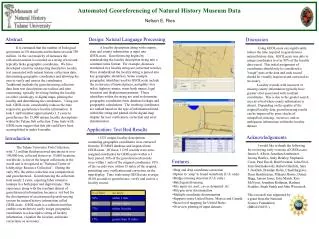
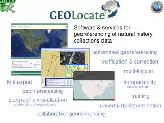
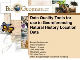
Software & services for georeferencing of natural history collections data automated georeferencing verification & correction multi-lingual kml export interoperability soap & rest api batch processing training geographic visualization uncertainty determination google, bing, openstreet, wms collaborative georeferencing
Other Internet Sources • Google Maps • Getty Thesaurus of Geographic Names • Useful for old or alternative names • Worldwide • FuzzyG- JRC Fuzzy Gazetteer • Worldwide • Designed for bad spelling • Falling Rain • Worldwide • Great for hard to find localities outside of US
Why Georeference? • Correct geographic and specimen identification data = dependable occurrence record. • Occurrence data validates the importance of biological collections, especially to non-taxonomists. • Distribution of populations and species ranges • Phylogeography • Niche modelling • Conservation planning and biodiversity management • Provides uncertainty data, which allows data to be evaluated with regards to its fitness for research application and resulting quality of output.