Download
1 / 30
300 likes | 441 Vues
Georeferencing to the NHD: Moving from ArcView to ArcIMS ESRI User Conference July 9, 2002. Authors: James Rineer, RTI International (presenter) Anne Marie Miller, RTI International (presenter) Michael Plastino, US EPA, Office of Water Thomas Dewald, US EPA, Office of Water.

E N D
Georeferencing to the NHD: Moving from ArcView to ArcIMSESRI User ConferenceJuly 9, 2002 Authors: James Rineer, RTI International (presenter) Anne Marie Miller, RTI International (presenter) Michael Plastino, US EPA, Office of Water Thomas Dewald, US EPA, Office of Water
Presentation Overview I. Background • National Hydrography Dataset (NHD) • Reach Indexing Concepts and Tools (PC-based Reach Indexing Tools and Web-based Reach Indexing Tools) II. Web-Based Reach Indexing Tool Overview • Goals • Technology • Design overview • Interface Tier • Middle Tier • Database Tier • III. Conclusion Overview 2
Acknowledgments • The work described in this presentation was funded by the U.S. Environmental Protection Agency under Contract 68-C-01-007 with Research Triangle Institute (RTI). RTI gratefully acknowledges this support. • Disclaimer: Although the research described has been funded wholly or in part by the U.S. Environmental Protection Agency Contract 68-C-01-007 to Research Triangle Institute, it has not been subject to the Agency's review and therefore does not necessarily reflect the views of the Agency, and no official endorsement should be inferred. Mention of trade names or commercial products does not constitute endorsement or recommendation for use. Overview 3
National Hydrography Dataset (NHD) • Set of spatial data that contains information about surface water features. • Surface water features are represented by "reaches," which are assigned unique identifiers • Contains 52 feature types: streams, lakes, reservoirs, canals and dams. • Based upon the USGS Digital Line Graph (DLG) hydrography and the EPA Reach File Version 3 (RF3). • 1:100,000-scale NHD (higher resolution NHD - in progress) • NHD is available online at http://nhd.usgs.gov/ Background 4
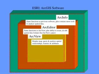
PC-based Reach Indexing Tool (PC-RIT) • Georeferencing (reach indexing):The process of describing (or locating) entities in a GIS coverage; assigning an NHD reach code to the waterbody feature. • PC-based Reach Indexing Tool (PC-RIT):ArcView 3.x extension; Tool for georeferencing surface water features to reaches in NHD. Background 5
Linear Events Background 6
Point Events Background 7
Waterbody Features Stored as shapefiles, but function similarly to event tables when used with the Reach Indexing Tools. Background 8
Metadata Support Functions Selection Tools 2D Feature Indexing Dynamic Segmentation
Why Move to the Web?PC-RIT WebRIT • No client software required • PC-RIT requires each user to purchase ArcView • Makes application accessible to more users • Any computer with an internet connection and compatible web browser can use the WebRIT • Instant updates and bug fixes available for all users • Instant feedback of results • Up-to-date data sources • Faster and easier validation of data Background 10
WebRIT-GRTSWeb-based Reach Indexing Tool for the Grants Reporting Tracking System • Georeference the locations of nonpoint source projects funded by grants issued under Section 319 of the Clean Water Act • Nonpoint source projects are tracked in GRTS • Use WebRIT-GRTS to capture which NHD reaches a grant affects • First step towards moving some of the PC-based RIT functionality to the web Background 11
WebRIT-WATERS WebRIT-GRTS Why Expand WebRIT-GRTS? • Index partial linear reaches • Index points along reaches • Index waterbody reaches • Central capture of indexed data • Update existing NHD indexing • Validate existing NHD indexing • Enter, update, and validate other types of spatial data (polygonal and lat/lon data) Background 12
WebRIT-WATERS PC-RIT WebRIT-GRTS NHD Indexing Tools Background 13
WebRIT-WATERS(Web-based Reach Indexing Tool for Watershed Assessment, Tracking, and Environmental Results) Goals • Perform dynamic segmentation tasks using Oracle Spatial’s Linear Referencing System (LRS) • ArcIMS can not do dynamic segmentation by itself • Support a large number of users • Allow for Entering, Validating, and Updating of multiple types of data (Points, Lines, Polygons) • Utilize a centralized database for data collection • Distribute the processing between the client browser, web server, and database servers WebRIT 14
Key WebRIT = WebRIT-WATERS Database RAD = Reach Address Database IGD IGD = Integrated GeoDatabase WebRIT RAD WebRIT-WATERSDesign Overview ArcIMS HTML viewer Interface Tier Internet Information Server (IIS) ASP / COM+ DLL Middle Tier ArcIMS Connector OO4O ArcSDE Database Tier NOTE: WebRIT contains Oracle Spatial tables registered with ArcSDE Periodic batch process WebRIT 15
WebRIT-WATERS(Web-based Reach Indexing Tool for Watershed Assessment, Tracking, and Environmental Results) Technology • ArcIMS – HTML viewer model • ArcSDE – Running on Oracle • IIS/ASP – Microsoft’s Internet Information Server and Active Server Pages • Oracle/Oracle Spatial • PL/SQL stored procedure perform dynamic segmentation tasks and create the spatial data • Oracle Spatial tables are registered with SDE • Oracle Objects for OLE (OO4O) – component used for connection to Oracle in VB or ASP WebRIT 16
Key WebRIT = WebRIT-WATERS Database RAD = Reach Address Database IGD IGD = Integrated GeoDatabase WebRIT RAD WebRIT-WATERSDesign Overview ArcIMS HTML viewer Interface Tier Internet Information Server (IIS) ASP / COM+ DLL Middle Tier ArcIMS Connector OO4O ArcSDE Database Tier NOTE: WebRIT contains Oracle Spatial tables registered with ArcSDE Periodic batch process WebRIT 17
WebRIT-WATERS(Web-based Reach Indexing Tool for Watershed Assessment, Tracking, and Environmental Results) Interface Tier • Started with ArcIMS HTML viewer and added custom JavaScript code and ASP pages • Enhanced the selection tools to work more like ArcView • The selection set can be added to, subtracted from, or inverted • The user can undo the last selection • Selections can be made on multiple layers at one time • Selections are drawn on the acetate layer and stored in JavaScript global variables WebRIT 18
WebRIT-WATERS(Web-based Reach Indexing Tool for Watershed Assessment, Tracking, and Environmental Results) WebRIT 19
Key WebRIT = WebRIT-WATERS Database RAD = Reach Address Database IGD IGD = Integrated GeoDatabase WebRIT RAD WebRIT-WATERSDesign Overview ArcIMS HTML viewer Interface Tier Internet Information Server (IIS) ASP / COM+ DLL Middle Tier ArcIMS Connector OO4O ArcSDE Database Tier NOTE: WebRIT contains Oracle Spatial tables registered with ArcSDE Periodic batch process WebRIT 20
WebRIT-WATERS(Web-based Reach Indexing Tool for Watershed Assessment, Tracking, and Environmental Results) Middle Tier • Relies on IIS, ArcIMS Connector and, ASP • HTML forms are completed and are submitted to ASP processing pages (Selection Box) • ASP processing pages call OO4O to launch procedures stored in the Oracle database [perform dynamic segmentation, create spatial data, and other spatial analyses] • The ASP processing pages use the HTML “onload” event to call JavaScript functions (Refresh Map) • ASP pages also perform server side data validation and error capture and recovery WebRIT 21
Key WebRIT = WebRIT-WATERS Database RAD = Reach Address Database IGD IGD = Integrated GeoDatabase WebRIT RAD WebRIT-WATERSDesign Overview ArcIMS HTML viewer Interface Tier Internet Information Server (IIS) ASP / COM+ DLL Middle Tier ArcIMS Connector OO4O ArcSDE Database Tier NOTE: WebRIT contains Oracle Spatial tables registered with ArcSDE Periodic batch process WebRIT 22
WebRIT-WATERS(Web-based Reach Indexing Tool for Watershed Assessment, Tracking, and Environmental Results) Database Tier • Utilizes Oracle and Oracle Spatial to perform dynamic segmentation tasks creating or updating events (Stored Procedures) • NHD data is stored in a central EPA SDE/Oracle database called the Reach Address Database (RAD) • Streets, States, Counties, Cities, and other contextual data layers are stored in a central EPA SDE/Oracle database called the Integrated GeoDatabase (IGD) • The WebRIT database maintains its spatial data in Oracle Spatial Spatial Data Option (SDO) format which is registered with ArcSDE and visualized through ArcIMS • Changes to spatial data in Oracle are automatically updated in ArcIMS after the map is refreshed WebRIT 23
WebRIT-WATERS: Metadata WebRIT 26
Key WebRIT = WebRIT-WATERS Database RAD = Reach Address Database IGD IGD = Integrated GeoDatabase WebRIT RAD WebRIT-WATERSDesign Overview ArcIMS HTML viewer Interface Tier Internet Information Server (IIS) ASP / COM+ DLL Middle Tier ArcIMS Connector OO4O ArcSDE Database Tier NOTE: WebRIT contains Oracle Spatial tables registered with ArcSDE Periodic batch process WebRIT 28
Conclusion • WebRIT-WATERS uses ArcIMS for the mapping interface and ArcSDE with Oracle Spatial to perform the dynamic segmentation tasks • ASP is the glue that holds Oracle Spatial and the ArcIMS HTML viewer model together • Benefits to using ArcIMS in combination with Oracle Spatial include • Create/Enter spatial data through the web • Ability to do dynamic segmentation through the web • A multi-tiered application with distributed processing • Spatial data is stored in a non proprietary format • Modular approach • Provide georeferencing tools to a large audience Conclusion 29
More Information • Reach indexing tools and training • http://www.epa.gov/owow/monitoring/georef/ • EPA’s Watershed Assessment, Tracking, and Environmental Results (WATERS) integrated information system for the nation’s surface waters • http://www.epa.gov/waters/ • National Hydrography Dataset • http://nhd.usgs.gov/ Conclusion 30