Download

1 / 41
430 likes | 649 Vues
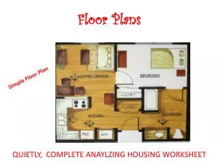
Automatic Construction of Indoor Floor plans. BY Srikanth Anumolu Rohith Madavaram Abhi Reddy. Introduction. During the last decade, there has been a rapid growth in location based applications, including location-enabled social networking, direction finding, and advertisement.

E N D
Automatic Construction of Indoor Floor plans BY SrikanthAnumolu RohithMadavaram Abhi Reddy
Introduction • During the last decade, there has been a rapid growth in location based applications, including location-enabled social networking, direction finding, and advertisement. • This has been driven by the flourishing of smart phones and mobile devices, location determination technologies, and wireless Internet connectivity. • A key requirement to many of these location-based applications is the avail- ability of a map to display the user location on. This map can be a street map, in case of outdoor applications, or a floorplan, in case of indoor applications. • Traditionally, outdoor location-based services providers, such as Google Maps, Bing Maps, FourSquare, etc, provide outdoor street maps for almost all regions around the globe. However, the indoor equivalent floorplans are currently very limited, affecting the ubiquity and spread of indoor location-based applications.
Introduction (Contd…..) • Recently, a number of commercial systems for in- door direction finding have started to emerge, e.g. Point Inside and Micello Indoor Maps. • In late 2011, Google Maps started to pro- vide detailed floorplans for a few malls and airports in the U.S. and Japan. Nevertheless, all these systems depend on manually building the floor plan. • Manual addition/editing of all buildings floorplans around the world requires an enormous cost and effort which may be unaffordable. In addition, keeping these floorplans up to date is another challenge. • In this presentation, we discuss on CrowdInside as a automatic floorplan construction system.
What is CrowdInside? • CrowdInside leverages the ubiquity of smart phones to infer information about the building floorplan along with other semantic information. • In particular, today’s smart phones have an array of sensors, e.g. inertial sensors (accelerometers, com- passes, and gyroscopes), that can be used to construct traces of movement in a transparent manner to the users. • People walking in their homes, offices, and even visitors collect these traces and send them for processing by CrowdInside. Using this crowdsourcing ap- proach, CrowdInside can provide the general layout of a building, identify the rooms and corridor locations and shapes, along with identifying other points of interest, such as elevators, stairs, and escalators.
What is CrowdInside? (Contd…) • CrowdInside, however, has to address a number of challenges including handling the smart phones noisy sensors, estimating the positions of points of interests in the building, detecting rooms and corridors shapes, and identifying doors locations. • Implementation of CrowdInside in a shopping mall and a university campus shows that it can estimate the floorplans with high accuracy with a relatively small number of traces. • Such a system enables a wide set of indoor location based systems including, in- door directions finding, fine-grained location-based ads, indoor so- cial networking applications, and ubiquitous indoor localization.
Few points on Crowd Inside System • We present the Crowd Inside system architecture for leveraging the smart phones sensors in a crowdsourcing approach to automatically estimate the indoor floorplans for virtually any building around the globe. • We provide techniques for estimating points of interests (or anchor points) in the environment (such as building entrances, elevators, stairs, and escalators) based on the phones inertial sensors with high accuracy. • We provide a novel technique for constructing accurate indoor user traces based on the noisy inertial sensors in today’s commodity smart phones. The proposed technique depends on resetting the accumulation of error by leveraging the detected anchor points. • We employ classification techniques to separate corridors from rooms and further apply clustering techniques to separate the rooms from each other. • We show how to identify the rooms shapes using computational geometry techniques. • Finally, we implement the system on different Android phones (Samsung Nexus S, Nexus One, Galaxy Ace and Galaxy Tab) and evaluate it in a campus building and a mall.
System Architecture The system consists of three main module: (a) the Data Collection Module is responsible for collecting measurements from users’ devices, (b) the Traces Generation Module is responsible for building accurate motion traces based on a novel anchor-based error resetting technique and (c) the Floorplan Estimation Module that separates the corridors from the rooms and detects the rooms boundaries.
Data Collection Module • This module is responsible for collecting measurements from the various sensors embedded in the users’ mobile devices. • The time- stamped measurements collected can be buffered and then sent to server in the cloud for later processing when a connection is available to reduce the communications cost and/or save energy. • Data collected are measurements from sensors including accelerometers, magnetometers, gyroscopes, and the received WiFi signal strength values from available access points. • The GPS is also queried with a low duty cycle to detect the user’s transition from outdoors to indoors. The duty cycle can be set adaptively ac- cording to user’s current position (e.g. more frequently when the user approaches the border of the building.)
Traces Generation Module Background :- • Since the main goal is to trace the users inside a building, we cannot depend on the GPS as it requires direct line-of-sight to the satellites. • To address this problem, we rely on a dead-reckoning based approach. In dead- reckoning the current location (Xk,Yk) is estimated with the help of the previous location (Xk−1,Yk−1), distance traveled (S), and direction of motion (θ) since the last estimate as: Xk = Xk−1 + S ∗ cos(θ) Yk= Yk−1 + S ∗ sin(θ) (θ can be estimated from the magnetometer and/or the gyroscope, while the displacement S can be obtained from the accelerome- ter. The initial position is the last known GPS coordinate, de- tected by the loss of the GPS signal. )
Traces Generation Module • Theoretically the distance traveled can be calculated by integrat- ing acceleration twice with respect to the time. • However due to the presence of noise in the accelerometer output, error accumulates rapidly with the time. Another source of error is the presence of a component of acceleration due to the gravity of earth. • This error accumulation still exists even if we use the zero velocity update technique • To reduce the accumulation of errors, we extend the pedometer- based approach so that it makes the error in displacement linear in time rather than cubical . • To minimize these errors , the next section gives the details of our extensions.
Proposed Anchor based tracking We believe that the inaccuracy in the traces is due to two main reasons: 1. Error due to the inaccuracy in estimating the trace starting point. 2. Error accumulation of displacement with time, which has been reduced to linear with time using the proposed technique. To further reduce these two sources of error, we introduce the notion of anchor points.
Effect of using anchor points to reset the error in dead-reckoning. Anchor points are points in the environ- ment with unique sensor signatures that can be used to reset the trace error when the user hits one of them as shown in Figure . In particular, we identify two classes of anchor points: those based on the GPS sensor (building entrances and windows) and those based on inertial sensors (stairs, elevators, escalators, room doors, etc).
GPS-based Anchor Points • The most observable change to the phone sensors when a user enters a building is the loss of the GPS fix. This can be used to detect the building entrance position. • However, this requires the GPS to be always on, to obtain good accuracy, which can kill the phone battery quickly. • However, this comes at an increased error in estimating the door location as the loss of the GPS signal cannot be determined unless the GPS sensor is on. • Fortunately, leveraging the large number of traces obtained by our crowdsourc- ing approach, we can reduce the ambiguity of the building entrance location by statistical techniques.
In particular, the building entrance location is uniformly distributed in the interval between the last obtained GPS position and the first loss of the GPS signal as shown in the figure below. • Using the law of large numbers, the building entrance position can be estimated with high accuracy Therefore, whenever the loss of the GPS signal is detected, the user position can be reset based on the position of the nearest building entrance/window, enhancing the trace accuracy. This also helps in reducing the error in the trace starting point.
Inertial-based Anchor Points • This class of anchor points are based on using the inertial sensors, i.e. the accelerometer, compass (magnetometer), and gyro- scope. • These sensors have the advantage of being ubiquitously installed on a large class of smart phones, having a low-energy foot- print, and being always on during the phone operation (to detect the change of screen orientation). • Our focus in this section is on defining a set of rules that enable us to clearly identify elevators, escalators, and stairs as an example of the anchor points that can be identified using the inertial sensors and separating them from other patterns such as normal walking and being stationary.
The figure shows a classification tree for detecting the three classes of interest: elevators, escalators, and stairs. • Elevator: The elevator has a unique acceleration pattern that makes it easily distinguishable with high accuracy (Figure 7). A typical elevator usage trace consists of a normal walking period, followed by waiting for the elevator for sometime, walking into the elevator, standing inside, an over-weight/weightloss occurs (depending on the direction of the elevator), then a stationary period which depends on the number of the floors the elevator moved, another weight-loss/over-weight period, and finally a walk-out.
To recognize the elevator motion pattern, we developed a Finite State Machine (FSM) that depends on the observed state transitions (Figure 8). The detected direction of motion (based on the order of the weight-loss over-weight events) and the number of floors traveled (based on the time or displacement during the inside-elevator pe- riod), can be used to further enhance the accuracy.
Escalator: Once the elevator has been separated, the key observation that distinguishes the constant speed scenarios (escalator/stationarity) from the dynamic scenarios (stairs/walking) is that users do not move their legs in the constant speed scenarios. Moving legs has a significant effect on the variance of the acceleration pattern (as shown in the figure). To further separate the escalator from stationarity, we found that the variance of the magnetic field when the user is stationary is much less than the case when she is using an escalator (as shown in the Figure ). We believe that this is due to the change of location in the case of the escalator and the presence of the powerful motor of the escalator.
Stairs: Once the dynamic scenarios have been separated based on the variance of acceleration, what remains is to differentiate between the stair and walking cases. Figure 11 shows that the correlation between the acceleration in the Y and Z axes can be a good measure to separate the two cases. The intuition is that when the user is using the stairs, her speed increases or decreases based on whether the gravity is helping her or not. This creates a higher correlation between the acceleration in the direction of motion and direction of gravity as compared to walking. Furthermore, our measurements show that climbing down stairs exhibit a higher motion intensity than climbing up (as the gravity is helping the user in the former case).
Estimating the Location of Inertial-based Anchor Points • Similar to the case of GPS-based anchor points, to estimate the location of an inertial-based anchor point we use the average loca- tion of all position estimates for users coming by this anchor point. • Once the location of an anchor point is found, it is added to the generated floorplan and also used to enhance the newly generated traces. • In addition, the WiFi signal and AP MAC addresses can be used to distinguish between the different anchor points of the same kind. This is especially needed in the case of dense anchors from the same type, such as using turns as virtual anchor points.
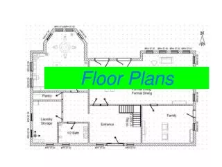
FLOORPLAN ESTIMATION MODULE • Once accurate motion traces are collected from different users, the goal of this module is to estimate the building floorplan. • There are two levels of details that can be obtained: (1) the overall shape and (2) the room-corridors details. We start by giving the details of both modules and end the section by a discussion of other higher level semantic information that can be obtained.
Overall Floor-plan Shape This level of detail provides a black and white occupancy map of the building. In particular, areas where users move represent walk- able area (black) and areas free of users’ traces represent blocked area (white). In order to automatically estimate the overall floorplan shape, we represent each user step by a point. The goal is to estimate the best shape that represents the point cloud generated from all collected traces (Figure 13(b)). We found that alpha shapes is a general tool t which has the property that the two points lie on its boundary. Note that for α < 0, this is equivalent to drawing an edge between two points of the set if there exists a generalized disk of radius 1/α which has the property that the two points lie on its boundary and does not contain any of the remaining points.
The α-shape is a generalization of the concept of the convex hull (for α = 0). Figure 13(d) shows the α-shape of the point cloud in Figure 13(b). Note that the convex hull of the same point cloud cannot capture the concavity and holes in the floorplan shape (Figure 13(c) hat can capture the building shape with high accuracy. An alpha shape (α-shape) is a family of piecewise linear simple curves in the Euclidean plane associated with the shape of a finite set of points [7]. An edge of the α-shape is drawn between two points in the set if there exists a generalized disk of radius 1/α containing the entire point set and
Detailed Floor-plan • To further obtain more details about the building internals, we apply a number of processing steps on the collected traces to dis- cover the distinct rooms, corridors, and room doors. • These include traces segmentation and filtering, segments classification into rooms and corridors, segments clustering to obtain rooms boundaries, estimating the doors positions, and final shaping and labeling. We give the details of these modules in the following subsections.
Detailed Floor-plan • In the detailed floor planning section, the following are the sub-sections • s of these modules in the following subsections. 1) Traces segmentation and filtering:- The first step in our approach is to break the continuous motion traces into segments.Segmentsare straight parts of the trace that are separated by either turns or pauses (periods of inactivities). Finally, we filter the segments by excluding short segments in terms of both time and/or distance as we found that those segments are not descriptive.
Detailed Floor-plan 2) Segments classification:- The goal of this module is to identify the type of each segment as one of two categories: corridors or rooms. Once identified, the clustering and shaping modules described in the next section deter- mine the rooms and corridors areas. We use a standard tree-based classifier using the following features: • Average time spent per step in the segment • Segment length • Neighbor traces density The result of classification is shown in Figure 14(b). Segments that are classified as “Corridors” are drawn in blue, whereas those classified as “Rooms” are shown in black.
Detailed Floor-plan 3) Segments:- Once we identified the type of each segment (i.e. room or corridor), we apply a clustering algorithm on all segments of type “room" to find the number of rooms, their boundaries, and wherethey exist. We use a density-based clustering algorithm (DBSCAN) to group segments that lie close to each other into one cluster. 4) Shaping:- To estimate the shape of rooms, we calculate the α-shape of the points corresponding to all the segments that belong to each room separately (as generated by the clustering module). Similarly, to obtain the corridor shape, we find the α-shape of the complete corridors point set. The final estimated floorplan is shown in Fig- ure 14(d) where different rooms are shown in different colors.
5) Estimating doors positions:- To estimate the locations of the room-doors, we extract all the intersection points of two segments; one of which is of a corridor type while the other is of a room type. The distribution of those points of intersection is shown in Figure . We apply a spatial clustering algorithm (DBSCAN) on these points based on the Euclidean distance between points as a similarity measure.
Evaluation:- • In this section, we evaluate the performance of the CrowdInside system in two typical testbeds. We start by describing the testbeds followed by evaluating the performance of the anchor points estimation accuracy, trace generation accuracy, and the floorplan esti- mation accuracy. Test beds:- The first testbed is used to evaluate the accuracy of trace generation and anchor-based error resetting. The second testbed is used for evaluating the floorplan construction as we had access to most of the rooms.
Anchor Points Estimation Accuracy:- The actual location of the building entrance was recorded manually as a ground truth and we can know the shows the accuracy of estimating the entrance position
Floorplan Estimation Accuracy:- • Figure shows the effect of increasing the number of traces (segments) on the accuracy of the generated floorplan. Figure 14(d) shows the generated floorplan for the different number of segments.
Conclusion In this presentation, we presented the CrowdInside system for the automatic construction of indoor floorplans. This approach is completely autonomous and depends only on the data collected from users moving naturally inside the buildings. We presented a method for enhancing the dead-reckoning accuracy by using unique anchor points which are found in typical indoor spaces for error resetting. Based on the accurate user traces, we described approaches for detecting both the floorplan layout and a more detailed floorplan with rooms, corridors, and doors identified.
Conclusion Neither the generation of traces nor the floorplan estimation require special infrastructure nor prerequisite details about the buildings layout. This can be implemented by a system using commodity mobile phones running the Android operating system and evaluated it in two testbeds. Currently, an expansion related to CrowdInside in multiple directions including inferring higher level semantic information, such as rooms types and owners, energy-efficiency aspects, user incentives, among others is under process