Implementing AB2886: Underground Storage Tank Regulations in California
Learn about GeoTracker data flow, electronic data formats, tools available, and submitting data. Understand linking data, global ID, formats, and structure for compliance. Training includes chain-of-custody and benefits of electronic data formats.

Implementing AB2886: Underground Storage Tank Regulations in California
E N D
Presentation Transcript
California Underground Storage Tank Program AB2886 Implementation Sacramento Training August 13 & 14, 2001 Marilyn R. Arsenault ArsenaultLegg, Inc. ma@arsenaultlegg.com
AB2886 Implementaion • GeoTracker Data Flow Overview • Part 1- Implementation • Electronic Data Formats for GeoTracker • Data Requirements • Available Tools • Submitting Data to GeoTracker • Part 2 - Format Details • Data Format Details • Advanced Format Content
SURVEY_XYZ GeoTracker-Public GeoTracker-Private
Part 1 - Implementation • Formats • Preparation • Verification • Uploading
Electronic Formats • Standardized Data Format • Fields of information are listed in a defined order • Names of organizations, analytes, and methods are generally given codes (valid values) for consistency • Data delivery has a defined format (e.g., fixed length or comma/quote delimited)
Delivery Format GLOBAL ID FIELD PT NAME PARAMETER RESULT UNITS T0605902476 MW-1 BZ 25 UG/L T0605902476 MW-1 MTBE 33 UG/L VALID VALUES BZ = Benzene MTBE = Methyl-tert-butyl ether UG/L = ug/L
Linking Data to GeoTracker • Global ID • An identifier created by the GeoTracker System • Represents a site or facility identifier • Field Point Name • The name assigned by the Consultant/RP to a survey or sample collection point
What is SURVEY_XYZ? • A format for electronic delivery of well location coordinates, elevation and groundwater measurement data • Provides the geo-spatial coordinates for the GeoTracker System
Location Information • One-time submittal • Latitude/Longitude data only (in decimal degrees, to 7 decimal points) • Measure to +/- 1 meter accuracy • Submission will be based upon Global ID and Field Point Name
Elevation Information • Periodic submittal • From top of casing • Relative to Mean Sea Level (MSL) • Submission will be based upon Global ID and Field Point Name
Depth to Groundwater • Submit each time a well is sampled • From top of well casing to groundwater surface • Measure to +/-0.01 foot accuracy • Submission will be based upon Global ID and Field Point Name
Site Map • Periodic submittal • Site Map • File type • gif • tiff • jpeg • shape file • pdf
SURVEY_XYZ Benefits • Geo-spatial data of known precision and accuracy • Data available for modeling constituents • Active archive for public use
What is EDF? • An electronic version of a laboratory report • Data is formatted for ease of use by multiple parties • Provides a consistent level of quality
Chain-of-Custody • Global ID • Field Point Names • Sample IDs • Collection Date/Time • Preservation
Analytical Results • Laboratory IDs • Analyses Date • Preparation Batch • Results
Data Quality Control • Control Limits • Surrogates • Blanks • Spikes
How it Works • Laboratory exports data from their Laboratory Information Management System (LIMS) • Data is converted into EDF 1.2i format using either tools developed by the laboratory or tools provided by the EDF Program • Data is then transferred to the client with an associated hard copy report
Benefits of EDF • Eliminates laborious reentry of hard copy laboratory data • Hard copy reports from unrelated laboratories may have the same format and appearance • Nonconformance to standard analytical methods and procedures easily identified • Conforms to SW-846 method requirements • Provides a standard data format to be shared by multiple parties
Available Tools • GeoTracker - Web-based Geo-spatial Database • COELT - Corps of Engineers Loading Tool • EDCC - Electronic Deliverable Consistency Checker • DataStream Free - Data Verification and Reporting Tool
COELT - Corp of Engineers Loading Tool • Laboratory software for preparation of EDF deliverables • Allows for link to Laboratory Information Management System and manual data entry • Electronic data consistency checking ensures format compliance • Hard copy reports generated from electronic data - legally defensible
EDCC - Checks • Format Errors • Fields submitted in the incorrect order • Incorrect valid values • Logic Errors • Analysis Date prior to Sample Date • Test without results • Content Errors • Detection limits greater than reporting limits
EDCC - Electronic Data Consistency Checker • EDCC is available as software for a PC and is also accessible via the Web at the GeoTracker site • EDCC - PC version checks for all laboratory generated content • EDCC - Web version checks for all laboratory generated content plus Global IDs and Field Point Names
DataStream Free • Reporting Tool • Organizes Data • Data Clean-Up • QA/QC Reports
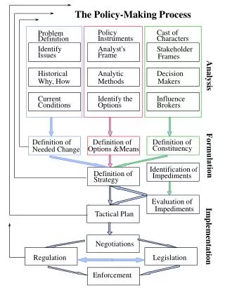
Implementation • Preparing for the sampling event • Sample submission to the laboratory • Laboratory analysis and reporting • Data formats preparation • Data format verification • Uploading data into GeoTracker
GeoTracker Set-up Tasks • Obtain Password • Claim Facilities • Establish Facility Security • Obtain Global IDs • Load Field Point Names
GeoTracker Security Provides Access to facilities RP has claimed AGENCY Provides Access to Consultant Accesses Facility to Upload Data CONSULT LAB May Access GeoTracker to Check Data
SWRCB GeoTracker Http://geotracker.swrcb.ca.gov
Responsible Party GeoTracker Set-upTasks PASSWORD FACILITY REQUEST AGENCY
Consultant GeoTracker Set-upTasks PASSWORD LOGIN CONSULT FACILITY REQUEST DENY CONSULT MONITORING REQUEST GLOBAL IDS CONSULT
Consultant GeoTracker Set-upTasks (cont.) ASSIGN FLD PT CONSULT UPLOAD FLD PT CONSULT
Consultant Analytical Data Tasks REPORT2 CONSULT LAB REPORT1REPLACE EDCC LAB EDCC APPEND REPORT1 CONSULT
Consultant Analytical Data Tasks (cont.) CONSULT EDF UPLOAD CONFIRMATION CONSULT REPORT SUBMITTAL AGENCY
Consultant Field Data Tasks CONSULT CONSULT CONSULT CONSULT
Consultant Survey Tasks CONSULT CONSULT CONSULT CONSULT CONSULT CONSULT
Help Desk • Support for parties generating or using EDF deliverables • COELT, EDCC, and DataStream Free software technical support • New valid value code requests and valid value list updates • Automatically receive updated documentation and valid values
Tutorials • Step-by-step guide through software functionality • Provides practice exercises • Includes sample data for use with the software • Supplements for beginning to advanced users
geotrackerhelp@ecointeractive.com (800)-506-9118or edfhelpdesk@arsenaultlegg.com (800)-506-3887 8am to 6pm PST To Contact Us
Part 2 - The Details • SURVEY_XYZ format content • EDF 1.2i format content • Advanced format concepts
Location Information V V Valid Value Example V
Site Map • Site Map