Tsunamis
Tsunamis. BANDA ACEH, INDONESIA: June 23, 2004 A satellite image of the waterfront area of Aceh province's capital city before the tsunami. BANDA ACEH, INDONESIA: December 28, 2004 An image taken after the tsunami shows destroyed housing and the shoreline nearly wiped out.


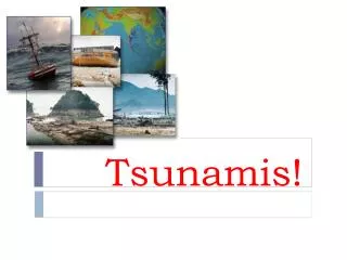
Tsunamis
E N D
Presentation Transcript
BANDA ACEH, INDONESIA: June 23, 2004 A satellite image of the waterfront area of Aceh province's capital city before the tsunami.
BANDA ACEH, INDONESIA: December 28, 2004 An image taken after the tsunami shows destroyed housing and the shoreline nearly wiped out.
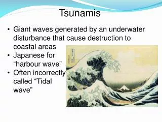
What is a Tsunami? • When mass movement, such as an earthquake or landslide, suddenly displaces a large amount of water from its equilibrium state a disastrous wave called a tsunami can form. • Tsunami literally translates from Japanese to “harbor wave” but are often call tidal waves because small, distant-source tsunamis resemble tidal surges.
Tsunami Sources • Earthquakes (e.g. Sumatra, 2004: >200,000 people killed; Papa New Guinea, 1998: ~3,000 people killed) • Volcanic eruptions (e.g. Krakatoa, 1883: tsunamis killed 30,000 people; Santorini, 2002). • Mass Movement (e.g. Alaska, 1958: waves up to 518 m high formed in Lituya Bay). • Extraterrestrial Impacts - large impacts have the potential to create enormous tsunamis.
Tsunami Earthquake Sources • Earthquakes that suddenly uplift or down-drop the sea floor generate tsunamis. • Generally such surface deformation is largest for reverse and normal faulting earthquakes, and small for transform faulting events thus the potential for tsunamis is lower for strike slip faults (e.g. the Balleny earthquake 1998 did not generate a tsunami). In general tsunami are generated by reversal faults.
Tsunami Genesis • Tsunamis are caused by events that drastically and suddenly shift a large volume of water. From Plummer McGeary Carlson
Tsunami Earthquakes • Some earthquakes have generated very large tsunamis for their “size”. These events are called tsunami earthquakes. • Analysis of seismograms from these events suggest that they are the result of low-frequency seismic energy. • These earthquakes present a problem for tsunami warning systems
Tsunami Earthquakes • One way to identify these events is to compare Ms to Mw • Ms ~ 20 seconds period • Mw ~ 100-200 seconds period • Since the signals are enriched in long periods the magnitude is unusually larger than the Ms estimate.
An earthquake with a big vertical component is more “tsunamogenic” than a purely horizontal event.“Slow” events with a long duration are also sources of larger tsunamis Standard Earthquake M~7.0 From E. Okal Slow-source Tsunami Earthquake mb ~5.8, MS ~7.2, MW~7.7
Describing Ocean Waves • Ocean waves are deformations of the sea surface. • Wavelength: distance between crests (l) • Wave height: vertical distance between crest and trough • Period: time between 2 successive crests to pass (T)
Describing Ocean Waves • The deformation propagates with the wave speed while on average water remains in the same position (the water does not pile up on the beach). • Water moves in the propagation direction at the crest while moving in the opposite direction at the through. • Water of a deep-water wave moves in a circular orbit on a circle which diameter is decreasing downward. The motion become negligible at a depth of ~ half wavelength.
Describing Ocean Waves • Energy moves in the propagation direction. • Most ocean waves are produced by wind bringing the energy from the wind offshore toward the coast. • The rate at which a wave loses its energy is inversely related to its wavelength. Long-wavelength waves can travel further.
Describing Ocean Waves • Deep water waves are surface waves. • Deep Water: the water depth where a wave passing overhead is not discernable at the sea bed. • Deep Water Waves: the wavelength is < 1/2 Water depth (D)
Describing Ocean Waves • Wind Waves: T~ 10-20s l~10-600m • Deep Water Velocity: v=l/T (v~1-30m/s) • The speed of deep water waves depends on wavelength, deep water waves are dispersive. • Shallow Water Velocity:
Describing Ocean Waves • Shallow Water Velocity: • The shallow water velocity does not depend on wavelength. Shallow water waves do not show dispersion. • As the wave approaches shallow water the shape of the motion becomes more elliptical and the velocity slows down. To conserve energy the wave rises higher.
Describing Ocean Waves • Tsunami Wave: T~3600 s l~800 km • Since the ocean has an average depth of 5 km it is always a shallow water wave, the velocity is increasing with ocean depth. (friction with the bottom lower) • Typical tsunami wave velocity (water depth 5000m) v~220 m/s = 792 km/hr (cruise velocity Jumbo 747 ~800km/hr)
Describing Ocean Waves • Tsunami Wave: T~3600 s l~800 km • Since the long-wavelength waves lose less energy a tsunami can travel transoceanic distances with only limited energy loss. • In the deep ocean the amplitude of a tsunami is a few cm to few dm on a very long wavelength: it is not felt aboard a ship or seen from air in open ocean (but can be measured by buoy or satellite altimeter). • When a tsunami approaches the shoreline the velocity decreases (D diminish) and in order to conserve energy (proportional to v and H) the amplitude increases.
An Example • Tsunami Wave Example: Sumatra 2004 • How long does it take to get to Sri Lanka? Distance ~1600 km Water Depth ~4000 m T= 2000/713=2.2 hr
An Example • Tsunami Wave Example: Sumatra 2004 • How long to get to Thailand? Distance ~500 km Water Depth ~1500 m T= 500/430=1.1 hr
An Example • Tsunami Wave Example: Sumatra 2004 • “Correct” numerical model using observed source and high definition bathymetry of the front propagation Courtesy: K. Satake, unpublished
An Example • Tsunami Wave Example: Sumatra 2004 • How high is the wave? 2 1 1 NOAA
Describing Tsunamis • Tsunami wave height is the height of the wave at the shore. • Tsunami run-up height is the maximum height that the wave reaches on land.
Tsunami Locations • Large subduction zones produce the most tsunamis. The Pacific, rimmed with subduction zones, has the most tsunamis. • Pacific ~ 80% • Atlantic ~ 10% • Elsewhere ~ 10%
Tsunami Propagation • Tsunamis are most devastating near the earthquake. They are larger and strike the region soon after the earthquake. • They also travel across entire oceans and cause damage and death thousands of miles from the earthquake.
Local Tsunami Damage • Damage close to the tsunami is usually more devastating. • Even small events can generate locally high waves. (For example in a bay the waves can be focused and increase their amplitude, a landslide triggered by an earthquake in a fiord in Alaska in 1958 created waves with a run-up up to 518 m high). • The warning time can be dramatically short.
Wave diffraction • Waves that pass from a media where they move fast to a media where they move more slowly, are refracted, and waves that move around obstacles, are diffracted. This can highly influence the local damages resulting from the waves. Bascom, 1964 86 feet = 26 m
Tsunami Warning • Because tsunamis travel relatively slowly, we have a chance to warn distant regions of potential tsunamis. • These efforts provide strong arguments for real-time earthquake monitoring. • Alerts are issued routinely by cooperating governments. • Check out: • http://wcatwc.gov/
Tsunami Warning • As soon as an earthquake of magnitude >6.5 is located in the sea the alarm start. • Using computer simulations and maps like the one in the following slide scientists forecast the time of arrival in different locations.
Tsunami Travel Times (Hawaii) From Merritts et al., 1998
Tsunami Warning • As soon as an earthquake of magnitude >6.5 is located in the sea the alarm start. • Using computer simulations and maps like the one in the following slide scientists forecast the time of arrival in different locations. • The use of Buoy and tide gauges help to verify the effective presence of a tsunami, the alarm is given.
Tsunami Warning • As soon as an earthquake of magnitude >6.5 is located in the sea the alarm start. • Using computer simulations and maps like the one in the following slide scientists forecast the time of arrival in different locations. • The use of Buoy and tide gauges help to verify the effective presence of a tsunami, the alarm is given. • Once that the alarm is given is necessary that the local communities have emergency plans, that they receive the messages, and that the population knows what to do
Sumatra Tsunami 2004 A emergency reaction example (thanks to Benz, USGS)
Propagation, Response and Warning Times for the M9.0 Sumatra EQ 100 Northern Sumatra People are sensing severe shaking NEIC No information regarding earthquake PTWC No information regarding earthquake and/or tsunami 1 minutes after OT P S 0 0 90 90 100
Propagation, Response and Warning Times for the M9.0 Sumatra EQ Northern Sumatra Significant structural damage in Banda Aceh Tsunami inundation along the Sumatran coast EQ is widely felt throughout the region NEIC Short period alarm on eight stations in the region PTWC Short period alarm on western Pacific stations 10 minutes after OT P S Short-period alarm stations 90
Propagation, Response and Warning Times for the M9.0 Sumatra EQ Northern Sumatra Tsunami inundation spreads further along the Sumatran coast NEIC Short period alarm on sixteen stations In the region Mb6.2, Mwp8.2 earthquake located off the north coast of Sumatra Pager notification to duty seismologists and others at NEIC PTWC Mwp8.2 earthquake located off the north coast of Sumatra No tsunami advisor for the Pacific Ocean 12 minutes after OT P S 0 90
Propagation, Response and Warning Times for the M9.0 Sumatra EQ Northern Sumatra Tsunami inundation spreads further along the Sumatran coast and reaches the Nicobar Islands NEIC First automatic location released at NEIC Pager notification to about 10 people in the USGS PTWC Confers with NEIC on the location and magnitude of the Earthquake Release Tsunami Information Bulletin 16 minutes after OT P S
01:14 WC&ATWC Tsunami Information Bulletin Location 3.4 N, 95.7 E BASED ON LOCATION AND MAGNITUDE THE EARTHQUAKE WAS NOT SUFFICIENT TO GENERATE A TSUNAMI DAMAGING TO CALIFORNIA - OREGON - WASHINGTON - BRITISH COLUMBIA OR ALASKA. SOME AREAS MAY EXPERIENCE SMALL SEA LEVEL CHANGES. IN AREAS OF INTENSE SHAKING LOCALLY GENERATED TSUNAMIS CAN BE TRIGGERED BY SLUMPING. THE PACIFIC TSUNAMI WARNING CENTER WILL ISSUE TSUNAMI BULLETINS FOR HAWAII AND OTHER AREAS OF THE PACIFIC.
30 minutes after OT M5.5
34 minutes after OT M6.1 M5.5
39 minutes after OT M6.0 M6.1 M5.5
43 minutes after OT M5.5 M6.0 M6.1 M5.5
Propagation, Response and Warning Times for the M9.0 Sumatra EQ Northern Sumatra Tsunami is passing thru the Nicobar Islands NEIC Automatic Ms magnitude is calculated (Ms8.5) Pager notification to about 30 people in the USGS Aftershocks suggest Ms8.5 is too low PTWC Confers with NEIC on the location and magnitude of the earthquake Notifies US Military on Diego Garcia on the possibility of an approaching tsunami 44 minutes after OT 0 90