Download
1 / 6
60 likes | 242 Vues
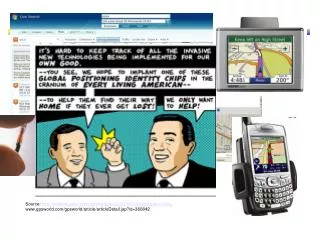
Source: http://archive.salon.com/comics/tomo/2001/07/09/tomo/index.html , www.gpsworld.com/gpsworld/article/articleDetail.jsp?id=360842. Shashi Shekhar Mcknight Distinguished University Professor. Contact Info : www.cs.umn.edu/ ~shekhar , www.spatial.cs.umn.edu

E N D
Source: http://archive.salon.com/comics/tomo/2001/07/09/tomo/index.html, www.gpsworld.com/gpsworld/article/articleDetail.jsp?id=360842
Shashi ShekharMcknight Distinguished University Professor Contact Info: www.cs.umn.edu/ ~shekhar , www.spatial.cs.umn.edu Area: Spatial Databases, Spatial Data Mining, Geographic Info. Systems Courses: Csci 8715: Spatial Databases, Csci 4707: Database I (Fall 2008) Projects: NSF: III-CXT: Spatio-temporal Graph Databases for Transportation Science NSF: IGERT: Non-equilibrium Dynamics Across Space and Time NSF: CRI:IAD Infrastructure for Research in Spatio-Temporal and Context-Aware Systems and Applications USDOD: Spatio-Temporal Pattern Mining for Multi-Juris. Multi-Temporal Activity Datasets USDOJ: Spatial Database Research for Mapping and Analysis for Public Safety USDOD: Modeling and Mining Spatio-temporal Data UM: OVPR: Minnesota Futures: Exploring Spatio-temporal Future of Geo-Informatics
Shortest Paths Storing graphs in disk blocks Evacutation Route Planning only in old plan Only in new plan In both plans Parallelize Range Queries Spatial Databases: Representative Projects
Location prediction: nesting sites Spatial outliers: sensor (#9) on I-35 Nest locations Distance to open water Vegetation durability Water depth Co-location Patterns Tele connections Spatial Data Mining : Representative Projects
Spatio-Temporal (ST) Questions • How do we conceptualize spatio-temporal (ST) worlds? • How do we measure ST concepts, recognize them in (remotely) sensed information or in the field, and identify their accuracy and quality? • How do we represent ST concepts with incomplete/ uncertain information, with alternative data models, and possibly with multiple representations for the same data, in digital environments? • How do we store, access, and transform ST concepts, facilitating data sharing, data transfer, and data archiving, while ensuring minimum information loss? • How do we explain ST phenomena through the application of appropriate methods of forward or inverse models of physical and human processes? • How do we visualize ST concepts on a variety of media such as maps on electronic displays or animated displays ? • How do we use ST concepts to think about spatio-temporal phenomena, and to seek explanations for spatio-temporal patterns and phenomena? • Source: Adaptation from NCGIA proposal to NSF by Goodchild et al.