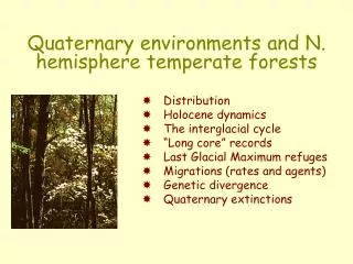
Quaternary Environments Non-Marine Geological Evidence
Quaternary Environments Non-Marine Geological Evidence. Geological Studies. Virtually all continental sedimentary deposits convey a paleoclimatic signal Aeolian Glacial Lacustrine Fluvial Deposits. Loess. Wind blown silt Quartz, Feldspars, and Mica

Quaternary Environments Non-Marine Geological Evidence
E N D
Presentation Transcript
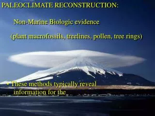
Geological Studies • Virtually all continental sedimentary deposits convey a paleoclimatic signal • Aeolian • Glacial • Lacustrine • Fluvial Deposits
Loess • Wind blown silt • Quartz, Feldspars, and Mica • Material originates from glacial outwash, braided stream deposits, or desert conditions
Loess Deposits Around the World Christopherson. 2004. Elemental Geosystems 4th Edition. Prentice Hall Publisher.
Christopherson. 2004. Elemental Geosystems 4th Edition. Prentice Hall Publisher.
Chinese Loess Chronology • North Central China (southeast of the Gobi Desert) • 300m thick • Alternating sequences of loess and intervening paleosols • Baoji Type section • 37 soils and loess deposits
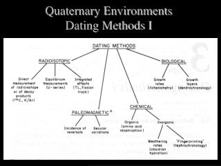
Dating of Loess • Relative Dating of the Loess-Paleosol Sections • Aminostratigraphy on snails in the deposit • Thermoluminescence over the last glacial cycle • Paleomagnetism for the Quaterary (dated with K/Ar)
Magnetic stratigraphy of the loess-paleosol section at baoji, loess plateau, north central China
Composite marine oxygen record with the proposed correlation to the loess-paleosol sequence
Grain size variations from the Baoji type section compared to Milankovich cycles (obliquity and eccentricity)
Periglacial Features • Disturbed ground due to extremely low temperature conditions • Provide information on periods of low temperature • Provide information on areas close to the ice sheet margins for which there are few other sources of proxy paleoclimate data
Problems with Periglacial Features • Direct dating of the features is difficult. Usually only get bounding dates. • Indicate a maximum temperature limit only • Discontinuous record
Periglacial Features • Continuous permafrost • Fossil ice wedges – Winter temperatures of -12 to -20°C • Discontinuous permafrost • Pingos – Max annual temperature of -2°C • Intense seasonally frozen ground • Sorted polygons • Stone stripes • Periglacial involutions
Ice Wedge http://www.radio.cbc.ca/programs/quirks/archives/02-03/beringia/beringia.html
Snowlines and Glaciation Thresholds • Snowline • Limit between season snow accumulation and permanent snow • Assumed to be at the 0°C isotherm • Equilibrium Line Altitude (ELA) • Limit between accumulation and ablation zones • 70% of total area of glacier • Glaciation level • Lowest limit at which permanent ice field can develop
Problems of Snowline Estimates • Present day analogs have not been well studied • Atmospheric lapse rates in mountainous regions are not well documented • Paleosnowline reconstructions are often based on features of varying age
Glacial Evidence • Destruction of previous evidence • Down-wasting as opposed to shortening • Lag in timing at glacial front • Glacier length • Basal slope • Ice thickness • Temperature • Overall geometry • Dating problems • 14C • Lichenometry • Cosmogenic Isotopes
Glacial History • Holocene Glacier Fluctuations • Most detailed record • Reduction of glacial extent in the mid-Holocene (termed the Altithermal by Antevs) • Little Ice Age • Best recorded in western Europe • Historical records, Paintings, and Sketches • Dendrochronological evidence
Principle Episodes of Glaciation US Mountain Glaciers US Laurentide Canadian Laurentide Poland and Western Former Soviet Union European Alps Southern Alps Antarctica
Lake-Level Fluctuation • Record changes in temperature and precipitation through time • Evidence • Abandoned wave-cut shorelines and beach deposits • Percehed deltas • Exposed lucustrine sediments • Paleosols in a lake core record • Lake Cores • Stratigraphy • Geochemistry • Macrofossil evidence • Microfossil evidence • Sedimentary facies
Lake Basins • Endoreic regions • Land-locked basins with loss through evaporation • Areic regions • Lack of surface drainage • Arid environments • Pluvials • Periods of high lake levels