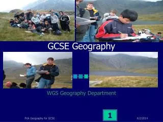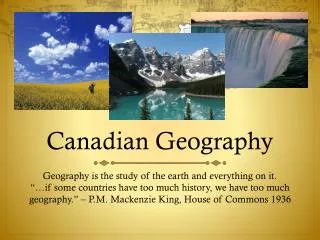
What is Geography?
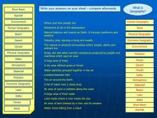
What is Geography?. Write your answers on your sheet – compare afterwards. River Basin. Rainfall. Environment. Human Geography. Where and how people live Movement of air in the atmosphere Natural features and events on Earth. It includes landforms and weather

What is Geography?
E N D
Presentation Transcript
What is Geography? Write your answers on your sheet – compare afterwards River Basin Rainfall Environment Human Geography Where and how people live Movement of air in the atmosphere Natural features and events on Earth. It includes landforms and weather Industry, jobs, earning a living and wealth The natural or physical surrounding where people, plants and animals live Noise, dirt and other harmful substances produced by people and machines which spoil an area A large area of trees A dry area without grass or forest Water particles grouped together in the air Lowland between hills The air around the Earth A fall of water over a steep drop An area of sand or pebbles along the coast A large area of fresh water Land made where a river meets the sea An area of land drained by a river and its streams Water drops falling from a cloud Human Geography Wind Beach Physical Geography Desert Economic Geography Clouds Environment Physical Geography Pollution Valley Forest Atmosphere Desert Clouds Waterfall Valley Pollution Atmosphere Economic Geography Waterfall Lake Beach Lake Delta Delta Forest River Basin Wind Rainfall
Map Work Write your answers in the spaces on the right Terms Meanings / definitions Answers Symbols A book of maps Ordnance Survey To cut through the land and look at it from the side Map A method of giving direction using north and south Height The official government organisation that produces UK maps Contour The link between the distance on a map and its real distance Layer Colouring A list of signs and symbols with an explanation of their meaning Key A line drawn on a map to join places at the same height above sea level Grid Square A drawing showing part of the Earth’s surface from above Grid Reference A simple drawing or sign to give information on a map Landforms How high or low a place is measured in metres above sea level Relief A method of showing height on a map by using colours Compass points Six figures that locate a point on a map Contour interval The difference in height between contours on a map Spot Height Four figures that represent a 1 km² on a map Scale Natural features formed by rivers, the sea, ice and volcanoes Cross - Section Shape of the land’s surface and its height above sea level Atlas A point on a map with a number giving its height