HATCH, NM, Background Information
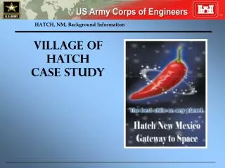
HATCH, NM, Background Information. Village of Hatch Case Study. Regional Setting. The study area is located in Hatch, NM. The historical problems of record are associated with flooding and the related consequences.

HATCH, NM, Background Information
E N D
Presentation Transcript
HATCH, NM, Background Information Village of Hatch Case Study
Regional Setting The study area is located in Hatch, NM. The historical problems of record are associated with flooding and the related consequences. Structures and roadways have been impacted by flows from the surrounding mountains, significantly flooding the community several times in the past 10-years. Flooding originates from two sources-Spring Canyon and Placitas Arroyo. Initial investigations determined that there is a likely Federal interest in a project to manage the flood risk in the community. Your instructions are to determine the planning objectives, measures to meet the objective(s),, formulation strategies to combine the measures and alternative plan(s) .
Flood History: • The Village of Hatch experienced significant Flood events in 1988, 2002 and 2006. • FEMA and Corps’ analyses determined Spring Canyon is a flood threat to the Village of Hatch. • The entire Village of Hatch lies within a “100-year” Floodplain
Flood Potential: • Spring Canyon channel capacity is 1,300 CFS (100-year flow is-1% chance event-estimated at 2,600 CFS) • Estimated average annualized flood damages of $1.1 million from Spring Canyon
Existing and Likely Future Without-Project Conditions • Physical Setting • 7.2 square mile watershed draining from the south flowing north into the Rio Grande • An upstream detention structure controls 5.4 square miles of the basin • Elevation in the drainage drops from 6,000 ft to 4,030 ft • Flooding events in 1988, 1992 and 2006 left three feet of water in the street • More than 50% of buildings are at least 50-years old • The riparian ecosystem along the channels are degraded and subject to land use modifications • 70% of households median income is at or below the US poverty level
Existing and Likely Future Without-Project Conditions • Physical Setting (continued) • Once flows enter the village there is no clear drainage pathway into the Rio Grande; floodwaters remain in place until evaporated. • The Village storm drainage system is perhaps sized for a 5-year event. Lack of O&M (no money to pay for O&M) and sediment renders the system largely inoperable during larger events.
Existing and Likely Future Without-Project Conditions • Social and Economic Conditions • 2004 population of 1,661 • 284 single residential structures within the 1% event floodplain • 87 commercial structures within the 1% event floodplain • 27 public structures within the 1% event floodplain • 1 apartment within the 1% event floodplain
Existing and Likely Future Without-Project Conditions • Social and Economic Conditions (continued) • Median income for a household: $16,100 • Many seasonal inhabitants • “Chile capitol of the world” • 72 homes with flood insurance
More Information • Non-damaging Channel Capacity • 1,300 cubic feet per second (cfs) • 100-year flow • 2,600 cfs • Flood Damages • Estimated average annualized flood damages $1.1 Mil • Federal Disaster Area in 2006