T he Man-In-The-Loop (MITL) Nowcast Demonstration:
290 likes | 531 Vues
T he Man-In-The-Loop (MITL) Nowcast Demonstration: Forecaster Input into a Thunderstorm Nowcasting System. R. Roberts, T. Saxen, C. Mueller, E. Nelson, A. Crook, H. Cai, J. Pinto,

T he Man-In-The-Loop (MITL) Nowcast Demonstration:
E N D
Presentation Transcript
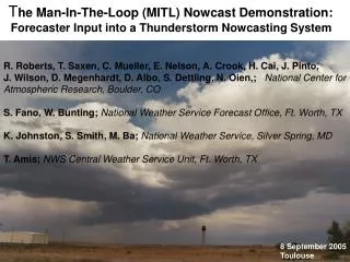
The Man-In-The-Loop (MITL) Nowcast Demonstration: Forecaster Input into a Thunderstorm Nowcasting System R. Roberts, T. Saxen, C. Mueller, E. Nelson, A. Crook, H. Cai, J. Pinto, J. Wilson, D. Megenhardt, D. Albo, S. Dettling, N. Oien,; National Center for Atmospheric Research, Boulder, CO S. Fano, W. Bunting; National Weather Service Forecast Office, Ft. Worth, TX K. Johnston, S. Smith, M. Ba; National Weather Service, Silver Spring, MD T. Amis; NWS Central Weather Service Unit, Ft. Worth, TX 8 September 2005 Toulouse
What are the goals of the MITL demonstration? • To determine the role of the forecaster in nowcasting • To demonstrate the added value of forecaster input into • automated aviation-related thunderstorm nowcast • products
National Weather Service Forecast Office Ft. Worth, Texas End User Aviation Community Public MITL Demonstration NCAR Auto-nowcaster System NWS Forecaster March 2005 – March 2007
NCAR Auto-Nowcaster (ANC) System Storm Initiation nowcasts Extrapolated nowcasts Extrapolates, grows, dissipates and initiates storms. How does it do this? 1 hour forecast Verification
Combined Likelihood Field for Storm Initiation 60 min Storm Initiation Likelihood Field Blue Regions - Little chance of storm development Green Regions - Moderate likelihood for thunderstorms Red Regions - Areas of forecast storm initiation • Environmental conditions (Numerical Model) • Frontal forcing (θe gradients, vorticity, convergence) • CAPE/CIN Layered instability • CAPE (max between 900 and 700 mb) • Relative humidity (average from 875-to-725 mb) • Boundary-layer • Magnitude of convergence and vertical shear • Colliding boundaries • Vertical velocity along boundary • Boundary-relative steering flow • New storm development along boundary • Clouds • Clear sky or cumulus clouds • Cloud growth observed with cloud top cooling rate
National Weather Service Forecast Office Ft. Worth, Texas End User Aviation Community Public MITL Demonstration NCAR Auto-nowcaster System NWS Forecaster? March 2005 – March 2007
FAA RCWF Domain June 12, 2003 A single piece of observational data alone is not sufficient to automatically detect surface convergence boundaries on all scales, from a cold front down to gust fronts and lake breezes. Forecasters can fill this role.
60 min 0 min Entering convergence features locations requires only a few minutes of a forecaster’s time…
Thunderstorm Initiation Likelihood Field Thunderstorm Initiation Likelihood Field So have added a new tool: Human-drawn polygon tool to increase or decrease forecast interest in an area Tool was used at the WFO to bump up interest in this area However, not all boundaries are created equal…..
Ft. Worth WFO 25 April 2005 Forecast: 1831 Z Radar Image: 1831 Z
Ft. Worth WFO 25 April 2005 Forecast: 1842 Z Radar Image: 1842 Z
Ft. Worth WFO 25 April 2005 Forecast: 1854 Z Radar Image: 1854 Z
Ft. Worth WFO 25 April 2005 Forecast: 1905 Z Radar Image: 1905 Z
Ft. Worth WFO 25 April 2005 Forecast: 1831 Z Radar Image: 1831 Z Forecast: 1831 Z Radar Image: 1929 Z
Ft. Worth WFO 25 April 2005 Forecast: 1842 Z Radar Image: 1842 Z Forecast: 1842 Z Radar Image: 1941 Z
Ft. Worth WFO 25 April 2005 Forecast: 1854 Z Radar Image: 1854 Z Forecast: 1854 Z Radar Image: 1952 Z
Ft. Worth WFO 25 April 2005 Forecast: 1905 Z Radar Image: 1905 Z Forecast: 1905 Z Radar Image: 2003 Z
Ft. Worth WFO 25 April 2005 Forecast: 1917 Z Radar Image: 1917 Z Forecast: 1917 Z Radar Image: 2020 Z
Ft. Worth WFO 25 April 2005 Forecast: 1929 Z Radar Image: 1934 Z Forecast: 1929 Z Radar Image: 2030 Z
Ft. Worth WFO 25 April 2005 Forecast: 1941 Z Radar Image: 1940 Z Forecast: 1941 Z Radar Image: 2042 Z
Ft. Worth WFO 25 April 2005 Forecast: 1952 Z Radar Image: 1951 Z Forecast: 1952 Z Radar Image: 2054 Z
Ft. Worth WFO 25 April 2005 Forecast: 2003 Z Radar Image: 2003 Z Forecast: 2003 Z Radar Image: 2107 Z
Ft. Worth WFO 25 April 2005 Forecast: 2020 Z Radar Image: 2020 Z Forecast: 2020 Z Radar Image: 2119 Z
Ft. Worth WFO 25 April 2005 Forecast: 2030 Z Radar Image: 2030 Z Forecast: 2030 Z Radar Image: 2129 Z
End End End 60 min Nowcast Field
Forecasters’ Qualitative Assessment of Nowcasts For 43 events Poor Reasonable Good Very Good Forecast Quality: Good No initiation was forecasted on boundary 1 and none occurred. Boundary 3 is showing initiation just west of Young and Stephens Counties. Forecast Quality: Poor Slow response on Boundary 6. Cells beginning to initiate in Kaufman County but no initiation shown by Auto-nowcaster.
AREA WEATHER UPDATE NATIONAL WEATHER SERVICE FORT WORTH TX 310 PM CDT SUN APR 10 2005 > WARNING DECISION UPDATE FOR NORTH TEXAS MESOANALYSIS PROGRAMS SHOW 1000-1500 J/KG CAPE ALONG AND JUST AHEAD OF DRYLINE. THUS...CU/DEVELOPING STORMS ALONG/E OF DRYLINE SHOULD CONTINUE TO INTENSIFY. STORM INITIATION TOOL ALSO SUGGESTS HIGH POSSIBILITY OF DEVELOPMENT FARTHER SW...OVER CORYELL/LAMPASAS COUNTY AREA. DEEP-LAYER SHEAR MORE THAN SUFFICIENT FOR ORGANIZED STORMS AND AT LEAST MID-LEVEL MESOS. AS STORMS EVOLVE INTO THE EVENING...A MORE LINEAR MODE IS EXPECTED.
Summary • Initial results of the forecaster-computer mix are very encouraging • Based on forecaster feedback modifications have been made to the ANC system in real-time and more will be added this winter • Quantitative and qualitative evaluations of performance will be done at the end of the first year -includes working closely with B. Brown’s group to use their new object-oriented verification techniques • Continue training forecasters on the ANC system and working closely with the CWSU to refine the nowcast products for the aviation community
