Emergency Feedlot Data Program: Update
The Emergency Feedlot Data Program update addresses critical agricultural threats such as disease, natural disasters, power failures, and more. Current systems for managing information on animal agriculture facilities and feedlots face challenges of accessibility, understanding, and spatial management. This proposal outlines steps to enhance information sharing among local and state agencies, empowering counties to manage data effectively. By adopting new standards, protocols, and GIS technologies, we aim to increase response speed, confidence, and the usability of vital information during emergencies.

Emergency Feedlot Data Program: Update
E N D
Presentation Transcript
Emergency Feedlot Data Program: Update Where are all the chickens?!?!?
Many Agricultural Threats • Disease • Natural Disasters • Weather • Fire • Other • Power Failure • Crime
Local Response Infrastructure Information People Equipment Funds State Federal
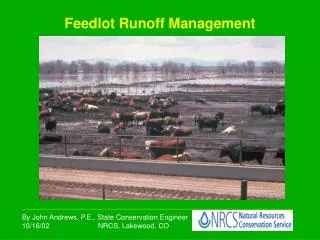
Problem Organizations that carry information on animal agriculture facilities and feedlots: • MDA • BAH • PCA / BWSR • Counties - Not managed spatially - Not easily understood - Not easily accessible
Not Managed Spatially • Requires intermediate steps • Harder to verify & correct RESULT: Slower response, Lower confidence
Not Easily Understood • Too many attribute fields • Too many codes • Too many disparate business needs & rules • Not enough documentation RESULT: Slower response
Not Easily Accessible • Several Data Custodians • Statutory Protections • Perceived & Real Threats to Privacy • No Protocols in Place RESULT: Slower response
Proposal Update • Responders focus on the area affected with confidence • Information is usable and easy to understand • Information is accessed easily and quickly • Empower counties to manage information spatially • Set standards for data used by emergency responders • Design emergency information sharing protocols between local and state agencies
Spatially Managed? • Grants funds available, in exchange for commitment to new data standards & protocols for four years • Technical assistance and training available for: • Use of basic GIS software • “Geocoding” of address lists • Geospatial data management • Designing information conversion processes
Delegated Counties County Participants • Blue Earth • Brown • Carver • Cottonwood • Douglas • Le Sueur • Meeker • Nicollet • Norman • Polk (East) • Polk (West) • Rice • Rock • Stearns • Wabasha • Waseca • Winona
PCA & MDA Easily Understood? Convert disparate source data to meet new standards, then fuse together
MDAFTP Compilation ALWAYS ON DisasterLAN More accessible?
Next Steps • Outreach: connect technology to emergency response, agriculture • Assess capabilities; train as necessary; target resources to the highest need • Conduct test uploads and mock emergencies
Discussion and Input Mike Dolbow: (651) 201-6497 mike.dolbow@state.mn.us Ted Radintz: (651) 201-6541 ted.radintz@state.mn.us