Download
1 / 14
140 likes | 257 Vues
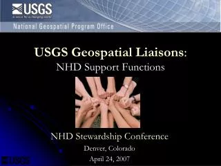
Evolution of Partnerships and the USGS Geospatial Liaison Network. Ingrid Landgraf October 3, 2012 2012 MAGIC State GIS Clearinghouse Summit. Northwest. Midwest. Northeast. Pacific. Southcentral Area. Rocky Mountain/ Southern Plains. Southeast. Alaska.

E N D
Evolution of Partnerships and the USGS Geospatial Liaison Network Ingrid Landgraf October 3, 2012 2012 MAGIC State GIS Clearinghouse Summit
Northwest Midwest Northeast Pacific Southcentral Area Rocky Mountain/ Southern Plains Southeast Alaska
National Geospatial Program Mission Data visualization • Organize, maintain, publish, and disseminate the geospatial baseline of the Nation’s topography through The National Map • Foster a general understanding of broad geographic patterns, trends, and conditions through The National Atlas of the United States of America® Data services Historic Map scans Online maps: US Topo
National Geospatial Program Strategic Direction Sharpen focus on our topographic mapping mission • High investment – layers that define topo mapping: Elevation - Improve data quality and resolution nationally, pursue a national enhanced elevation data initiative Hydrography and watershed boundaries - Work with stewards to maintain data, enhance NHD to support users’ modeling and business needs, improve user tools • Moderate investment - Geographic names: Fulfill the Public Law 80-242 requirements of the Board on Geographic Names • Maintenance investment - Imagery, transportation, boundaries, selected structures and land cover: For reference purposes, maintain coverage by obtaining data from other organizations and suppliers with a minimum investment
National Geospatial Program Strategic Direction • Emphasis on meeting user needs • Priority communities of use • Waterresources • Natural resources conservation • Geologic mapping • Natural hazards
Strategic Direction for Partnerships • Addition of user engagement activities at headquarters and in liaison network • Increase specialization • In user communities • In topographic mapping data themes • Focus partnerships and data acquisition • Focus partnerships in liaison network to elevation, NHD, and imagery • Address both topographic and ancillary themes at headquarters
Draft Liaison Specializations Partnerships and Coordination (Elevation, Imagery) • Coordinate data acquisition/ stewardship and inventory partnerships • Serve as technical expert for partners and users on 3DEP, LiDAR, IfSAR, urban area imagery, NAIP • Agreements Management NHD Engineer / Water Resources COU Liaison • Coordinate and support NHD stewardship and applications • Support users in applying NGP products and services to hydrologic applications, facilitate documentation of Water Resources user needs COU Liaison for Geologic Mapping, Hazards and Natural Resources Conservation • Support users in applying NGP products and services to COU-related applications, facilitate documentation of COU user needs
Need State Support • Flexibility as we work out the new structure • Your feedback on what’s working and what’s not • Help us to connect with the COU representatives in your state • Communication