Surface Water and Groundwater Interaction Modelling
360 likes | 824 Vues
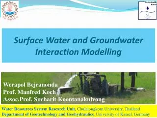
Surface Water and Groundwater Interaction Modelling. Werapol Bejranonda Prof. Manfred Koch Assoc.Prof. Sucharit Koontanakulvong. Water Resources System Research Unit , Chulalongkorn University, Thailand Department of Geotechnology and Geohydraulics , University of Kassel, Germany.

Surface Water and Groundwater Interaction Modelling
E N D
Presentation Transcript
Surface Water and Groundwater Interaction Modelling Werapol Bejranonda Prof. Manfred Koch Assoc.Prof. Sucharit Koontanakulvong Water Resources System Research Unit, Chulalongkorn University, Thailand Department of Geotechnology and Geohydraulics, University of Kassel, Germany
Contents • Introduction • Study Area • Application • Methodology • Modeling • Results
Nan river Yom river Study area Source: RID 3rd regional bureau Existing irrigation projects and its supplies by reservoirs
Study area : Plaichumpol Irrigation Project Division 1 Sukkhothai Nan river Division 2 Yom river Phitsanulok Thailand main irrigation canal Phichit Division 3 main irrigation canal
Overview of SW-GW interaction Rainfall Irrigation supply GW Pumping Surface water River/Canal Saturated Zone
Objectives study water use patterns and interaction between surface water and groundwaterdetermining the potential of conjunctive use focused on water use and allocation in an irrigation area from both canals and local shallow wells.
Data collection (SW-GW) 1 2 Groundwater Level Monitoring Existing monitoring well : 35 wells New-installed well: 2 wells (to investigatestream-groundwater interaction) Stream Stages Infiltration Test 10 points varied with soil types (to investigatesurface recharge)
50 m. 200 m. Canal Stage (at check gate) Infiltration Test Bed Materials Observed Wells Saturated Zone Over view of field data collection
Conceptual Model 40-100 m. Upper aquifer - Semi-confined Lower aquifer–Confined 200-300 m. Upper aquifer (Qfd and Qlt) Lower aquifer (Qht)
Calibration & Verification GW potential investigation Model calibration 1993 2005 2035 GW potential Investigation GW use variation obs. gw level during simulation Demand projection
GW ModelBoundariesand Sources/Sinks Head Source/Sink (Pond) Flow Boundaries River Source/Sink Head Boundaries
GW ModelBoundariesand Sources/Sinks Flow Boundaries River Sources Head Boundaries
GW table away from Main Irriagtation Cannal main irrigation canal distance form main irrigation canal (km)
Recharge 7.1 River-Aquifer interact. River-Aquifer interaction 1.6 1.3 Lateral outflow 103.6 Water balance analysis (SW-GW interaction) Unit :million m3/month Wet season GW pump 9.2 Lateral inflow Upper Aquifer(Δstorage = -34.6) 69.8 Leak to lower aquifers 0.004 Dry season Recharge 0.9 GW pump 13.2 Lateral inflow Lateral out flow Upper Aquifer(Δstorage = -3.3) 18.4 10.9 Leak from lower aquifers 0.001
Groundwater potential Sukkhothai Division 1 Nan river Yom river Division 2 Phitsanulok main irrigation canal Average conjunctive water useand their ratios during the dry season Phichit main irrigation canal Division 3
Annual groundwater-use • guideline for conjunctive-use planning in case of normal water situation at the Plaichumpol Irrigation Project river Irrigation canal groundwater use ratio (percentage of irrigation supply) non-irrigation 0 – 25 % 25 – 50 % 50 – 140 %
Computed groundwater level varied with season in 1997-2007 PCP-01 main irrigation canal PCP-12 Nan river PCP-19