Download

1 / 21
210 likes | 420 Vues
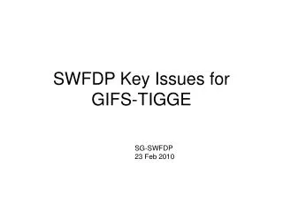
Current status of development of TIGGE products and support to SWFDP. 10 th THORPEX GIFS-TIGGE Working Group meeting Boulder, NCAR and NOAA/ESRL 25 – 27 June, 2012. KYOUDA Masayuki 1 , YAMAGUCHI Munehiko 2 , and MATSUEDA Mio 3 1: Japan Meteorological Agency (JMA)

E N D
Current status of development of TIGGE products and support to SWFDP 10th THORPEX GIFS-TIGGE Working Group meeting Boulder, NCAR and NOAA/ESRL 25 – 27 June, 2012 KYOUDA Masayuki1, YAMAGUCHI Munehiko2, and MATSUEDA Mio3 1: Japan Meteorological Agency (JMA) 2: Meteorological Research Institute of JMA (MRI/JMA) 3: University of Oxford and MRI/JMA
Contents • SWFDP in Southeast Asia • as aGIFS/TIGGE FDP • GIFS/TIGGE product for SWFDP provided from MRI/JMA • Tropical Cyclone (TC)–related product • High impact weather (HIW)-related product • Improvement on support to SWFDP • Provision of HIW-related product to SWFDP • Change of working area • For a near real-time basis 2
Target Severe Weather Events The following events are focused in order of decreasing priority and associated hazards such as flooding, landslides, high waves and swell: • tropical cyclone (both from the South China Sea and from the Bay of Bengal) track, intensity, structure changes and landfall process (wind and gust, rainfall and storm surge); • heavy rain triggered by tropical cyclones, SW and NE monsoon, troughs and ITCZ migration, and orography; • thunderstorms and hail associated with severe convection; • cold conditions and frost; • extreme hot and dry conditions associated with föhn effect.
SWFDP in SOUTHEAST ASIA • Participating Centres • Global Centres : CMA, JMA, and KMA • Regional Centres : Viet Nam (Regional Forecast Support Centre), RSMC Tokyo, RSMC New Delhi (tropical cyclone forecasting support), and HKO (training and technical support) • NMCs : Cambodia, Lao P.D.R., Thailand, and Viet Nam • Field phase • Period : One-year period from Summer 2012 to Summer 2013 • Target Severe Weather • Tropical cyclone both from the South China Sea and from the Bay of Bengal • Heavy rain The red-colored rectangle is the target domain for SWFDP-SeA.
NWP-TCTEF Project • A WWRP-RDP project “North Western Pacific Tropical Cyclone Ensemble Forecast Project (NWP-TCEFP) ” intends to build on the TIGGE concept and take advantage of the TIGGE CXML data provided by multiple organizations for improving tropical cyclone (TC) track forecast skill over the North western Pacific, starting from 2009, as a five-year project. • The objectives of the NWP-TCEFP Project are: • to explore and develop effective ways of obtaining and utilizing the track forecast data from TIGGE data providers to improve medium range forecast of TC track forecast • to develop software for a real time multi-model TC forecasting system from data transfer to verification • to evaluate the utility of multi-model forecasts of TC track predictions and provide recommendations on future multi-model ensemble systems and on future GIFS-RDPs
List of available products - TC track - Deterministic forecast Ensemble forecast Strike Probability Point Strike Probability
Testify GIFS Products for Operational Use NCEP JMA EMCWF MSC Meteorological Research Institute STI UKMO KMA • Feedback • Evaluation of usefulness in forecasting operation CMA Regional Centre Hanoi Multi-Centres Grand Ensemble GIFS Products Daily Severe Weather Forecasting Guidance National Met. Centres Cambodia Thailand Lao P.D.R. Vietnam
Progress to date 2010/04 The first release of the Web site for the Project 2010/10 Major update of the Web site 2010/10 WMO sent the letter to PRs of the Typhoon Committee Members on the Project and Web page 2010/11 Presentation of the Web site at the IWTC-6 in La Reunion 2011/08 Presentation of the Web site at the THORPEX GIFS/TIGGE WG meeting in Geneva 2011/12 TCS sent the questionnaire to the TC Members on the Web site 2012/01 TCS received the replies of the questionnaire from 13 TC Members Original source : Progressreport for NWP-TCEFP at ESCAP/WMO Typhoon Committee – 44th session, Hangzhou, China
Results of the questionnaire Original source : Progressreport for NWP-TCEFP at ESCAP/WMO Typhoon Committee – 44th session, Hangzhou, China
Specification of HIW-related TIGGE product http://tparc.mri-jma.go.jp/TIGGE/tigge_extreme_prob.html http://tparc.mri-jma.go.jp/TIGGE/tigge_SWFDP.html (for SWFDP regions) Updated everyday! (2-day delay) precipitation wind temperature thresholds for prob. forecasts Multi-centergrand ensemble 13 areas including 4 SWFDP areas Forecast time up to +15 days
Verification results of HIW-related TIGGE product Multi-center grand ensemble Multi-centre grand ensemble shows a better relationship between forecast and observed probabilities (isless overconfident) than single-centre ensembles.
Provision of HIW-related TIGGE product for SWFDP Data size: 2.5GB/day for ECMWF, JMA, NCEP and UKMO (prcp, t2m, u10m, and v10m on 1.25deg. grid) TIGGE portal: ECMWF Until Feb. 2012: got TIGGE data and made products at MRI Since Mar. 2012: get TIGGE data and make products at Oxford, and then transfer products to MRI web server Oxford Univ. MRI/JMA ECMWF more stable! Total time: 12.5 hrs Total time: 4.5 hrs Data transfer to MRI: 8hr Make products @MRI: 3.5hr Products transfer to MRI: 0hr Data transfer to Oxford: 1hr Make products @Oxford: 3hr Products transfer to MRI: 0.5hr
Change of working area • Presently, the TIGGE data transfer and the creation of all TIGGE products are conducted at the University of Oxford. • Details of the data transfer are as follows: • Data processing at ECMWF, an archieve centre, requires 60 minutes. • Data transfer from ECMWF to the University of Oxford requires 15 minutes. • It is because it takes quite a long time to get the TIGGE gridded data from ECMWF at MRI. • In the case of MRI operation, • Data processing at ECMWF requires 60 minutes. • Data transfer from ECMWF to MRI requires 7 HOURS. ? Geographical reason ? So hard to reduce the processing time anymore... • MRI intends to continue providing its TIGGE products widely.
For a near real-time basis • TIGGE was well established to provide a new world-wide service on distributing the operational NWP and EPS data. • especially on the assumption of data exchanging on a real time. • The THORPEX IPO should approve a near real-time TIGGE access for TIGGE product providers such as Met Office (potential) and MRI (current). • As well as UCAR and NCAR at a meningitis prediction pilot study in the Sahel region of Africa.