Coastal Landforms
Coastal Landforms. Mr Fehrenbach June 2014. Learning Objectives. Understand the importance of geology (rock type) on coastal landforms Use maps and diagrams to describe and explain different landform Produce annotated field sketches of different coastal landforms. Coastal Landforms.

Coastal Landforms
E N D
Presentation Transcript
Coastal Landforms Mr Fehrenbach June 2014
Learning Objectives • Understand the importance of geology (rock type) on coastal landforms • Use maps and diagrams to describe and explain different landform • Produce annotated field sketches of different coastal landforms
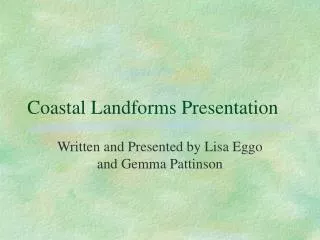
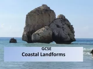
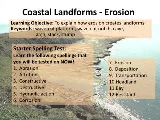
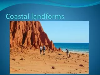
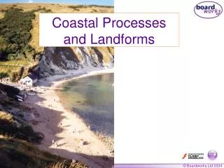
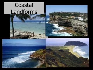
Coastal Landforms Which coastal landforms can you name? Headland and bay Cliff, Cave, Arch, Stacks, Stumps Wave cut platform
How does geology affect coastal landforms? Hard rock such as granite and limestone erode slowly, soft rock such as chalk, sandstone and clays erode quickly. Draw a simplified diagram to explain how a headland and bay might be formed. Before and After. On your diagram label the different rock types.
Wave-cut platform The waves attack the base of the cliff through the processes of abrasion, corrosion, hydraulic action and attrition. Over time the cliff will be undercut and a wave-cut notch is formed. Eventually the cliff becomes unstable and collapses. Further cliff retreat will form a wave-cut platform.
How is a wave-cut platform made? • Complete the Activity sheet given
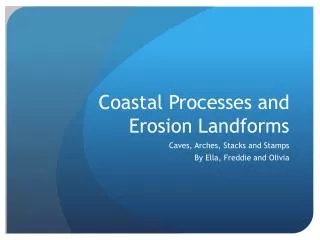
Caves, arches, stacks and stumps Match the image with the most appropriate label. A B C D 1 3 2 4 1. The waves erode FAULTS (cracks) in the headland. 2. The waves eventually erode through the headland to form an ARCH. 3. The arch becomes unsupported and collapses to form a STACK. 4. A STUMP is formed from the collapsed stack.
If these photos were taken of one headland over time, which of these landforms would be the first to be formed?
1 2 This is acave(‘Stair Hole’). This is anarch(‘Durdle Door’). 3 4 This is astack(Old Harry’s Rocks). These arestumps.
The sea is at work here Complete Activity Sheet Homework Bring to next lesson an A4 colour picture of a coastal landscape to draw next lesson. You will annotate all physical and human features and describe how it has been formed and influenced by mans activity. coastal landscapes - Google Search
How can we describe coastal landscapes? Read information Sheet. Complete Activities on plain A4. Draw sketch in a rectangle 18cm by 12cm. Give sketch a Title- Hurst Castle Spit, Hampshire Write description below sketch with reference to Activity 2 on sheet.
Producing annotated fieldsketch • Draw a rectangular frame on your piece of A4 20cm by 15cm. Locate your landscape. • Draw a pencil sketch to identify the main features of photograph • Mark on the key physical features such as Relief, Drainage and Vegetation • Mark on the key man made features such as Buildings, Roads, and Tourist Facilities etc. • Around the edge of your sketch write a description of your landform describing as many features and processes you can.