Coastal Landforms
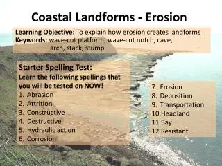
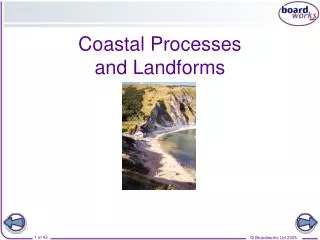
Coastal Landforms. Cliffs and wave cut platforms - Beaches Caves, arches, stacks and stumps Headlands and bays Spits Summary. Cliffs and wave cut platforms

Coastal Landforms
E N D
Presentation Transcript
Cliffs and wave cut platforms • - Beaches • Caves, arches, stacks and stumps • Headlands and bays • Spits • Summary
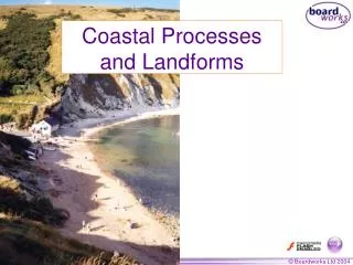
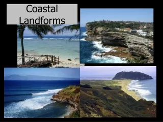
Cliffs and wave cut platforms Sea cliffs are the most common landform of coastal erosion. Cliffs begin to form when destructive waves attack the base of the rock face between the high and low water marks. Processes such as hydraulic action and corrasion undercut the base of the cliff to form a WAVE CUT NOTCH. The rock above hangs over the notch and with continued wave attack the notch begins to widen, until the overhangs weight becomes so great it collapses. The waves set about gradually removing all of the waste rock and then begin to attack the new cliff face again. The process continues again and again until eventually a WAVE CUT PLATFORM remains. A WAVE CUT PLATFORM is a gently sloping rocky area between the high and low water marks.
Beaches The beach is a gently sloping area of land between the high and low water marks. Beaches differ from place to place as result of the size of the fetch, human interference and material type. The most common beach materials are sand, shingle and pebbles. Sandy beaches are usually gently sloping but coarser materials such as large shingle allow steeper gradients to develop. Some of the material may be thrown up into steep ridges by storm waves. The materials from which a beach are formed are carried by longshore drift along the coast.
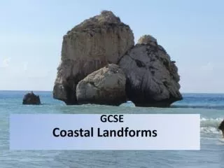
Caves, arches, stacks and stumps Waves often tend to find any weakness or crack in a rock and widen it bythe process of hydraulic action. This often results in the formation of caves on a headland. Once the cave has formed, the waves are able to enter and continue eroding back into the headland until they eventually break through to form an arch (for example Durdle Door in Dorset). In time, the base of the arch is attacked by the waves and this puts increasing pressure on the roof of the arch. If there is a weakness in the roof of the arch, it will collapse leaving a tall, isolated stack (for example Old Harry, Dorset coastline) The stack is the attacked at the base by the force of the waves and will eventually collapse to form a stump (for example Old Harry’s wife, Dorset coastline)
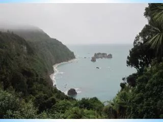
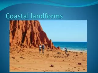
Headlands and bays Headlands and bays forms where a coastline if made up of alternating resistant (harder) and less resistant (softer) rock. At some points along the coastline the rock will be eroded as it is less resistant and in other areas the rock will remain as it is more resistant. This results in certain areas of the coastline sticking out to sea to form HEADLANDS ( for example Flamborough Head, Yorkshire coastline) and other areas are eroded away to form BAYS (for example Lulworth Cove, Dorset Coastline)
Spits A spit is a long, narrow ridge of sand or shingle. One end of the spit is attached to the land and the other end extends out into the sea. The process of longshore drift carries material along the beach. When the coastline changes direction or where there is a river estuary, the longshore drift continues to move material in the same direction. In this way, a ridge of deposited material gradually builds up in the deeper water. If the winds sometimes blow from a different direction, this can cause material to be moved in a different direction and the spit develops a ‘hooked’ or curved end. Behind the spit, in the calm water, mud is deposited and salt marsh will develop. On the spit itself, sand can be piled up by the wind to form sand dunes. An example of a spit in the UK is Spurn Point which can be found along the Yorkshire Coastline
SUMMARY • A wave cut notch forms when destructive waves undercut a cliff face • The collapse of the overhang above a wave cut notch and the retreat of the cliff eventually results in the formation of a wide, rocky wave cut platform • The beach is a gently sloping area of land between the high and low water marks and consists of sand, shingle and larger pebbles. • Caves, arches, stacks and stumps are formed when destructive waves erode a headland • Headlands and bays form in areas of alternating resistant and less resistant rock • A spit is a long, narrow ridge of sand and shingle extending out into the sea or across a river estuary.