Download
1 / 10
100 likes | 253 Vues
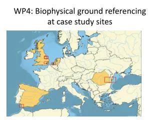
WP4: Biophysical ground referencing at case study sites. WP4 addresses two particular activities in FAST. Linking data from satellite images to the biophysics of foreshores and flood plains by ground referencing ( WP3 and WP4);

E N D
WP4 addresses two particular activities in FAST • Linking data from satellite images to the biophysics of foreshores and flood plains by ground referencing (WP3 and WP4); • Linking biophysical characteristics to wave and/or flow attenuation and erosion/deposition patterns for different water levels and wave heights/flow speeds through field measurements (WP4)
WP4: Biophysical ground referencing at case study sites T4.1 Hyperspectral and ground based laser scanner ground referencing (May 14 - Sep 16) UCam, NIOZ, UCA T4.2 Foreshore and floodplain vegetation characterisation (May 14 – Sep 16) UCam, Geoecomar, NIOZ, UCA T4.3 Measuring wave dissipation of different foreshore and floodplain types (Oct 14 – Sep 16) UCam, Deltares, Geoecomar, NIOZ, UCA T4.4 Measuring stability (Mar 14 – Jun 16) UCam, Deltares, Geoecomar, NIOZ, UCA
WP4: Who does what? “Coordinate the ground referencing and case-studies (WP4), guarding standard measuring methods for wave/flow attenuation” UCam NIOZ “Coordinating remote sensing analyses (WP3), deriving general algorithms for foreshore and flood plain classification, measuring sedimentation/erosion processes in a standardised way” All: fieldwork Discussion Priority: standard measures for veg & spectrometry (& e.g. LAI)
Discussion Priority: Variability in layout between sites? (quadrats can vary, wave sensors not…?)…
Site 2 Site 1 Discussion Priority: Move field spectroscopy and veg sampling forward to meet D4.1 and 4.2? Coordinating field spectroscopy? What instruments where? Do we need to more closely link to exact timing of RS? How many bi-monthly soil samples? (Capacity to process Chl-a, PSD?) Destructive biomass sampling… when? Where? Non-destructive photo imaging?
WP4 Link to other work packages • WP3: RS sample point locations; timing • WP5: Tool requirements (no of points, types of relationships) • WP6: Dissemination: field images (promotional materials, web page, etc)
Cartmel (29 January 2013) Tillingham (29 March 2013) Energy at PT1: 111 J/m2 114 J/m2 Wind speed: 1.6 m/s 26.6 m/s 6s 12s 8s 5s 6s 5s 7s 11s 6s