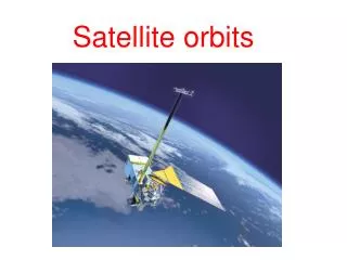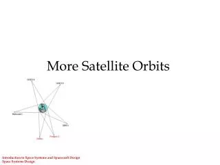
SATELLITE ORBITS
SATELLITE ORBITS. The monitoring capabilities of the sensor are, to a large extent, governed by the parameters of the satellite orbit. Different types of orbits are needed to achieve different data: Continuous monitoring – meteorological Global mapping- Land cover mapping

SATELLITE ORBITS
E N D
Presentation Transcript
SATELLITE ORBITS The monitoring capabilities of the sensor are, to a large extent, governed by the parameters of the satellite orbit. Different types of orbits are needed to achieve different data: Continuous monitoring – meteorological Global mapping- Land cover mapping Selective imaging- Urban area
What is orbit? The course of the motion of an object around a primary body in space or the path traced by it is called an orbit. Elliptic orbit is an orbit with the eccentricity greater than 0 and less than 1. Our Moon and the planets travel in orbits that are very close to being circular. A circle is a special kind of ellipse. Orbits of artificial satellites can be elliptical or circular. In general an orbit is a circular path described by the satellite in its revolution about the earth
For Remote Sensing purpose the following orbit characteristics are relevant: • Altitude • Inclination angle • Period • Repeat Cycle • Orbit Altitude- Distance between the satellite and the earth surface. The altitude influences the area that can be viewed (Coverage) and the details that can be observed (resolution) • LEO the Low earth orbit- 150 to 1000km • GEO the Geostationary orbit – 36,000km
Orbit Inclination Angle • Angle in degrees between the orbital plane and equatorial plane. • It decides together with the field of view the latitude up to which the earth can be observed • If inclination is 600, the satellite flies over the earth between latitudes 600 north and 600 south. • If it is LEO, it can not observe parts of earth at latitude above 600 north and 600 south. It means it can not observe polar region.
Orbital period • Time, in minutes, required to complete one full orbit. • Orbit period and the mean distance to the centre of the earth are interrelated (Kepler’s third law) • Example: If a polar satellite orbits at 860km mean altitude, • its orbital period is 101 minutes • Its ground speed is 23,700km/h = 6.5km/sec • Speed of an aircraft is 400km/h i.e. 60 times slower than satellite
Repeat Cycle • The time, in days, between two successive identical orbits. • The revisit time, the time between two successive images of the same area, is determined by the repeat cycle together with the pointing capability of the sensor. • Pointing capability means possibility of the sensor-platform to look to the side or fore and aft. • The sensors mounted on SPOT, IRS and Ikonos have this capability
Orbit TypesCommon for RS missions • Polar orbit • Sun- synchronous orbit • Geostationary orbit • Other orbits
POLAR ORBIT • Inclination angle between 800 and 1000 • An orbit having more than 90 degree angle means that the satellite motion is in westward direction • Launching a satellite in eastward direction requires less energy due to eastward rotation of earth • Such orbit enables observation of the whole globe, also near the poles • Typically placed in orbit at 600km to 1000km
Sun-Synchronous Orbit • Near polar orbit chosen in such a way that the satellite always passes overhead at the same time • The inclination angle is between 980 and 990 to achieve this. • Most sun synchronous orbits cross the equator at mid-morning at around 10:30 hours local solar time • At this time the sun angle is low and the resultant shadows reveal terrain relief • In addition to day-time images, this orbit also allows the satellite to record night-time images (thermal or radar) during the ascending phase of the orbit at the dark side of the earth. • Examples of Polar and SS orbits: Landsat, SPOT and IRS
Polar/Sun Synchronous Orbits Pass roughly over the north and south poles Fly over the same place on earth at the same time of day (sun always in same position) Examples: Landsat, AVHRR Good for land remote sensing Return time depends on Swath Width
Swath Width Swath Width
Geostationary orbit( GEOS, weather,Geosynchronous orbiting earth satellite) • The orbit in which the satellite is placed above the equator i.e. inclination angle is 00 • The altitude of placement is 36,000km • At this distance the orbit period of the satellite is equal to the rotational period of the earth, exactly one sidereal day • Used for meteorological and telecommunication satellites • Combination of geostationary orbit and polar orbit are used in meteorology
Other Orbits • Lagrangian or Liberation Points: For a satellite circling two massive bodies it appears that there are five points where pull of gravity of two bodies is at equilibrium (L1 to L5). • In these points the satellite can be positioned at zero velocity with respect to both bodies. • L1 point of sun-earth system (1,5 mkm from the earth) is in use by number of solar observation satellites.
DATA TRANSFER • The data of space borne sensors need to be sent to ground for further analysis. • Some old systems utilized film cartridge that fell back to a designated area on earth. • Now practically all earth observation satellites apply satellite communication technology as a downlink of data. • The data are directly sent down to a receiving station, or to a geostationary communication satellite that transmits the data to receiving stations on the ground.
Orbital Characteristics • Geosynchronous • Polar • Sun synchronous