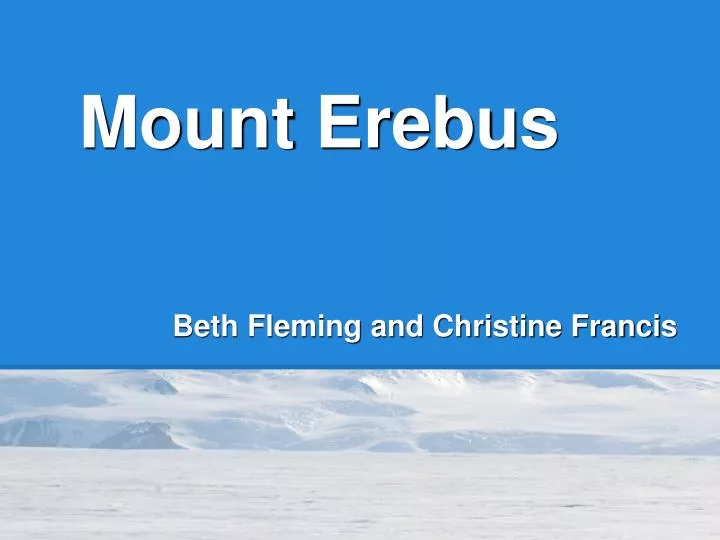
Mount Erebus
Mount Erebus. Beth Fleming and Christine Francis. Ross Island, Antarctica World's southernmost active volcano!. Discovered: 1841 Latitude: 77°32'0"S Longitude: 167°10'0"E. http://eye-maps.com/wp-content/uploads/2011/11/erebus-map.gif. Form and Dimensions. Mt. Erebus.

Mount Erebus
E N D
Presentation Transcript
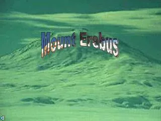
Mount Erebus Beth Fleming and Christine Francis
Ross Island, Antarctica World's southernmost active volcano! • Discovered: 1841 • Latitude: 77°32'0"S • Longitude: 167°10'0"E http://eye-maps.com/wp-content/uploads/2011/11/erebus-map.gif
Form and Dimensions Mt. Erebus • Stratovolcano atop a shield • Elevation 3,794 meters or 12,447 feet • Covered by a glacier • Summit temp: -30° F or -34.4° C http://www.volcano.si.edu/world/volcano.cfm?vnum=1900-02=&volpage=photos&photo=061066
Tectonic Setting:Mt. Erebus is part of the Pacific Ring of Fire AND sits atop a mantle plume or "hot spot" http://erebus.nmt.edu/index.php/volcanology/51-volcanological-evolution
Caldera The modern cone is located within an older CALDERA, which forms a summit plateau dating to between 17,000 and 100,000 years old. modern cone summit plateau of caldera http://www.volcano.si.edu/world/volcano.cfm?vnum=1900-02=&volpage=photos&photo=061081
Craters: Main Crater Inner Crater Side Crater Western Crater Side Crater Western Crater Main Crater Inner Crater
Erebus's Lava Lake One of only five consistently convecting lava lakes on Earth! http://assets4.bigthink.com/system/idea_thumbnails/39271/original/Erebus-Mainn-12.2005---Clive-Oppenheimer--MEO.jpg?1310483547 http://beyondpenguins.ehe.osu.edu/files/2011/06/web_Mt_Erebus_lava_lake.jpg
Eruptive Styles Both minor explosions and Strombolian eruptions, bomb ejections, effusive lava flows, and fumarolic activity Erebus Bomb January 1, 2006 Eruption Link http://www.exo.net/~pauld/antarctica/erebus.html
Eruptive History Active for 1.3 million years! http://www.shackletoncentenary.org/erebussnip2.JPG
Ice Towers and Caves Steam rising from fumaroles freezes to form ice towers and caves "Harry's Dream" http://www.polartrec.com/files/members/alex-eilers/images/mterebus_3_-_fumerole.jpg http://erebus.nmt.edu/index.php/icetowers
Petrology and Tephra Sampling • Dominantly phonolitic • basanite • trachyte • Tephra Sampling • geochemistry and dating • Chainsaw method http://volcanofiles.com/2011/12/30/erebus-science-tephra-sampling/
Petrology and Chemistry of Deposits • Lavas and bombs contain phenocrysts of anorthoclase feldspar http://www.andrill.org/iceberg/blogs/betty/images/erebus-crater.jpg • Spews microscopic crystals of pure gold, discovered by Dr. Raymond Chuan of the University of New Hampshire http://www.mindat.org/photo-119460.html
Environmental Hazard Holes occurred in the ozone layer over Antarctica in 1987 and 1989. • Emits chlorine compounds, carbon dioxide, sulfur dioxide, sulfric acid, chromium oxide, and nitrogen compounds. • These contribute to acid rain and the warming of the atmosphere. http://chemwiki.ucdavis.edu/Physical_Chemistry/Kinetics/Case_Studies/Depletion_of_the_Ozone_Layer
Geophysical Monitoring Mount Erebus Volcano Observatory, run by the New Mexico Institute of Mining and Technology McMurdo Station, operated by the United States CURRENT RESEARCH: • Use seismometers to understand the "plumbing" of Erebus • Use Argon-argon (40Ar/39Ar) radiometric dating determine the geochronology of summit and flank lava flows • Monitor SO2 flux and CO2 emissions from the lava lake • Establish a GPS base network to monitor the deformation of the volcano
NASA's Dante Eight-legged NASA robot descended 700 feet into the crater to sample the molten lava lake http://www.astrobio.net/albums/robot/acm.jpg Erebus's crater simulates the environment on the Moon and Mars http://www.frc.ri.cmu.edu/robots/robs/photos/1992_DanteI.jpg
Historical Significance On November 28, 1979, an Air New Zealand flight crashed on Mt. Erebus, killing all 257 people on board. http://www.nzhistory.net.nz/files/images/erebus-flags-bw.jpg http://images.theage.com.au/2009/10/15/792242/erebus-420x0.jpg
Works Cited • http://scini1.mlml.calstate.edu/wp-content/uploads/2008/11/mount_erebus.jpg • http://www.volcano.si.edu/world/volcano.cfm?vnum=1900-02= • http://www.agiweb.org/pubs/globalgis/metadata_qr/metadata/volc.html#t1 • http://www.nytimes.com/1989/12/26/science/volcano-at-south-pole-offers-golden-clues-about-the-atmosphere.html • http://antarcticsun.usap.gov/science/contentHandler.cfm?id=1232 • http://erebus.nmt.edu/index.php • http://volcanofiles.com/2011/12/30/erebus-science-tephra-sampling/ • http://www.nytimes.com/1993/01/02/us/on-lonely-mission-robot-starts-descent-into-volcano.html?n=Top%2fReference%2fTimes%20Topics%2fSubjects%2fT%2fTests%20and%20Testing • http://chemwiki.ucdavis.edu/Physical_Chemistry/Kinetics/Case_Studies/Depletion_of_the_Ozone_Layer