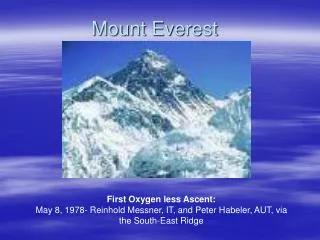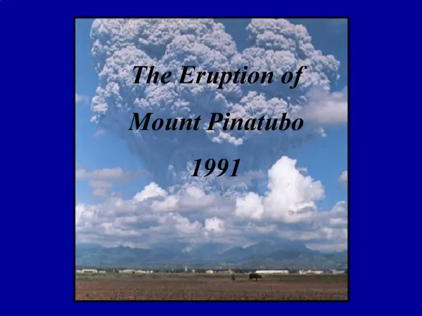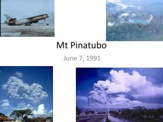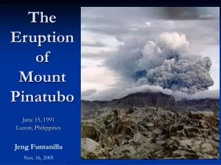
Mount Pinatubo
By Andy Shin. Mount Pinatubo. Location of Volcano. Location: Zambales, Luzon, Philippines Tarlac, Luzon, Philippines Pampanga, Luzon, Philippines Range: Zambales Mountains Coordinates:15°08’30”N 120°21’00”E. Place on W orld M ap. Philippine. Place on Regional Map.


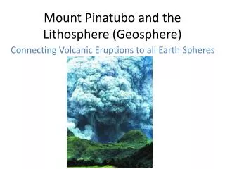
Mount Pinatubo
E N D
Presentation Transcript
By Andy Shin Mount Pinatubo
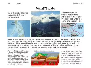
Location of Volcano Location: Zambales, Luzon, Philippines Tarlac, Luzon, Philippines Pampanga, Luzon, Philippines Range: Zambales Mountains Coordinates:15°08’30”N 120°21’00”E
Place on World Map Philippine
Location in Plate Boundary Philippine on Philippine sea plate
Why are people attracted to volcanoes? Minerals: -When magma rises from deep inside earth, in contains variety of minerals such as tin, silver, copper, gold and sometimes diamond as well. Sp it is good for both large scale mining, and small scale local activities. -Hot gases from vents bring minerals (especially sulphur) to the surface. This collects around vents as it condenses and becomes solid. Locals collect this and sells it. Geothermal energy: -The heat from underground steam is used to turn turbines and by doing this, we produce electricity. -The heat from underground steam is used to heat water supplies that are used to provide household heating and hot water. Fertile soil: -The volcanic rocks and ash need thousands of years to form soil. However when they weather and break down and form soils, it is one of the richest on the planet. -When it has rich soil, people live there to produce rich fruits, vegetables, and others. Tourism: -Volcanoes attract millions of tourists every year. -Around volcanoes there can maybe be warm bathing lakes, hot spring, bubbling mud pools, and steam vents. Also, people go there to see the wild, raw, and barren volcanic landscape, huge waterfalls, wildlife, climbing, hiking and others. -Tourism can create jobs in shops, restaurants, hotels, and others.
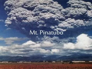
How was the place like before the eruption? • About 30,000 people lived on the side of the volcano in villages and other small groups. • The last eruption before 1991 was about 450 years ago, so most of the mountain and its peaks were completely covered in dense rainforest, so this supported the hunter-gathering Aeta. • On the surrounding flatter areas, the large amount of rain caused by the monsoon climate (almost 4m annually), and the fertile volcanic soils gave perfect conditions for agriculture, so a lot of people grew rice, fruits, and other foods. • Mount Pinatubo was a source to many major river systems, such as the Bucao river, Santo Tomas river, Maloma river, and other important rivers, which were significant ecosystems before the eruption. These maybe the reasons why people lived near Mount Pinatubo.
Damage caused Causalities: 2.1 million people affected 364 communities affected Over 847 people killed 184 people injured 23 people missing 100,000 people homeless Infrastructure: More then 8,000 houses completely destroyed Further 73,000 houses damaged Roads, bridges and communications were damaged or destroyed because of pyroclastic flows and lahars Many hospitals, schools, and factories were collapsed by the weight of the ash Power supplies were cut for 3 weeks and water supplies contaminated About 3.8 billion pesos used to repair Agriculture: 800 square km of rice-growing farmland destroyed About 800,000 livestock and poultrydied because of starvation or drinking contaminated water About 1.5 billion pesos of agriculture damage • Many reforestation projects were destroyed, total area of 150 square km (37,000 acres), and valued at 125 million pesos. • Damage to healthcare facilities • Education for thousands of children was seriously disrupted, because of the destruction of schools.
Immediate effects • 2.1 million people and 364 communities affected. • 847 people dead, 184 people injured, 23 people missing and 100,000 people homeless. • About 800,000 livestock and poultry died because of starvation or drinking contaminated water. • Enormous volume of ash and lava resulted to 10% reduction in the amount of sunlight reaching earth’s surface.
Long term effect • Millions of tons of sulfur dioxide were released to the atmosphere when the eruption happened. This resulted to a decrease in the temperature worldwide for a couple of years. • After the eruption happened, every rainy season brought more lahars and mudflows, which lead to the displacement of thousands of people. • Hundreds of square km of arable soil became infertile, which destroyed the lives of thousands of farmers. • The eruption caused a lot of effect on the ozone levels in the atmosphere, which caused a large increase in the destruction rate of ozone.
Global effects • The powerful eruption injected significant quantities of aerosols and dust into the stratosphere. This resulted in a reduction in sunlight reaching the Earth’s surface by about 10%. -Decrease in Northern hemisphere average temperatures by 0.5~0.6C. Also global fall of 0.4C. -Temperature in the stratosphere rose higher than normal, because of the absorption of radiation by the aerosols. • Effect on ozone levels in the atmosphere, which caused a large increase in the destruction rate of ozone. -Mid-latitudes reached their lowest recorded levels. -Southern hemisphere winter of 1992, the ozone hole over Antarctica was its largest size until then. -Fastest recorded ozone depletion rates. • The dust in the atmosphere affected the appearance of the lunar eclipse. -Usually even at mid-eclipse, we can still see the moon slightly, however the Pinatubo eruption caused the moon to be hardly visible during eclipses. This happened because the dust in the atmosphere absorbed great amount of sunlight.
Ash and aerosol emissions from Mount Pinatubo (Satellite measurement)
Why did the volcano erupt? The volcano erupted because the Philippine plate slide under the Eurasian plate because it is more dense.
Sources Picture: http://www.earlham.edu/~rhoderu/RoMarianas.jpg http://en.wikipedia.org/wiki/File:TOMS_AI_Jun16_91.gif http://maps-world.cn/map/world_map.GIF http://www.geography-site.co.uk/pages/physical/earth/images/rof.gif http://pubs.usgs.gov/fs/1997/fs114-97/resources/LaharMap1.gif http://www.uwec.edu/jolhm/EH2/Lennon/Pre-eruption_Pinatubo.jpg http://www.lakbaypilipinas.com/images/mount_pinatubo.jpg http://tonetcarlo.files.wordpress.com/2008/01/climbing-over-mt-pinatubo.jpg http://pinaykeypoint.files.wordpress.com/2008/12/pinatubo-trekking97.jpg http://vulcan.wr.usgs.gov/Imgs/Jpg/Pinatubo/Images/Pinatubo91_lahar_and_tephra_damage_sapangbato_06-22-91_med.jpg http://volcanoes.usgs.gov/ash/build/32923351-028_large.jpg http://pubs.usgs.gov/fs/1997/fs115-97/images/Pinatubofleeing.jpg http://geology.com/volcanoes/volcanic-hazards/volcanic-ash-weight-lg.jpg http://www.smate.wwu.edu/teched/geology/GeoHaz/vo-Mt-Pinatubo/vo-Mt-Pinatubo-14.JPG Information: http://uk.answers.yahoo.com/question/index?qid=20091021111728AA0TaKU http://en.wikipedia.org/wiki/Mount_Pinatubo http://park.org/Philippines/pinatubo/ http://geography.about.com/od/globalproblemsandissues/a/pinatubo.htm http://www.geography-site.co.uk/pages/physical/earth/volcanoes/why%20people%20live%20near%20volcanoes.html http://www.mattmayer.com/essays/pin91.htm